Scattered severe storms possible Sunday in Alabama
Scattered severe thunderstorms will be possible on Sunday across all of Alabama, and there will be chances for more storms on Monday and Tuesday, too.
Today (Sunday) is the day when the most storms are expected. NOAA’s Storm Prediction Center has expanded a Level 2 out of 5 severe weather risk area to include the entire state as of Sunday morning.
A Level 2 risk means that scattered severe storms will be possible. The strongest of those could have winds strong enough to take down trees and power lines as well as hail and heavy rain. The tornado risk is very low.
The most likely time for storms today will be during the afternoon and evening hours, roughly from 1 p.m. until 10 p.m., according to the National Weather Service. However, storms were already firing across parts of coastal Alabama on Sunday morning.
The weather service will be watching for a front to approach Alabama from the northwest. Areas along and ahead of the front will see the best chances for storms through tonight as several disturbances move across the area.
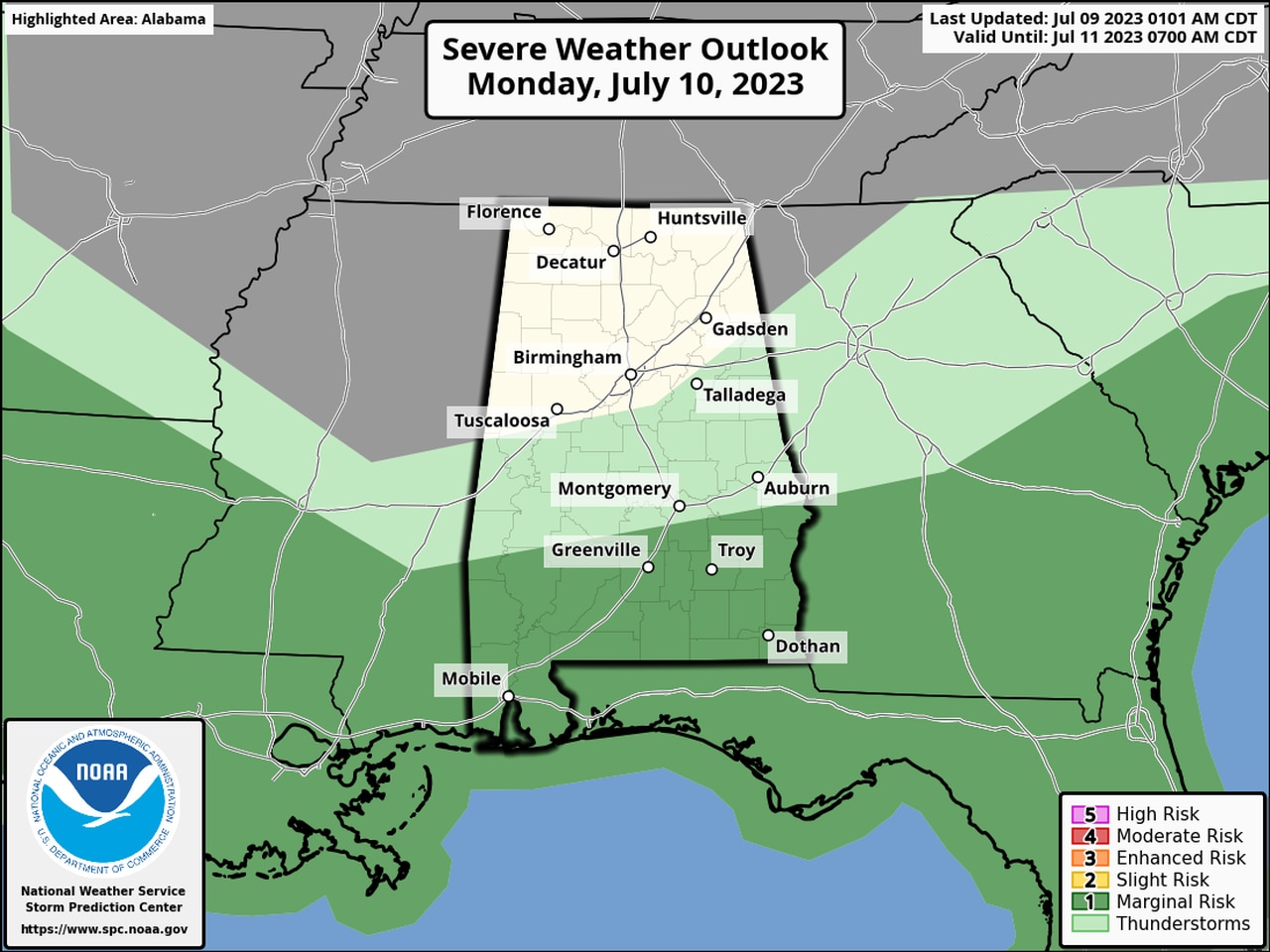
The front could stall out over parts of south-central or south Alabama on Monday, and the SPC has most of south Alabama in a Level 1 risk for severe weather on Monday:
There will be a Level 1 risk for severe weather on Monday for the areas in dark green.
A Level 1 risk means that isolated severe storms will be possible.
A similar setup is in the forecast for Tuesday but shifts southward again to include only extreme southern Alabama. Again it will be a Level 1 risk for isolated severe storms:
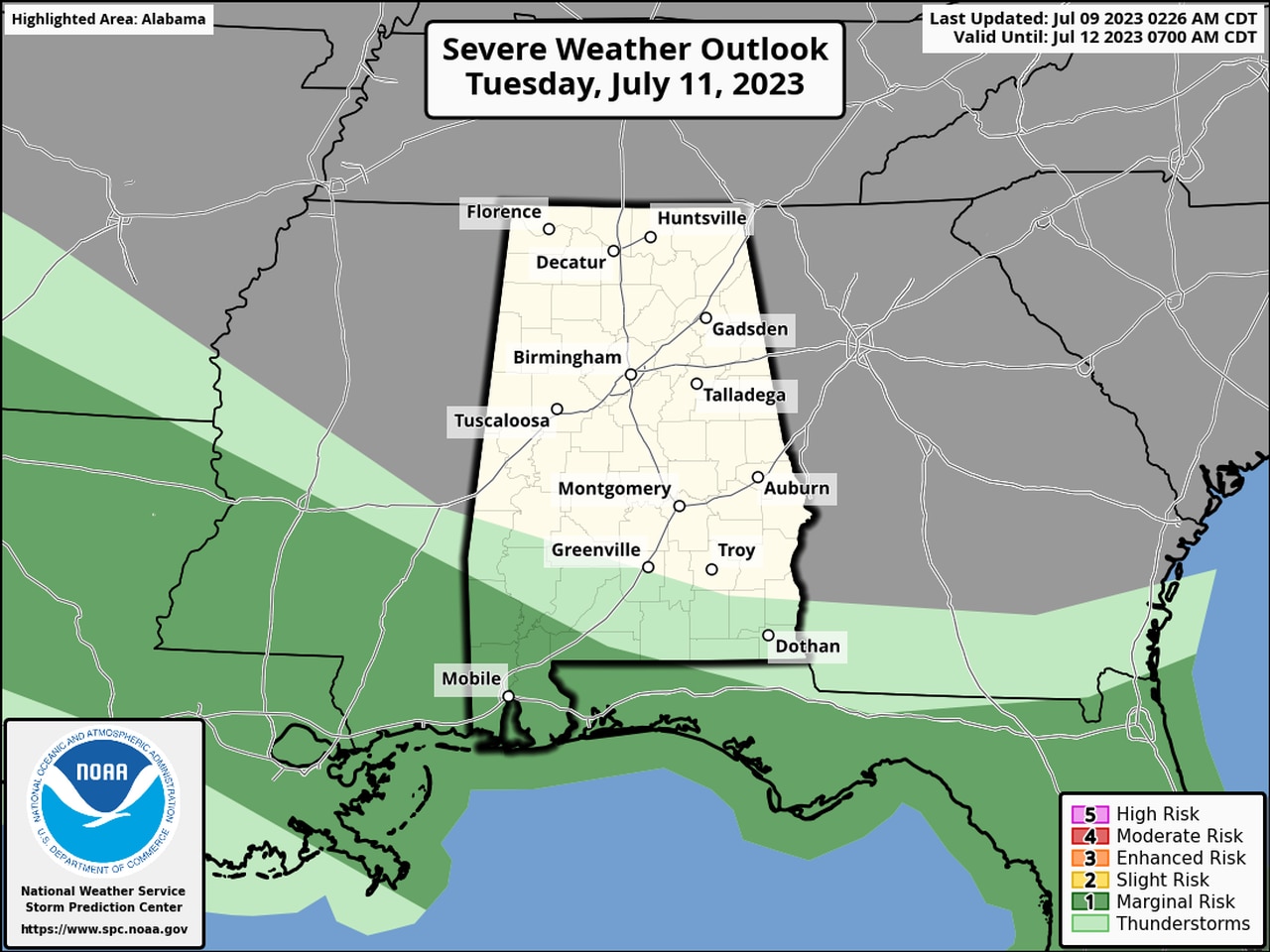
Only extreme south Alabama is expected to run the risk of seeing storms on Tuesday.
Daily chances for rain and storms will be in the forecast for this week, with temperatures expected to stay near seasonal norms.