A few strong storms possible later this week
The National Weather Service is sending out a heads up about the potential for strong storms in Alabama from late Wednesday into the day on Thursday as a cold front moves through the state.
NOAA’s Storm Prediction Center has part of west Alabama in a Level 1 out of 5 risk for severe weather on Wednesday into Thursday.
A Level 1 risk, which is marginal, means that isolated severe storms will be possible.
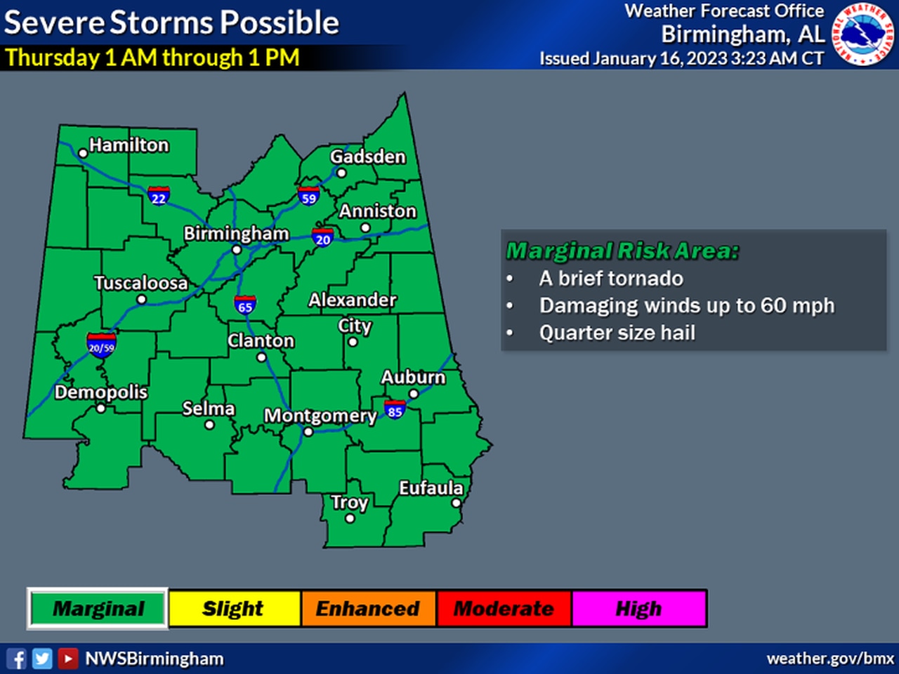
The National Weather Service in Birmingham also has all of central Alabama in a Level 1 risk for severe weather starting very early on Thursday.
Here’s the outlook for central Alabama from early Thursday morning into the early afternoon.
The weather service said a brief tornado, wind gusts up to 60 mph and hail will be possible with the strongest storms.
The time frame for storms in central Alabama, according to the weather service, will be 1 a.m. through 1 p.m. Thursday.
This next system isn’t a slam-dunk for severe weather, however.
Since the storms will be moving through during the overnight hours, forecasters are questioning how much instability will be in place to generate severe weather. There could be enough for stronger storms — but it also may not materialize.
The rain and storms are expected to move out of Alabama later in the day on Thursday, and Friday looks a bit drier before rain chances begin to increase again next weekend.
