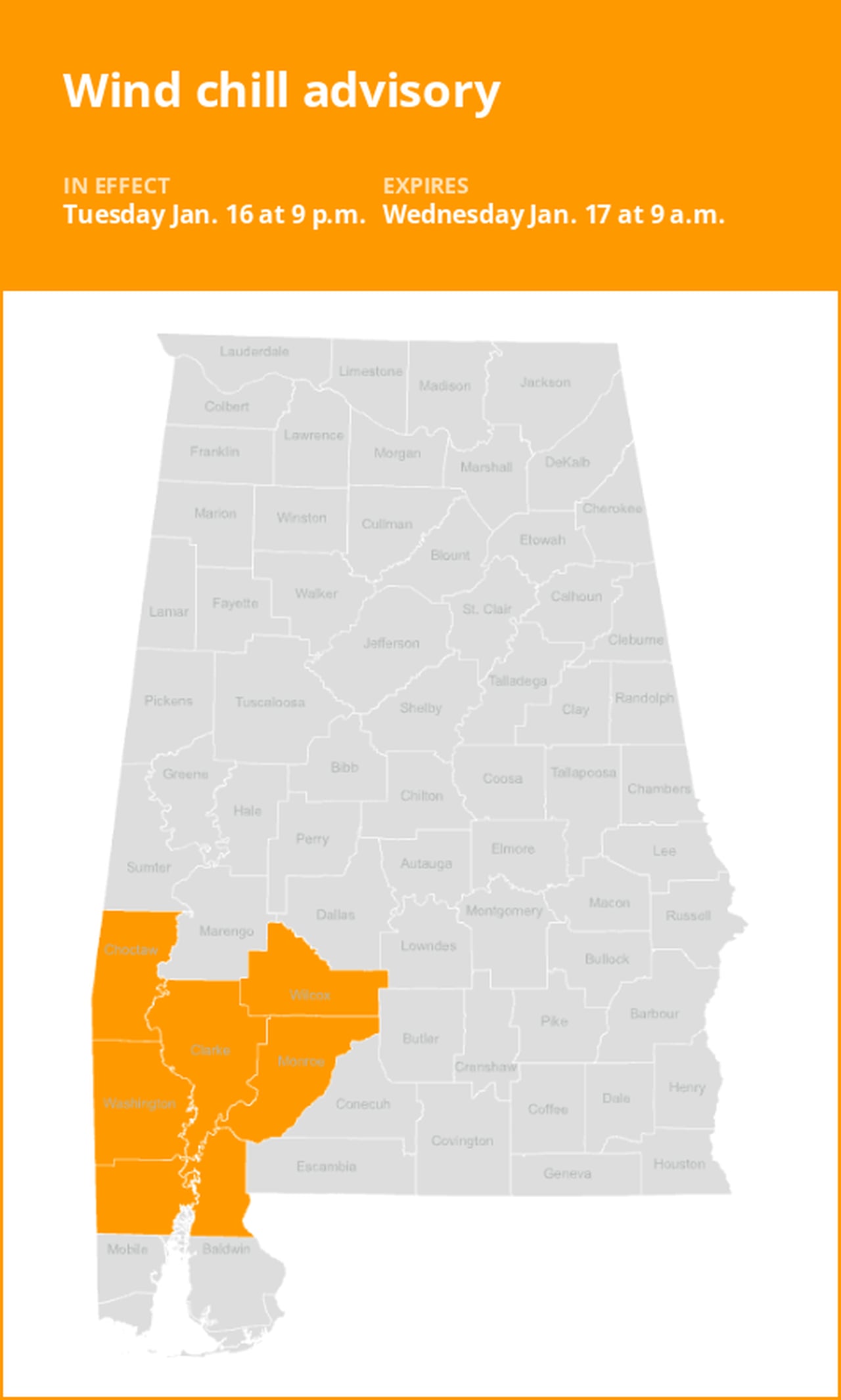
Wind chill advisory for Southwest Alabama for Tuesday and Wednesday
On Monday at 4:30 a.m. a wind chill advisory was issued by the National Weather Service valid from Tuesday 9 p.m. until Wednesday 9 a.m. for Choctaw, Washington, Clarke, Wilcox, Monroe, Mobile and Baldwin counties.
The weather service states, “Very cold wind chills expected. Wind chills as low as zero to 5 above zero.”
“Roads, and especially bridges and overpasses, will likely become slick and hazardous. The hazardous conditions could impact the morning or evening commute. Exposed skin may quickly become frostbitten or frozen. Wind chill values may fall to extremely dangerous levels and frostbite and hypothermia are possible if precautions are not taken,” describes the weather service. “Delay all travel if possible. If travel is absolutely necessary, drive with extreme caution and be prepared for sudden changes in visibility. Leave plenty of room between you and the vehicle ahead of you. Allow extra time to reach your destination. Avoid sudden braking or acceleration and be especially cautious on hills or when making turns. You are urged to stay indoors until conditions improve. If you must go outside, several layers of clothes will keep you warmer than a single heavy coat. A hat is also important as half your body heat loss can be from the head.”
Advance Local Weather Alerts is a service provided by United Robots, which uses machine learning to compile the latest data from the National Weather Service.