When will strong storms be possible in Alabama
The chance for severe storms has been added to the forecast for parts of Alabama for both today and tomorrow.
NOAA’s Storm Prediction Center has added a Level 1 out of 5 risk for severe weather for south Alabama for today (Wednesday).
A Level 1 risk means that isolated severe storms will be possible.
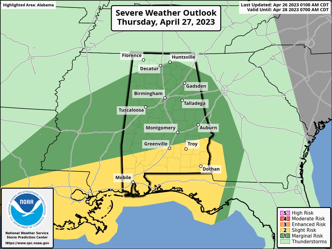
Then forecasters have upgraded the severe weather risk for Alabama for Thursday, adding a Level 2 (or slight risk) for the southern part of the state. A Level 1 risk has been expanded to include all of the rest of south Alabama, central Alabama and part of north Alabama as well.
Today’s severe weather outlook is at the top of this post. Below is the outlook for Thursday:
More of Alabama could see strong to severe storms on Thursday.
A Level 2 risk means that scattered severe storms will be possible. Those could also bring damaging winds and hail. A tornado or two will be possible.
A Level 1 risk means that isolated severe storms will be possible. The strongest of those could have wind gusts up to 60 mph and hail.
The most likely time for storms today will be this afternoon in south Alabama during the peak heating of the day, according to the National Weather Service. Rain showers were moving across parts of north and central Alabama on Wednesday morning, but that activity was not expected to become severe.
On Thursday more rain and storms will be possible, and the window for stronger storms will stretch from the late morning hours (10 a.m.) in western Alabama into the evening in eastern Alabama, according to the weather service.
Rain could linger into Friday morning as this system departs, and more rain will be possible over the weekend as well. However, no severe weather is expected for Alabama during that time.
Here’s a look at Thursday’s forecast from the National Weather Service offices in the state: