When will storms arrive where I live? Flooding, severe weather today, strong winds Friday
Flood warnings are in place through mid-morning for much of north Alabama as the upper part of the state could see as much as 5 inches of rain over 24 hours.
Jim Stefkovich, meteorologist, Alabama Emergency Management Agency, said between 1-3 inches of rain fell overnight with an additional 1-2 inches expected through this afternoon. Some of today’s storms could produce damaging wind gusts, he said.
A flood watch will continue for the northern part of the state through Friday at 6 p.m.
The majority of the state will be under a wind advisory from midnight to 9 p.m. Friday.
READ MORE: Alabama severe weather: When to expect the next round of storms
Timing of storms
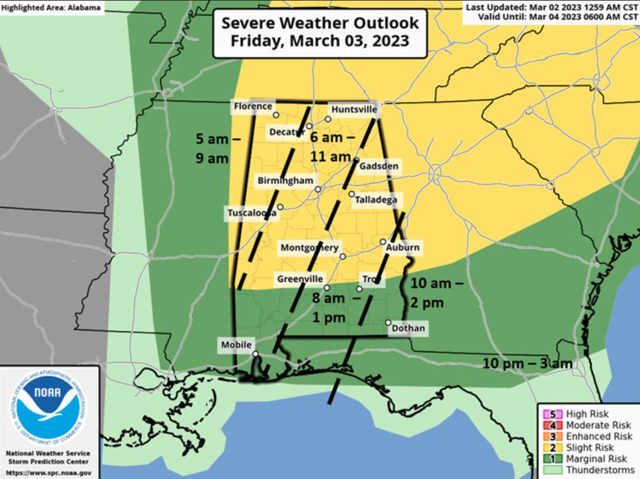
Storms will enter the northwestern quarter of the state starting at 5 a.m. Friday before moving to an area from Huntsville in the north down to Birmingham and Montgomery between 6 a.m.-11 a.m. The storms will continue to move eastward to places like Gadsden, Talladega, Auburn and Troy from 8 a.m.-1 p.m. The storms will exit the eastern part of the state from 10 a.m.-2 p.m.
READ MORE: North Alabama flash floods: Drivers warned to use caution with more rain on the way
Severe weather on Thursday and Friday
A broken line of storms ahead of a cold front will enter western Alabama early Friday morning and move quickly across the state through the rest of the morning hours, exiting the southeastern portions by early Friday afternoon. The storm could bring damaging straight-line wind gusts and the possibility for tornadoes.
Very strong winds will occur both ahead of and immediately behind the cold front and continue into Friday evening. Sustained winds between 15-25 mph with gusts of up to 50 mph – 55 mph in higher elevations – are possible. Wind intensity will decrease after Friday at 9 p.m.