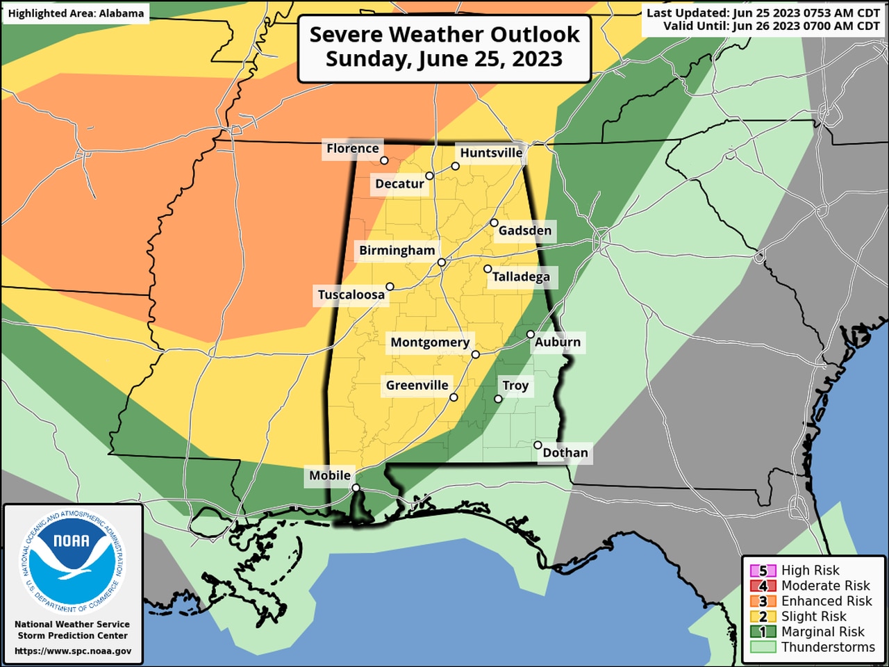
What time will severe weather arrive today where I live?
Two rounds of thunderstorms – both capable of producing severe weather – are expected in Alabama Sunday into Monday.
Jim Stefkovich, meteorologist, Alabama Emergency Management Agency, said the first wave will enter north Alabama early to mid-afternoon and affect areas mainly north of I-20 through 5 p.m. The second wave will enter northern Alabama between 5 pm and 8 pm, combine with the first wave of storms and continue southward across the state into Monday morning.
Both waves will bring the potential for damaging straight-line winds and large hail, especially for areas west of I-65.
READ MORE: Threat for severe storms increases for Alabama on Sunday
The first wave of storms will enter the northern third of the state between noon and 4 p.m. The central part of the state, including Birmingham, will see storms start around 2 p.m. before leaving around 5 p.m. The lower third of the state is not expected to see any severe weather.
The second wave will enter the north part of the state around 5 p.m. and last until about midnight. Storms will start around 7 p.m. for the central third of the state before exiting around 2 a.m. The southern third of the state will see the potential for severe weather in the second round from about 9 p.m.-4 a.m.
On Monday afternoon, a few storms capable of damaging wind gusts and hail may develop east of I-65 but severe weather is not expected to be widespread.
Heat will be on the increase after the storms. Stefkovich said a Heat Advisory is in effect Sunday for Washington and Mobile counties, as it will feel like 109 degrees in many locations this afternoon. Heat Advisories will expand to other sections of the state later this week.
READ MORE: Will it hit 100 degrees this week? Here’s where and when
