What time will Alabamaâs severe weather arrive where I live?
Severe weather is expected in Alabama today with some parts of the state at a Level 4 out of 5 risk for strong storms and possible tornadoes.
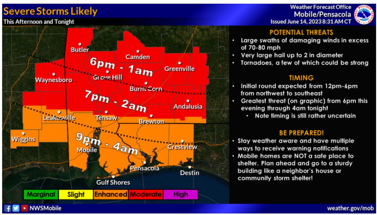
The area with the highest probability for severe weather will be in the south-central and southern parts of the state with numerous severe storms being “likely,” according to the National Weather Service.
Today’s storms, especially those later this afternoon and tonight, could bring hurricane-force wind gusts, baseball-sized hail, lighting and flooding rain. Tornadoes are also possible across the southern part of the state.
READ MORE: Alabama severe weather updates: Tornado watch for part of state; Level 4 risk today
The wave of storms entered the state Wednesday morning and with potential for intensifying overnight and into late Thursday morning and afternoon, according to the Alabama Emergency Management Agency.
In South Alabama, the initial round of strong storms is expected from noon to 6 p.m. Wednesday with the greatest threat through 4 a.m. Thursday. Damaging winds and large hail are possible with chances for tornadoes, some potentially strong, increasing in the overnight hours.
The potential for strong storms will continue through Thursday.
In central Alabama, the greatest risk Wednesday will be from damaging winds up to 60 mph and hail of up to 2 inches. Storms may increase in intensity as the day goes on with severe weather in Birmingham around noon – 5 p.m. before exiting the state to the east around 7 p.m.
North Alabama also has a potential for gusty damaging winds and hail. The strongest chance for thunderstorms is between 1-9 p.m. The best chances for severe weather will be south of the Tennessee River, according to the National Weather Service in Huntsville.