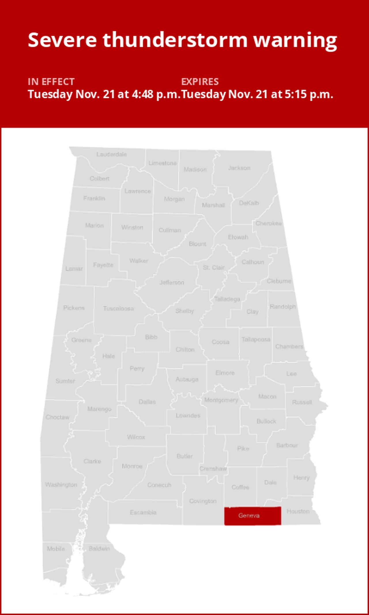
Update: Damaging winds expected with thunderstorms to hit Geneva County Tuesday
An updated severe thunderstorm warning was issued Tuesday at 4:48 p.m. by the National Weather Service for Geneva County.
Residents should prepare for wind gusts of up to 60 mph.
“At 4:48 p.m., a severe thunderstorm was located near Geneva, moving east at 25 mph,” according to the weather service. “Expect damage to roofs, siding, and trees.”
The warning is for Geneva, Hartford, Chancellor, Hendrix Crossroad, Kellys Crossroads, Eunola, High Bluff, Highfalls and Geneva Municipal A/P.
The weather service adds, “Remain alert for a possible tornado! Tornadoes can develop quickly from severe thunderstorms. If you spot a tornado go at once into the basement or small central room in a sturdy structure. For your protection move to an interior room on the lowest floor of a building.”
This warning is in effect until 5:15 p.m.
Preparing for approaching lightning: Expert safety advice
Lightning strikes the United States approximately 25 million times each year, with the bulk of these electrical discharges occurring during the summer months. Tragically, lightning claims the lives of about 20 individuals annually, as reported by the weather service. The risk of lightning-related incidents escalates as thunderstorms draw near, reaching its peak when the storm directly looms overhead. However, it gradually recedes as the tempest moves away.
To ensure your safety during a thunderstorm, consider the following recommendations:
1. Lightning safety plan:
- When venturing outdoors, it’s vital to establish a clear plan for seeking shelter in case of lightning.
- Monitor the sky for threatening signs and listen for the sound of thunder. If thunder is audible, it’s an indication that lightning is nearby.
- Seek shelter promptly in a safe location, preferably indoors.
2. Indoors safety measures:
- Once you’ve found shelter indoors, abstain from using corded phones, electrical appliances, or plumbing fixtures, and refrain from approaching windows and doors.
- These precautions help reduce the risk of electrical surges, as lightning can follow conductive pathways.
3. Wait for the all-clear:
- After the last lightning strike or thunderclap, wait at least 30 minutes before resuming outdoor activities.
- Lightning can strike even when a storm has seemingly passed, so exercise caution.
When indoor shelter isn’t available:
If you find yourself outdoors without access to indoor shelter during a thunderstorm, take these steps to maximize your safety:
- Avoid open fields, hilltops, or ridge crests, which expose you to greater lightning risk.
- Steer clear of tall, isolated trees and other prominent objects. In wooded areas, stay close to lower stands of trees.
- If you’re in a group, ensure that individuals are spaced out to prevent lightning current from transferring between people.
- Camping in an open setting during a thunderstorm is strongly discouraged. If no alternative exists, set up camp in a valley, ravine, or other low-lying areas. Remember that a tent offers no protection against lightning.
- Do not approach water bodies, wet objects, or metal items. While water and metal don’t attract lightning, they conduct electricity effectively and can pose significant risks.
In summary, when facing the threat of lightning, preparedness and vigilance are your best allies. By following these guidelines, you can significantly reduce the likelihood of lightning-related incidents and prioritize your safety.
Driving through downpours: Safety guidelines for wet roads
When heavy rain strikes, safety is paramount. Equip yourself with these guidelines from the weather service to navigate wet roads and avoid hazards:
Beware of swollen waterways:
- During heavy rain, avoid parking or walking near culverts or drainage ditches, where swift-moving water can pose a serious risk.
Maintain safe driving distances:
- Adhere to the two-second rule for maintaining a safe following distance behind the vehicle in front of you. In heavy rain, allow an additional two seconds of distance to compensate for reduced traction and braking effectiveness.
Slow down and drive with care:
- On wet roads, reducing your speed is crucial. Ease off the gas pedal gradually and avoid abrupt braking to prevent skidding.
Choose your lane wisely:
- Stick to the middle lanes on multi-lane roads to minimize the risk of hydroplaning, as water tends to accumulate in outer lanes.
Prioritize visibility
- Turn on your headlights and be careful of other vehicles to the rear and in blind spot areas as they are especially difficult to see through rain-spattered windows.
Watch out for slippery roads:
- The initial half-hour of rain is when roads are slickest due to a mixture of rain, grime, and oil. Exercise heightened caution during this period.
Keep a safe distance from large vehicles:
- Large trucks and buses can reduce your visibility with tire spray. Avoid tailgating and pass them swiftly and safely.
Mind your windshield wipers:
- Heavy rain can overload the wiper blades. When visibility is so limited that the edges of the road or other vehicles cannot be seen at a safe distance, it is time to pull over and wait for the rain to ease up. It is best to stop at rest areas or other protected areas.
- If the roadside is your only option, pull off as far as possible, preferably past the end of a guard rail, and wait until the storm passes. Keep your headlights on and turn on emergency flashers to alert other drivers of your position.
In the face of heavy rain, these precautions can make a significant difference in ensuring your safety on the road. Remember to stay informed about weather conditions and heed guidance from local authorities for a secure journey.
Advance Local Weather Alerts is a service provided by United Robots, which uses machine learning to compile the latest data from the National Weather Service.