Tropical system may affect eastern Florida next week
The National Hurricane Center was keeping tabs on an unusually active tropical Atlantic on Thursday.
There was Martin in the north Atlantic, which has been designated as a post-tropical system and was no threat to the U.S. Then there’s Tropical Depression Lisa over Mexico’s Yucatan Peninsula.
If that wasn’t enough there were two other disturbances that were being monitored for development.
None of the systems was an immediate threat to the U.S., but one of the disturbances will be watched closely because it could move toward Florida’s east coast and the Southeastern U.S. next week.
POST-TROPICAL CYCLONE MARTIN
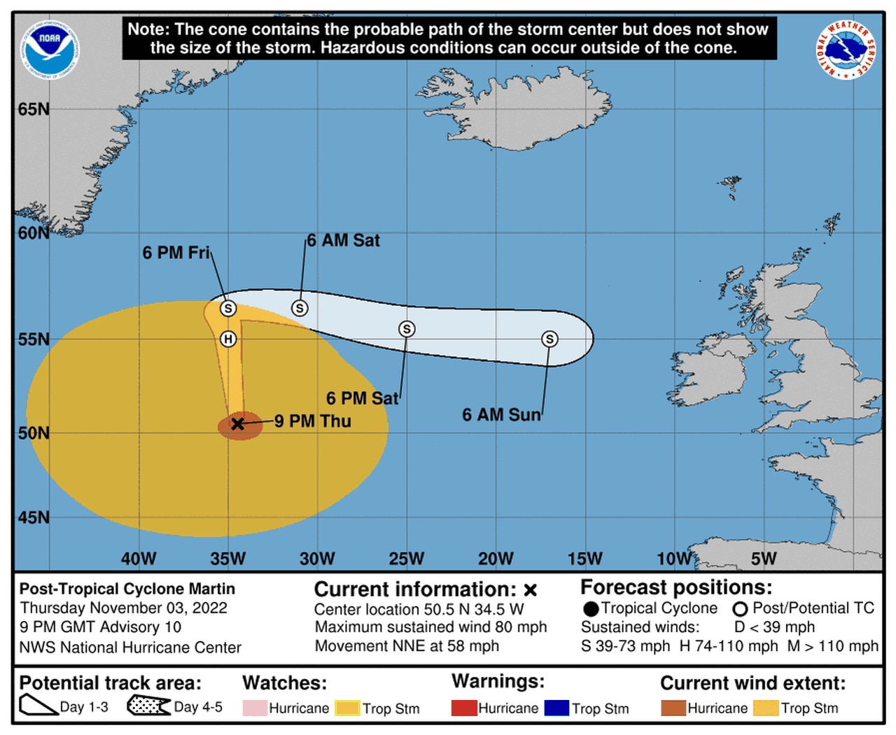
Martin was still a powerful storm on Thursday but it wasn’t a tropical system any longer.
The hurricane center said Martin was a “large and powerful” storm in the central north Atlantic but has lost all its tropical characteristics as of Thursday afternoon.
As of 4 p.m. CDT Thursday, Post-Tropical Cyclone Martin was located about 940 miles north-northwest of the Azores and was flying northeast at 58 mph.
Martin had 80 mph winds.
Martin’s winds were expected to weaken on Friday but it was expected to still be a large system through the weekend.
TROPICAL DEPRESSION LISA

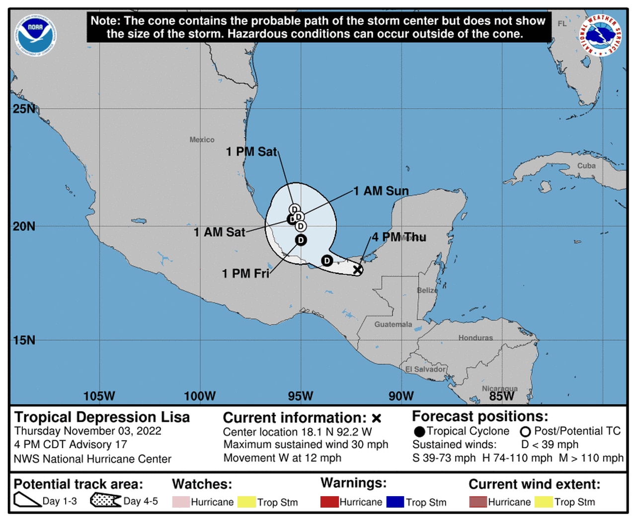
Tropical Depression Lisa was expected to move into the Gulf but not strengthen again.
Lisa was a tropical depression Thursday after making landfall in Belize on Wednesday with 85 mph winds.
Lisa is forecast to move over Mexico and into the southern Gulf of Mexico on Friday. The hurricane center doesn’t expect Lisa to strengthen again once it moves into the Gulf because upper-levels winds will be unfavorable.
As of 4 p.m. CDT Thursday, Tropical Depression Lisa was located about 45 miles southwest of Ciudad Del Carmen, Mexico, and was moving west at 12 mph.
Lisa had 30 mph winds, according to the hurricane center.
There were no watches or warnings in effect for Lisa, which is forecast to dissipate over the southern Gulf early next week.
Lisa could bring an additional 1 to 3 inches of rain to parts of southern Mexico over the next few days.
ELSEWHERE IN THE ATLANTIC
The hurricane center was also tracking two other disturbances, and one of them could bring some rainy and windy weather to Florida and the U.S. Southeast.
That disturbance was expected to develop over the weekend across the northeastern Caribbean and southwestern Atlantic. The hurricane center said conditions could allow tropical or subtropical development next week as it moves northwestward or westward, toward Florida.
It has a 30 percent chance of becoming a tropical depression in the next five days.
It’s too soon to say if it could become a named storm, but the next name on the 2022 storm list is Nicole.
Another disturbance with low chances of development was located a few hundred miles east of Bermuda on Thursday.
The hurricane center said any development would be slow over the next few days as the disturbance moves southward today and then westward by the weekend. Then it could merge with another system, and forecasters said further development was not anticipated.
That disturbance has only a 10 percent chance of becoming a depression in the next five days.
The tropical Atlantic is unusually busy for this late in the season. The last official day of the 2022 season is Nov. 30.
