Tropical Storm Lee: Could it threaten the US?
Tropical Storm Lee was already near hurricane strength on Wednesday morning as it continued on a westward path that had hurricane watchers paying close attention.
The National Hurricane Center expects Lee to strengthen into a powerful hurricane — possibly a Category 4 with 150 mph winds — by this weekend.
More uncertain is Lee’s potential path, which has those on the U.S. East Coast uneasy.
It’s too soon to say for sure where Lee will go, however. The storm is days away from potentially affecting land.
However, the hurricane center urged those in the Leeward Islands to keep a close eye on the storm: “The track guidance continues to show that the core of Lee will pass to the north of the northern Leeward Islands, however interests in those islands should continue to monitor the latest forecasts as the typical three- and four-day NHC track errors are about 90 and 125 nautical miles, respectively.”
The hurricane center’s official forecast track goes out to Monday morning and shows the center of Lee, expected to be a major hurricane at that point, sitting well north of Puerto Rico and east of the Bahamas.
Many computer models then turn Lee abruptly back to the northeast (and potentially away from the U.S.) further into the future. However, those scenarios are still very uncertain, and it is too soon for those on the East Coast to let their guard down.
As of 10 a.m. CDT Wednesday, Tropical Storm Lee was located about 1,200 miles east of the northern Leeward Islands and was moving west-northwest at 14 mph.
Lee had sustained winds of 70 mph. Hurricane-force winds begin at 74 mph. The hurricane center expects Lee to strengthen to a hurricane today, and it could become a Category 3 or stronger storm in 48 hours or less.
The hurricane center’s intensity forecast shows Lee possibly becoming a strong Category 4 hurricane with top winds of 150 mph in three days. Category 5 winds begin at 157 mph.
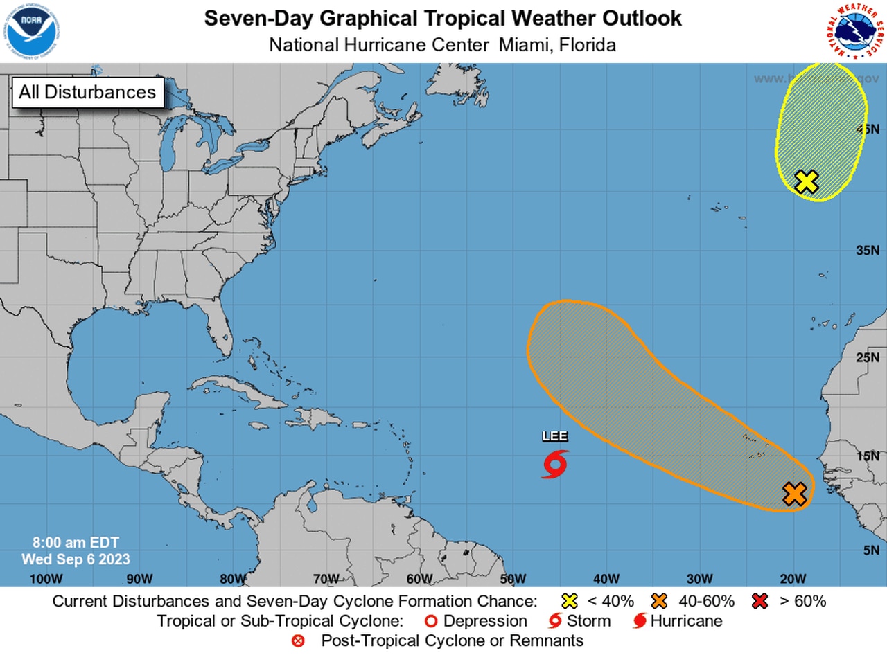
The hurricane center on Wednesday was also monitoring two other areas for potential development, but neither was a threat to the U.S.
One was a tropical wave in the eastern Atlantic that could become a depression later this week. It will move over the Cabo Verde Islands today and tonight, the hurricane center said. However, it is not expected to threaten the U.S. and will take a more northwest track that could keep it in the open Atlantic for the rest of its life.
The other disturbance, in the northern Atlantic, is what’s left of former Hurricane Franklin. It has a low chance of regenerating into a tropical or subtropical system and will move into more hostile conditions later this week, ending any chance of redevelopment.
In addition to Lee there are two other areas being monitored for development. Neither is a concern for the U.S.