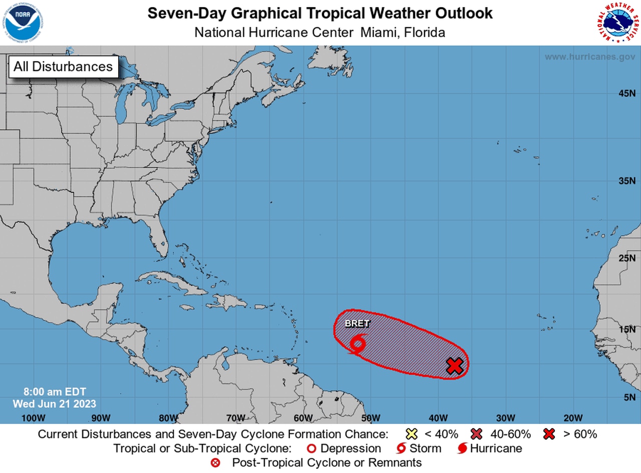
Tropical Storm Bret strengthens on track for Caribbean
Tropical Storm Bret’s winds rose to 60 mph on Wednesday as it closed in on the Leeward Islands in the Caribbean.
Tropical storm warnings and watches continued for some of those islands. Bret is on a path to cross through the islands on Thursday, and tropical storm conditions will be possible Thursday and Thursday night, according to the National Hurricane Center.
Then Bret is expected to take a path into the central Caribbean, where more unfavorable conditions are expected and could tear the storm apart before it threatens any other areas.
The Hurricane Hunters are scheduled to take a closer look at Bret today.
As of 10 a.m. CDT Wednesday, Tropical Storm Bret was located about 470 miles east of Barbados and was tracking to the west at 14 mph.
Bret’s winds were holding at 60 mph on Wednesday morning. Hurricane-force winds begin at 74 mph. The hurricane center doesn’t think Bret will be able to attain hurricane status before it moves into a more hostile environment in the Caribbean.
The hurricane center’s intensity forecast shows Bret peaking with top winds of 65 mph. It is forecast to weaken to a depression over the weekend.
A tropical storm warning is now in effect for St. Lucia. Tropical storm watches continued for the following Caribbean islands: Barbados, Dominica and Martinique.
The hurricane center warned others in the Lesser Antilles to keep an eye on Bret. Forecasters said more watches or warnings will likely be required for the islands later today.
Forecasters said Bret could bring 3 to 6 inches of rain — with some spots possibly getting up to 10 inches — to areas from Guadeloupe southward to Grenada, as well as gusty winds and rough seas.
ELSEWHERE IN THE TROPICAL ATLANTIC
A tropical disturbance to the east of Tropical Storm Bret (indicated by the red X) could become a tropical depression soon.
Bret is not the only thing brewing in the tropical Atlantic Ocean.
The hurricane center on Wednesday continued to track another tropical wave to the east of Bret in the central Atlantic, and it could become a tropical depression in the next day or two.
The hurricane center said it appeared the system had gotten better organized overnight, and conditions are favorable for that trend to continue.
Forecasters said a tropical depression will “likely” form over the next few days and track to the west at 10 to 15 mph.
A system has to have a defined center and winds of at least 39 mph to become a tropical storm and get a name. The next name on the 2023 Atlantic storm list is Cindy.
The Atlantic hurricane season began June 1 and lasts until Nov. 30. NOAA is forecasting a near-average season, with 12-17 named storms, seven to nine hurricanes and one to four major hurricanes (Category 3 or stronger).
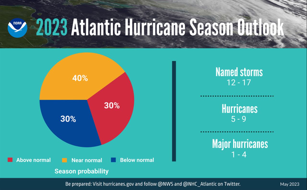
NOAA is predicting a near-average hurricane season in the Atlantic.