Tropical disturbance watched in the Gulf: What it means for Alabama
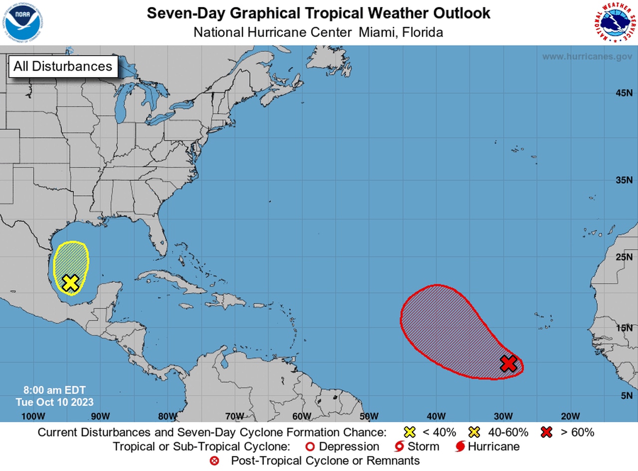
The National Hurricane Center continued to watch an area of low pressure in the Gulf of Mexico on Tuesday as well as a better-organized tropical wave far away in the eastern Atlantic.
The Gulf disturbance had only a 30 percent chance of becoming a tropical depression in the next seven days, but it could merge with a front and bring a lot of rain to drought-stricken areas in Alabama this week, according to forecasters.
Nonetheless, the hurricane center said the Hurricane Hunters will be dispatched to take a closer look at the system later today, “if necessary.”
The hurricane center said rain and storms have increased some with the disturbance in the southwestern Gulf as of Tuesday morning, and the surface pressure has been falling.
Forecasters said the system has a small opportunity to develop in in the next day before a frontal system approaches from the northwest.
Name or no name, the system will stir up the seas and bring gale-force winds to the northern Gulf by Wednesday. The National Weather Service in Mobile has issued a gale watch for the waters off Alabama and northwest Florida for Wednesday and Wednesday night.
The risk for rip currents will also be raised to high starting on Wednesday night, and a high risk will remain in effect until at least Friday.
The hurricane center said “potentially heavy rainfall” will also be possible along the Gulf Coast by late this week.
The hurricane center was also watching a better organized tropical wave in the eastern Atlantic several hundred miles southwest of the Cabo Verde Islands.
It could become a tropical depression in the next few days as it tracks to the west-northwest or northwest. It is no immediate threat to land.
The Atlantic hurricane season lasts until Nov. 30.
