Tornadoes, severe storms possible tonight in Alabama
Severe weather will be possible overnight in Alabama.
Tornadoes, straight-line winds, hail and heavy rain will all be possible as a line of storms tracks across Alabama starting late tonight.
Storms could reach Alabama’s western border by 10 p.m. and move eastward across the state overnight, according to the National Weather Service.
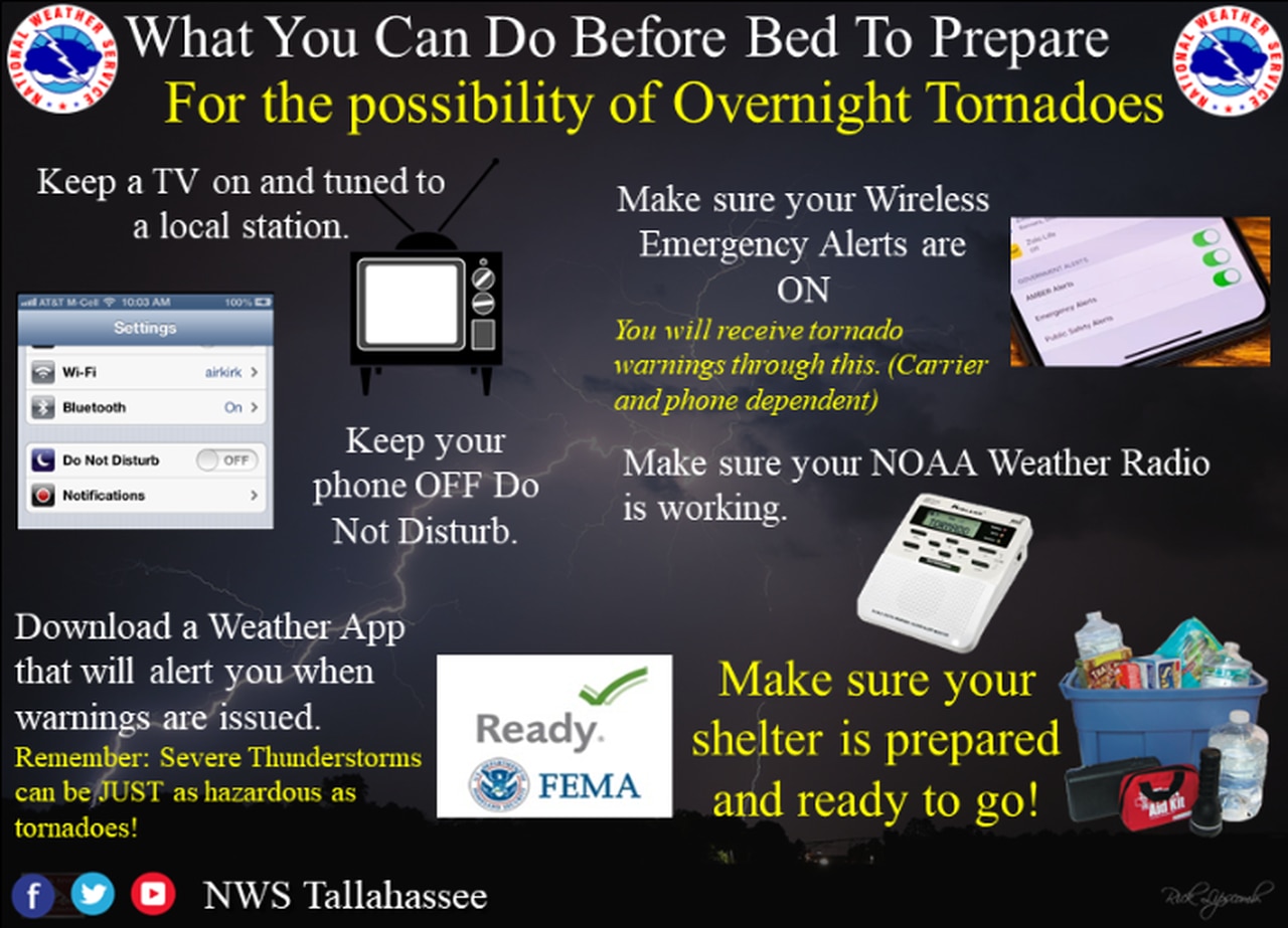
Forecasters said it’s very important that Alabamians have a reliable severe weather warning system in place for tonight.
“Nocturnal severe weather, whether that be tornadoes or damaging winds, is unfortunately far too common across Alabama, and it is imperative to have safety plans in place in the event of a severe weather risk,” the weather service in Birmingham said in its Friday forecast discussion.
Severe weather will be possible overnight. Here are some ways to prepare.
NOAA’s Storm Prediction Center has a Level 3 out of 5 risk for severe weather in place for the northwest corner of Alabama tonight. A Level 3 (or enhanced) risk means that numerous severe storms will be possible.
A larger part of north, central and west Alabama has a Level 2 risk tonight, which means that scattered severe storms are possible.
Parts of east and south Alabama will have a Level 1 risk and could see isolated severe storms. That Level 1 risk will linger into Saturday for southeast Alabama.
As of Friday morning the Level 3 risk area has been trimmed back and does not include as much of Alabama as it did in earlier forecasts. However, that area in northwest Alabama is still the spot that has the higher probability of seeing severe storms, according to the National Weather Service.
Will parts of the state catch a break? The weather service in Mobile also said that the threat for severe weather was trending downward for parts of south Alabama, though rain and severe storms will remain possible tonight.
Forecasters are expecting a line of storms — it could be a broken line of storms — to approach Alabama from the west tonight ahead of a strong cold front.
Storms could reach Alabama’s western border by 10 p.m. and head eastward. The weather service is expecting them to lose some intensity as they move farther east, but severe weather will remain possible in east Alabama as well.
Here’s a look at timing from the weather service:
NORTH ALABAMA
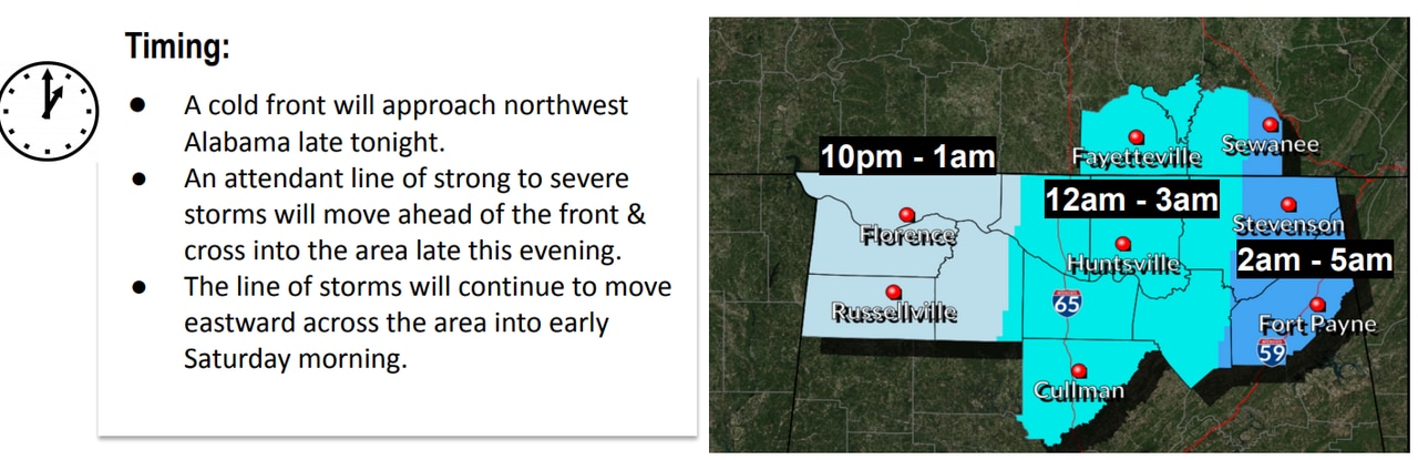
Strong storms could reach northwest Alabama by 10 p.m. and track eastward overnight.
CENTRAL ALABAMA
SOUTHWEST ALABAMA
SOUTHEAST ALABAMA
The threat for severe weather will not end with tonight’s storms, according to the weather service.
Forecasters think most of south Alabama could again see a few strong to severe storms on Sunday as a warm front lifts northward over the state. Severe weather isn’t expected in northern Alabama on Sunday, but rain and a few storms will be possible there as well.
There will be a Level 1 risk for severe weather for much of south Alabama on Sunday as well.