Tornadoes and severe storms possible in Alabama today
A fall round of severe weather will be possible across Alabama today, according to the National Weather Service.
Not only could there be severe thunderstorms, hail or even brief tornadoes, but it will also be windy — both near and away from storms. Look for winds to pick up this morning and stay breezy through the day.
That means that any outdoor decorations may need to take the day off and stay inside.
The weather service is expecting today’s storms to arrive in the form of a squall line starting this afternoon. Some rain could be possible this morning for southern parts of the state as well.
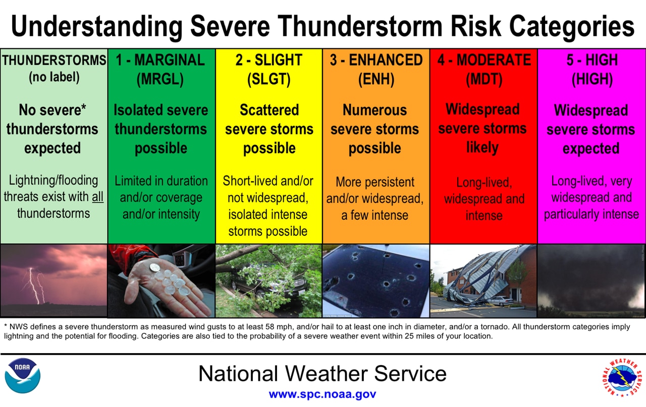
NOAA’s Storm Prediction Center is maintaining a Level 2 out of 5 risk for severe weather for a large part of Alabama today.
A Level 2 risk (or slight) means that scattered severe thunderstorms will be possible.
The rest of Alabama has a Level 1 or marginal risk, which means isolated severe storms will be possible.
Parts of Alabama will have slight and marginal risks for severe weather on Tuesday.
The strongest storms could have wind gusts up to 60 mph, and there will be a risk for a brief tornado, especially in west Alabama.
It will also be windy during the day today. Non-storm wind gusts could be as high as 40 mph, the weather service said, and wind advisories have been issued for parts of Alabama:
NORTH ALABAMA
* Wind advisory from 9 a.m. until 7 p.m. Tuesday for Lauderdale, Colbert, Franklin, Lawrence, Limestone, Madison, Morgan, Marshall, Jackson, DeKalb and Cullman counties.
CENTRAL ALABAMA
* Wind advisory from 10 a.m. until 7 p.m. Tuesday for Marion, Lamar, Fayette, Winston, Walker, Pickens and Tuscaloosa counties.
* Wind advisory from 1 p.m. until 9 p.m. Tuesday for Blount, Etowah, Calhoun, Cherokee, Cleburne, Jefferson, Shelby, St. Clair, Talladega, Clay, Randolph, Bibb, Chilton and Coosa counties.
The National Weather Service expects a line of rain and storms to move from west to east across the state starting this afternoon.
Storms could reach the Alabama-Mississippi border by noon and will work their way across the state through the evening hours.
The storms should be out of the state by Wednesday, and cooler weather is expected on Thursday and Friday.
The next weather system that could bring rain to much of the state is expected to arrive on Saturday, forecasters said.