Tornado watch possible later today in Alabama
Strong to severe storms will be possible on Saturday across a large part of Alabama.
The National Weather Service said tornadoes, damaging winds and heavy rain will all be possible with the strongest storms, which could make it to Alabama’s doorstep later this afternoon and into tonight. It will also be windy, even away from storms, so any outdoor decorations should be secured.
Rain and some storms were moving across parts of the state on Saturday morning, but no severe weather is expected until later today.
The weather service thinks a line of strong to severe storms could make it to west Alabama by 5 p.m. or so, but there is the potential for a few supercell storms to form earlier in the afternoon ahead of the main line. That possibility is still uncertain, however.
The weather service said a tornado watch could be issued for parts of the state sometime this afternoon unless there are big forecast changes.
The threat for isolated severe storms will continue into the overnight hours and into Sunday as well, mainly for parts of east and south Alabama.
NOAA’s Storm Prediction Center has expanded a Level 2 out of 5 risk for severe weather to include more of north and west Alabama today. A Level 2 risk means that scattered severe storms will be possible.
Some of the cities in the Level 2 risk area are Huntsville, Florence, Muscle Shoals, Decatur, Cullman, Hamilton and the northern part of Tuscaloosa.
Most of the rest of Alabama has a Level 1 out of 5 severe weather risk today and could have to deal with isolated severe storms.
Today’s storms could also bring a lot of rain. The weather service said 1 to 2 inches will be possible in parts of the state through Sunday morning.
Rain and storms will be possible on and off through the day today, but the threat for stronger storms will increase late this afternoon in west Alabama as a cold front approaches from the west.
The National Weather Service expects a line of storms to track from west to east across Alabama as the night progresses. Forecasters will also be on guard for the possibility of a few strong storms forming out ahead of the line — and those would be ones to watch for the possibility of tornadoes.
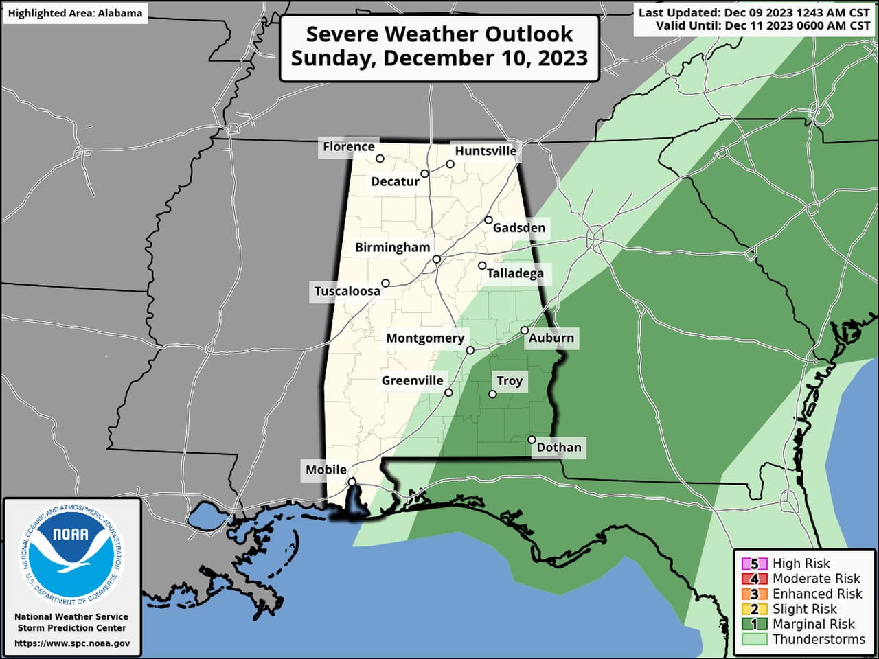
Storms could linger into Sunday. The Storm Prediction Center is forecasting a Level 1 risk for severe weather for the southeast corner of the state for Sunday:
The southeast corner of Alabama will have a Level 1 severe weather risk on Sunday.SPC
Drier and colder weather is expected from west to east following passage of the front starting on Sunday afternoon, and freezing temperatures are expected in parts of the state for the first part of the week.
The next chance for rain could arrive later next week, and so far no severe weather is expected.
Here is a look at what the weather service offices across the state were expecting: