The âSâ word is in the forecast for part of Alabama
Parts of north Alabama could see a little post-Christmas snow later this week, according to forecasters.
It is not expected to add up to much, if any, however.
The National Weather Service said parts of north and north-central Alabama, generally north of the Interstates 22 and 20 corridors, have the better chances of seeing any of the white stuff.
A few snowflakes will be possible as early as Wednesday night, but the weather service said the most likely time to see any snow will be from Thursday night into Friday morning.*
* Alabama snow forecast disclaimer: The weather service cautioned that forecast confidence in both the timing and the possible impacts from any snow that falls is low.
But one thing is more certain — ground temperatures are on the warmer side, so forecasters are not expecting major impacts.
Temperatures are forecast to cool down during the week, with highs only reaching the 40s and 50s in Alabama by Thursday.
Lows near freezing are expected later that night.
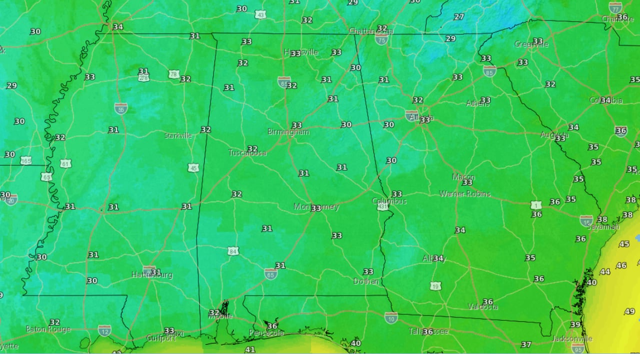
Here are the forecast lows for Thursday night into Friday morning:
Here are the forecast low temperatures from Thursday night into Friday morning.NWS
An upper-level weather system is expected to move into northern Alabama on Thursday, and precipitation is forecast to increase by Thursday afternoon, starting in northwest Alabama and tracking to the southeast.
Forecasters said “atmospheric conditions will support a rain-snow mixture or perhaps a transition entirely to snow from Thursday evening-Friday morning” in north Alabama, and there could be a brief rain-snow mix for areas in north-central Alabama.
No accumulations are expected at this point.
Temperatures are expected to warm up a little for the last weekend of 2023.