Strong tornadoes, severe storms possible Thursday
Severe weather is likely in Alabama on Thursday, according to the National Weather Service.
The entire state could see severe weather. Tornadoes — including some strong ones — wind gusts up to 70 mph, hail up to the size of golf balls and several inches of rain will all be possible starting this afternoon and lasting into the overnight hours.
Alabamians should have their severe weather plans in place and know exactly where they will go in the event of a tornado or damaging winds — especially this afternoon.
There could be multiple rounds of storms today, forecasters said.
“After seven days of advertising today’s severe threat, now it’s go time to put your preparations and severe weather plan into practice,” the National Weather Service in Birmingham said in Thursday morning’s forecast discussion.
NOAA’s Storm Prediction Center is maintaining a Level 3 out of 5 risk for severe weather for a large part of west and central Alabama. A Level 3 risk, also called an enhanced risk, means that “numerous” severe storms will be possible.
Nearly all the rest of the state has a Level 2 risk, which means that scattered severe storms will be possible.
Part of southeast Alabama has a Level 1 risk and could see isolated severe storms.
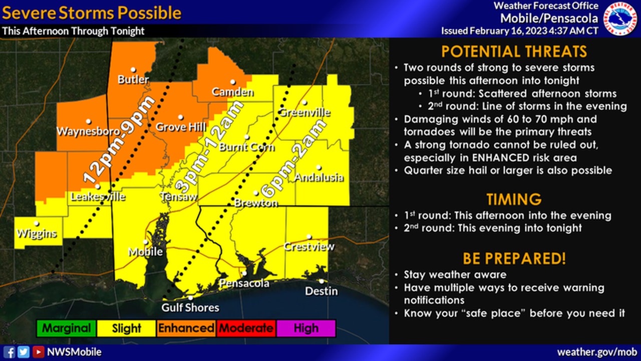
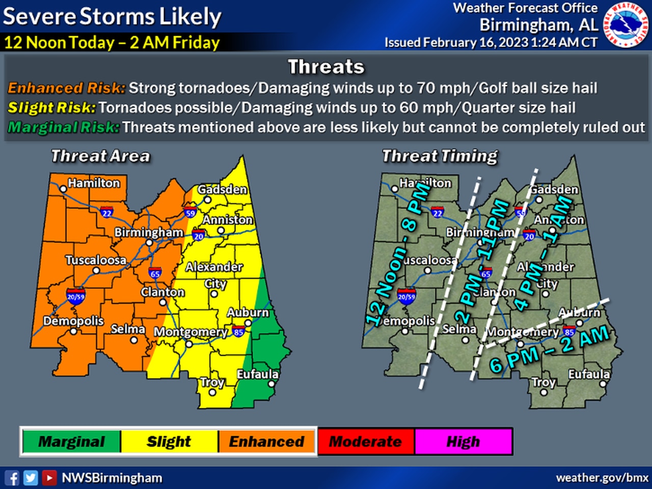
The National Weather Service said storms will be possible as soon as late this morning in west Alabama but will be most likely on the western border starting after noon. The storms are expected to push eastward through the afternoon and into the overnight hours.
Forecasters will be watching for two storm modes. There will be a squall line of storms that forms near or ahead of the cold front. Those storms could contain tornadoes and damaging winds.
Then there will also be the possibility of supercell storms that develop out ahead of the main line. Those could bring the potential for strong tornadoes as well as straight-line winds.
The weather service said forecast models are consistent in showing supercells develop across central and south Mississippi later this morning, which could then track northeast and into western Alabama early this afternoon.
Forecasters said those supercells could continue to track northeast through Alabama through the afternoon, and additional storms could develop along the cold front — and in between.
The weather service warned Alabamians not to let their guard down through the afternoon. It could be that tornadoes don’t initially develop in the afternoon, but forecasters said the threat could (and has in the past) increased around sunset.
The storms are expected to move out of Alabama during the day on Friday, although some rain could linger. Temperatures will fall behind the front as cooler and drier moves into the state, and lows by Saturday morning could be around the freezing mark in the northern half of the state.
No severe weather is in the forecast through the first part of next week.
Here is a look at the timing for storms expected today:
NORTH ALABAMA
CENTRAL ALABAMA
Here’s a look at when storms are expected in central Alabama on Thursday.
SOUTHWEST ALABAMA

Storms could reach southwest Alabama as soon as noon on Thursday.
SOUTHEAST ALABAMA
