Strong storms possible today, Monday in south Alabama
Alabama is facing two chances for rain and storms in the next few days — and those in south Alabama face the potential for severe weather, with damaging winds and tornadoes possible.
Isolated severe storms could be possible close to the coast starting later this evening, according to the National Weather Service. Another system will bring the potential for storms on Monday into Tuesday, and that system has the potential to produce significant severe weather, according to forecasters, including a strong tornado.
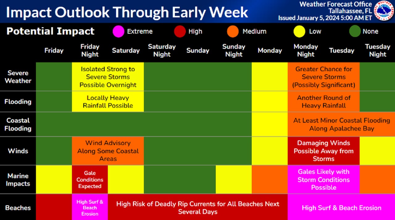
No severe weather is expected in north or central Alabama for either event, but there will be rain and perhaps a thunderstorm or two in the mix, according to the weather service.
However, forecasters are expecting winds to pick up later today and especially on Monday, so if there are still Christmas decorations outside they may need to be put away over the weekend.
Here are the details on both weather systems.
TODAY
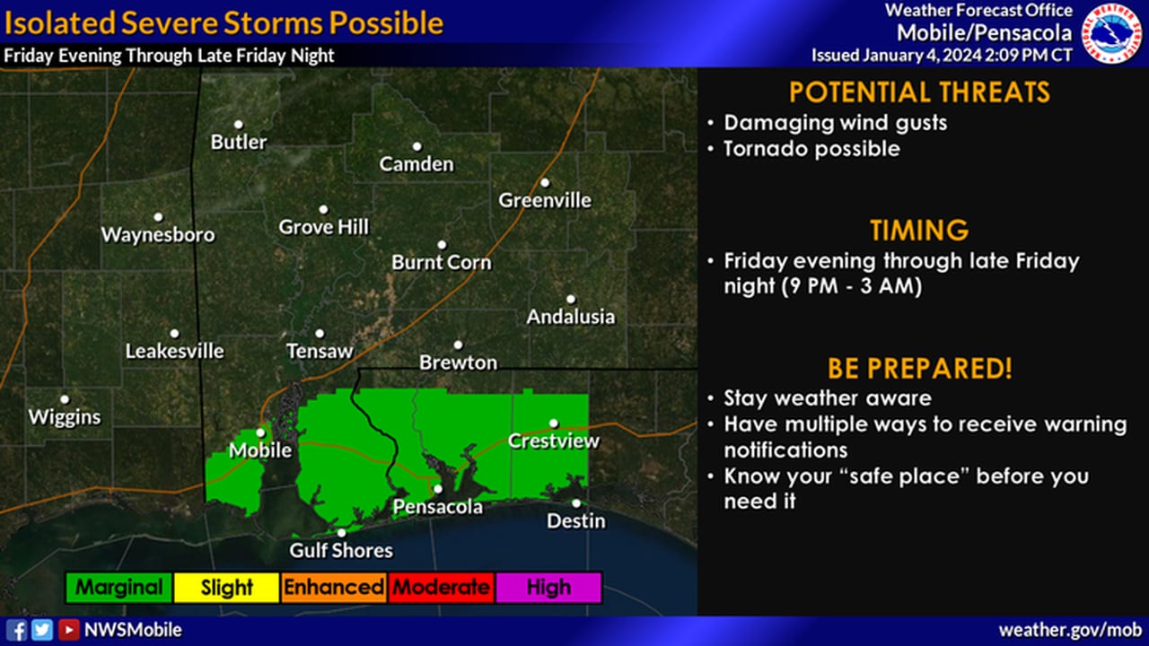
Here is the area that could see an isolated severe storm today.National Weather Service
NOAA’s Storm Prediction Center has a Level 1 out of 5 risk for severe weather confined to areas along the coast in Alabama and northwest Florida (see the map at the top of this post) for Friday.
A Level 1 (or marginal) risk means that isolated severe storms will be possible.
An area of low pressure is expected to track eastward along the Gulf Coast today, and there will be a warm front over the Gulf. That warm front will attempt to move northward toward the coast today, according to the weather service.
Strong to severe storms will be possible in areas south of the front, and forecasters will be tracking its northward progress very carefully today. The thinking as of Friday morning is that the front may not make it to the coast — and if it does it likely wouldn’t move that far inland.
So the weather service is thinking that areas along and south of the Interstate 10 corridor would stand the better chance of seeing stronger storms. Of course that area could widen if the warm front moves farther north than expected.
Storms will be the most likely starting tonight, according to the weather service.
In addition to storms there will also be a high risk of rip currents and heavy surf along the coast, forecasters said.
Rain and a non-severe storm or two will also move from west to east across the rest of the state starting later tonight.
The rain is expected to move out of the state during the morning hours on Saturday.
MONDAY-TUESDAY
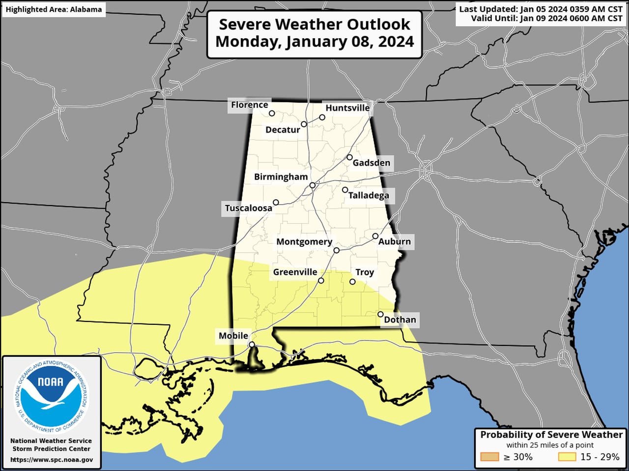
There will be a risk for severe storms in south Alabama from Monday night into Tuesday morning.SPC
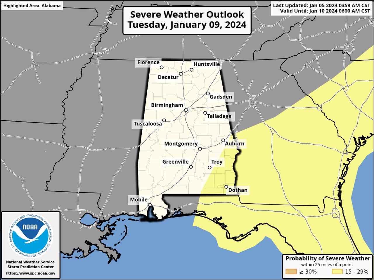
The risk for severe storms will continue into Tuesday morning for southeast Alabama.SPC
There appears to be a more significant risk for severe weather for south Alabama from Monday night into Tuesday morning.
The Storm Prediction Center has outlined an area that includes south Alabama in its Day 4 severe weather risk outlook. Southeast Alabama also is included in the Day 5 severe risk outlook.
SPC forecasters said the environment on Monday night into Tuesday “may become conducive to considerable organized severe thunderstorm development, including supercells, with potential to produce damaging wind gusts and a few strong tornadoes.”
Forecasters will again be watching for another warm front to lift northward from the Gulf. This one has the potential to make more progress inland, and a round of strong to severe storms will be possible in areas along and south of it.
Then another line of strong to severe storms is expected to develop and track from west to east across south Alabama late Monday into Tuesday morning.
This system could also bring 2 to 4 inches of rain to parts of south Alabama, according to the weather service.
And wind gusts, especially in south Alabama and along the coast, could get as high as 30-45 mph on Monday even away from storms, so there will likely be wind advisories issued for parts of the state on Monday.
Rain chances are expected to drop from west to east on Tuesday, and calmer weather is expected into the middle of next week.
Here’s a look at the severe weather risk for southeast Alabama.NWS