Strong storms possible late Friday in Alabama
Strong storms will be possible across a large part of Alabama on Friday, according to forecasters.
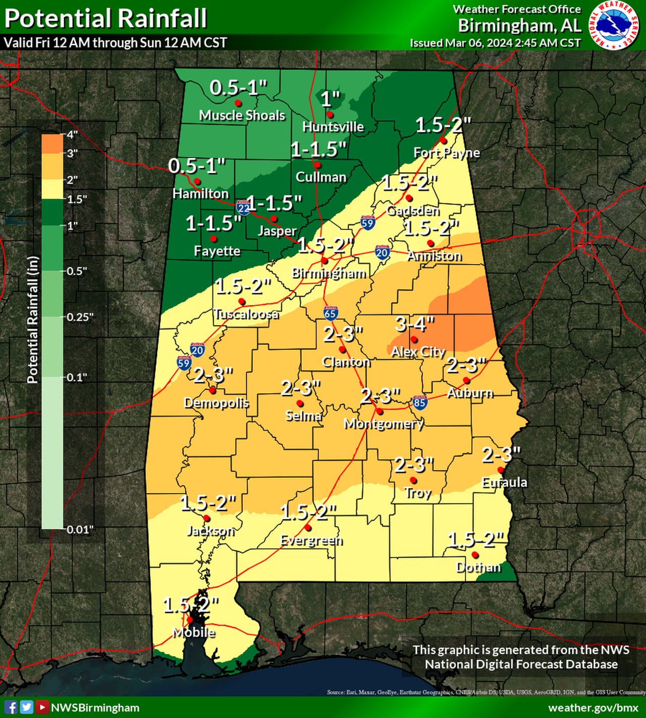
There could also be some heavy rain, and it could add up to 4 inches in some areas by Saturday, according to the National Weather Service.
The storms on Friday could arrive late in the day in west Alabama and last into Saturday afternoon in east Alabama. Damaging winds and a tornado or two will be possible, according to the weather service.
The Storm Prediction Center has added a Level 2 out of 5 (or slight) risk for severe weather for part of south Alabama for Friday. A Level 2 risk means that scattered severe storms will be possible. (See Friday’s severe weather outlook at the top of this post.)
A wider area, which includes all of the rest of the state except for the northeast corner, has a Level 1 risk. A Level 1 risk means that isolated severe storms will be possible.
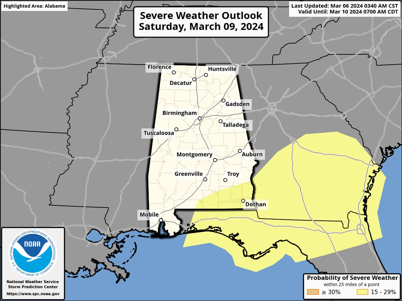
The threat for strong storms could linger into the day on Saturday for the southeast corner of Alabama. Here is the severe weather outlook for Saturday:
Some storms could last into the day on Saturday in southeast Alabama (areas in yellow).SPC
“The main takeaway is that a severe weather event with potential for tornado and damaging straight-line wind threats may impact our area,” the National Weather Service in Mobile said in its morning forecast discussion on Wednesday. “Please continue to closely monitor forecast updates over the next couple of days.”
The weather service also said some isolated flooding could be possible in areas that get a lot of heavy rain. Here is the rainfall forecast through midnight Sunday:

Some parts of central Alabama could get up to 4 inches of rain through Saturday night.NWS
The rain is expected to clear out from west to east starting on Saturday afternoon, and drier and cooler weather is expected statewide for Sunday and into the upcoming week. However, the weather service is forecasting temperatures to begin to warm up again next week.
