Strong storms possible in Alabama on Sunday and Monday
Strong to severe storms will be possible in parts of Alabama on Sunday and Monday, according to forecasters.
The strongest storms could have wind gusts capable of knocking down tree limbs and power lines, as well as a tornado.
Rain chances for Alabama will go up through the day today, but the most likely time for stronger storms, according to the National Weather Service, will be Sunday night into Monday morning.
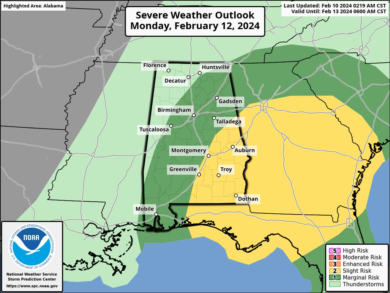
NOAA’s Storm Prediction Center is maintaining a Level 2 out of 5 risk for severe weather for part of southwest Alabama on Sunday, and part of east Alabama for Monday.
Sunday’s severe weather outlook is at the top of this post. Below is the severe weather outlook for Monday:
The threat for a few strong to severe storms will last into Monday morning in parts of Alabama.SPC
A Level 2 risk means that scattered severe storms will be possible.
Parts of central and south Alabama will have a Level 1 risk on Sunday, and part of northeast Alabama as well as south Alabama and parts of central Alabama will have a Level 1 risk on Monday.
A Level 1 risk means that isolated severe storms will be possible.
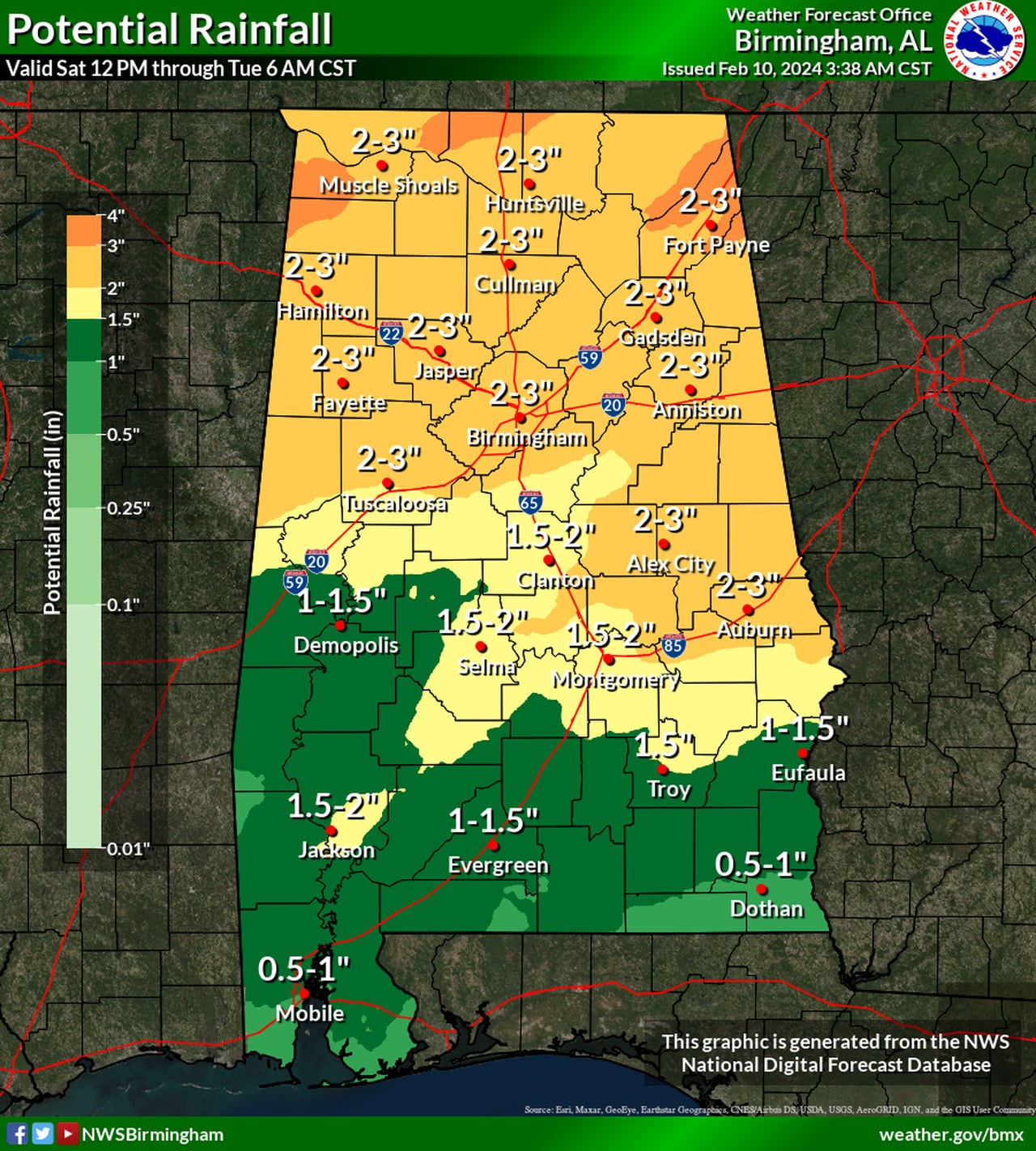
There could also be several inches of rain through Monday for parts of the state. Here is the weather service’s rain outlook:

Potential rainfall through Tuesday morning.NWS
The weather service said that a front stalled out across the state will kick off several rounds of rain and storms through Monday.
Unstable air will be located across south Alabama, which has the higher probability of seeing storms. If that unstable air can make it farther north then parts of central Alabama could see strong storms as well.
With several rounds of rain expected, forecasters will be watching in case flooding becomes a concern.
Rain and storms are expected to end from west to east during the day on Monday, and drier weather is expected from Tuesday through Thursday.
The next potential rainmaker for Alabama may be on track to arrive next weekend.
