‘Significant’ weather forecast change for Alabama
The National Weather Service said it has made some big changes to its forecast for severe weather for Alabama.
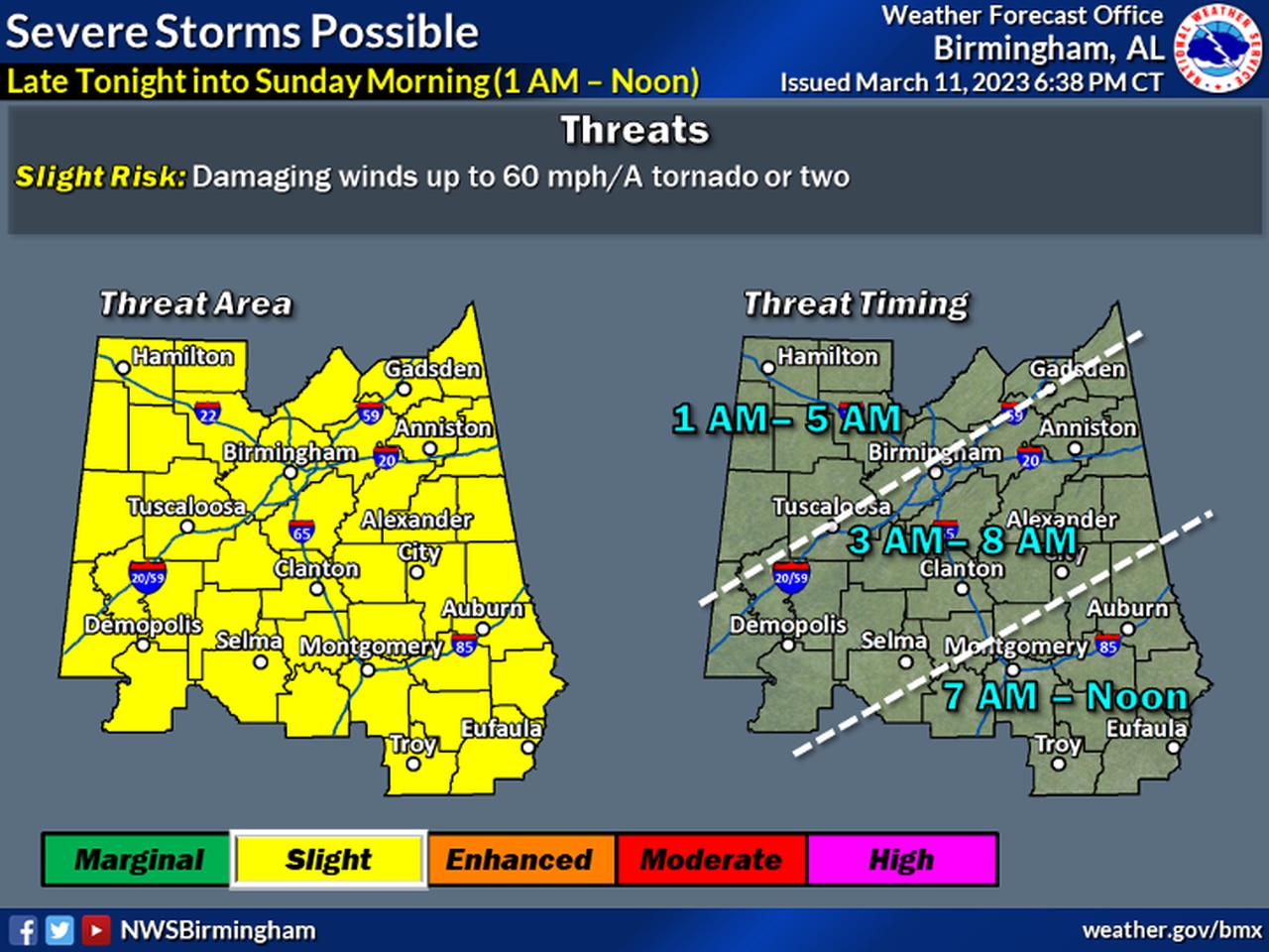
The weather service office in Birmingham said it now looks like strong to severe storms will be possible across central Alabama during the overnight and early morning hours — and there will likely not be a secondary threat on Sunday afternoon.
The overnight storms could end up being the main severe weather threat — at least for central Alabama, forecasters said.
The weather service in Birmingham altered its forecast for central Alabama and has placed that region in a Level 2 out of 5 severe weather risk for tonight, mainly from 1 a.m. until noon on Sunday.
Damaging winds and a tornado or two will be possible, the weather service said.
Forecasters said storms are now expected to develop across northern Mississippi late tonight and spread southeastward into Alabama during the early morning hours.
The weather service in Mobile said that storms are expected to reach the northern part of southwest Alabama late Sunday morning and could be strong to severe. They are expected to affect the rest of southern Alabama through the afternoon hours.
The weather service in Huntsville was tracking storms over southern Tennessee and far northern Alabama on Saturday night. As of 8:30 p.m. Saturday none was severe, but heavy rain could be possible for the northern part of the state.
The weather service said in its latest forecast discussion that the better conditions for strong storms will be south of north Alabama but a few stronger storms could be possible overnight.
