Severe weather: Tornado watch issued for north Alabama
Severe weather will be possible in northern Alabama overnight, and a tornado watch has been issued for northern Alabama.
There is also one tornado warning in effect for western Lauderdale and western Colbert counties in northwest Alabama until 8 p.m.
As of 7:32 p.m. the storm was in Mississippi near Thrashers and was moving east at 40 mph.
The tornado watch will be in effect until 2 a.m. Thursday and covers all of north Alabama and several counties in the northwestern part of central Alabama.
The Alabama counties in the watch are Cullman, Limestone, Madison, Morgan, DeKalb, Jackson, Marshall, Colbert, Franklin, Lauderdale, Lawrence, Fayette, Lamar, Marion, Walker and Winston.
NOAA’s Storm Prediction Center said a couple of tornadoes — including a strong tornado or two — will be possible in the watch area, which also includes part of Tennessee, as well as damaging winds and hail.
Forecasters were tracking storms over northern Mississippi and parts of Tennessee that were headed eastward toward Alabama. The SPC said the severe weather and tornado potential “is expected to steadily increase through mid into late-evening.”
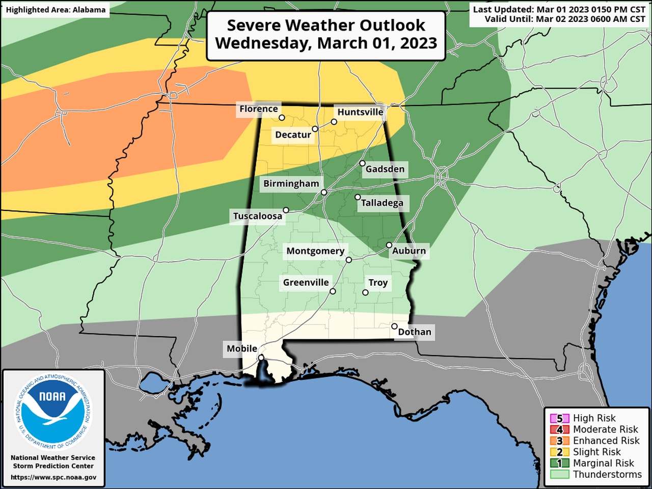
The SPC has the northern part of the state in a Level 2 out of 5 risk of severe weather overnight, which means that scattered severe storms will be possible.
Part of central Alabama has a Level 1 risk for severe weather, which means that isolated severe storms will be possible.
Parts of Alabama could have to deal with severe weather over the next three days. Above is today’s updated severe weather outlook. Areas in yellow have a Level 2 out of 5 risk for severe weather; areas in dark green have a Level 1 risk. Storms are expected to develop later this afternoon and especially tonight and could generate tornadoes, damaging winds, hail and flooding rain.