Severe weather possible Wednesday, Thursday and Friday
Forecasters think there will be three days this week that will have the potential for severe weather.
The first round of storms will be possible on Wednesday. Then a stronger system is expected on Thursday and could produce storms in Alabama into Friday as well.
Tornadoes, wind gusts to 70 mph, hail and flooding rain will all be possible, according to the National Weather Service.
It will also be windy — both near and away from storms.
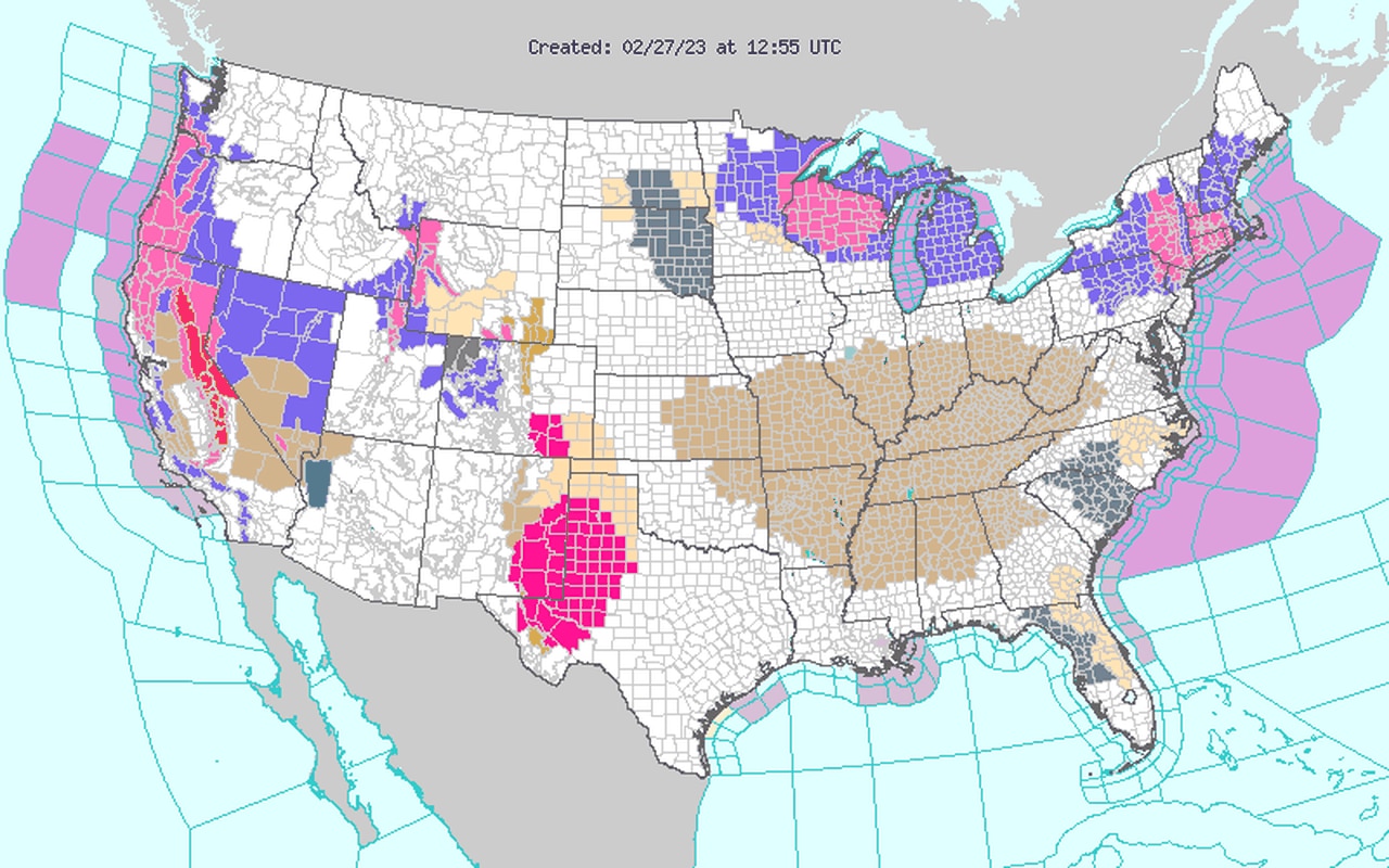
It could be windy today (Monday) as well, and a wind advisory is in effect for the northern two-thirds of Alabama until 6 p.m. Winds today could gust as high as 40-50 mph in some areas, according to the weather service.
The Alabama counties in brown on the map below are under wind advisories today:
A large part of Alabama will be under wind advisories today (Monday).
Let’s take a look at the upcoming chances for severe weather:
WEDNESDAY
NOAA’s Storm Prediction Center has added a Level 1 out of 5 risk, also known as a marginal risk, for all of north Alabama, most of central Alabama and part of south Alabama for Wednesday.
A Level 1 risk means isolated severe storms will be possible.
Here is Wednesday’s severe weather outlook:
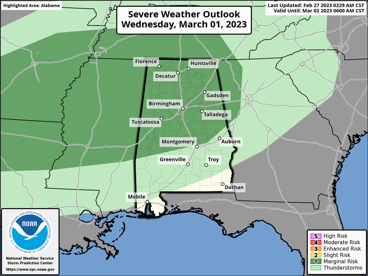
Isolated severe storms will be possible in the areas in dark green on Wednesday. Damaging winds and heavy rain will be the biggest concerns.
The weather service said large hail and wind gusts up to 60 mph will be possible with any storms that develop on Wednesday.
The most likely time for storms will be Wednesday afternoon into the evening hours, forecasters said.
A stalled frontal boundary over south Alabama and the Gulf is forecast to lift back to the north by Wednesday, and that, combined with a wave of energy from a storm system to the north, could combine to produce a few strong storms.
THURSDAY-FRIDAY
Unsettled weather over Alabama will continue from Wednesday into Thursday as another, stronger storm system approaches Alabama from the west and brings a cold front along with it.
The Storm Prediction Center has an enhanced risk for severe weather in place for parts of western Alabama in anticipation for Thursday, and most of the rest of the state will have a slight risk.
The weather service as of Monday morning was leaning more to the idea of a line of storms moving quickly from west to east across Alabama along a cold front, with those storms potentially spawning tornadoes.
Forecasters will also be watching for the possibility of strong (60 mph or higher) winds with the storms, which are expected to be moving quickly. That has the potential to bring down trees and power lines.
Forecasters, especially in north Alabama, will also be on guard for the potential for flooding. Some spots in the state could see 3 or more inches of rain from Wednesday into Friday, according to the weather service.
The timing for Thursday’s system will be refined in the coming days, but as of Monday morning the most likely time for severe weather will be from the afternoon hours of Thursday through the night and into Friday morning.
Western Alabama is the most likely place to see the stronger storms.
However, the Storm Prediction Center has a risk of severe weather for eastern Alabama on Friday as well.
Thursday’s severe weather outlook is at the top of this post. Below is Friday’s severe weather outlook:
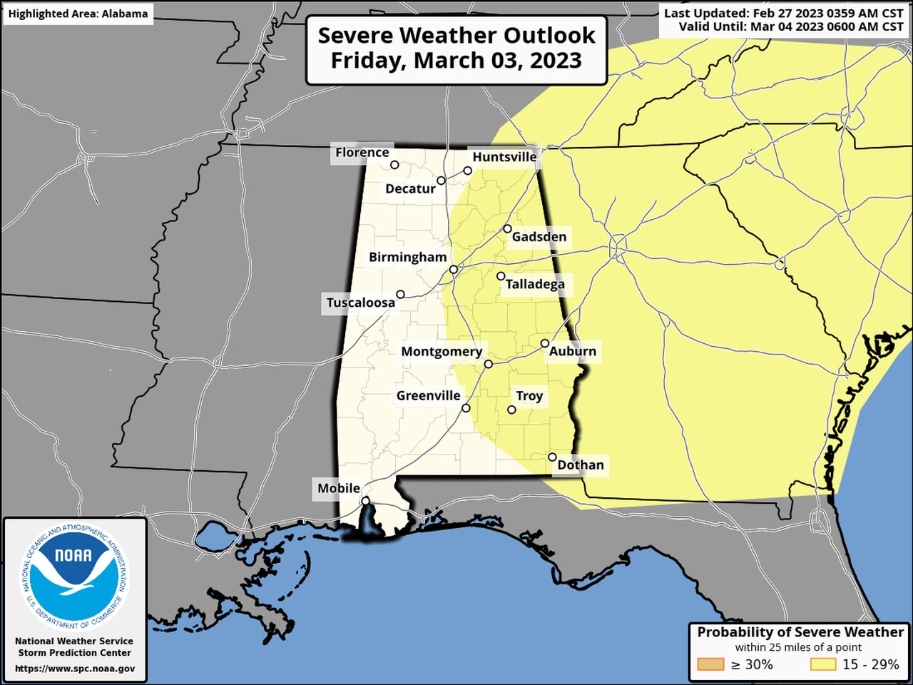
Strong storms could linger for the eastern half of the state on Friday.
Calmer, cooler and drier weather is expected to take over starting on Friday and is expected to last through the weekend, according to the weather service.