Severe weather possible Wednesday through Friday
The next few days could be busy in the weather department.
NOAA’s Storm Prediction Center is highlighting the possibility for severe weather for the next three days: Wednesday, Thursday and Friday, with Friday potentially being the busiest day for storms statewide.
Tornadoes, damaging winds and heavy rain will all be possible with the strongest storms, according to the National Weather Service.
Here’s a look at what to expect over the next three days.
Wednesday’s severe weather threat is expected to be confined to the northern half of Alabama. Severe weather is not expected across south Alabama.
Tornadoes, damaging winds and hail will all be possible across north and north-central parts of the state, according to forecasters.
The Storm Prediction Center has a Level 2 out of 5 risk for severe weather for northwest Alabama and a Level 1 risk for the rest of north Alabama and a chunk of central Alabama (Wednesday’s severe weather outlook is at the top of this post).
A Level 2 risk means that scattered severe storms will be possible. A Level 1 risk means isolated severe storms will be possible.
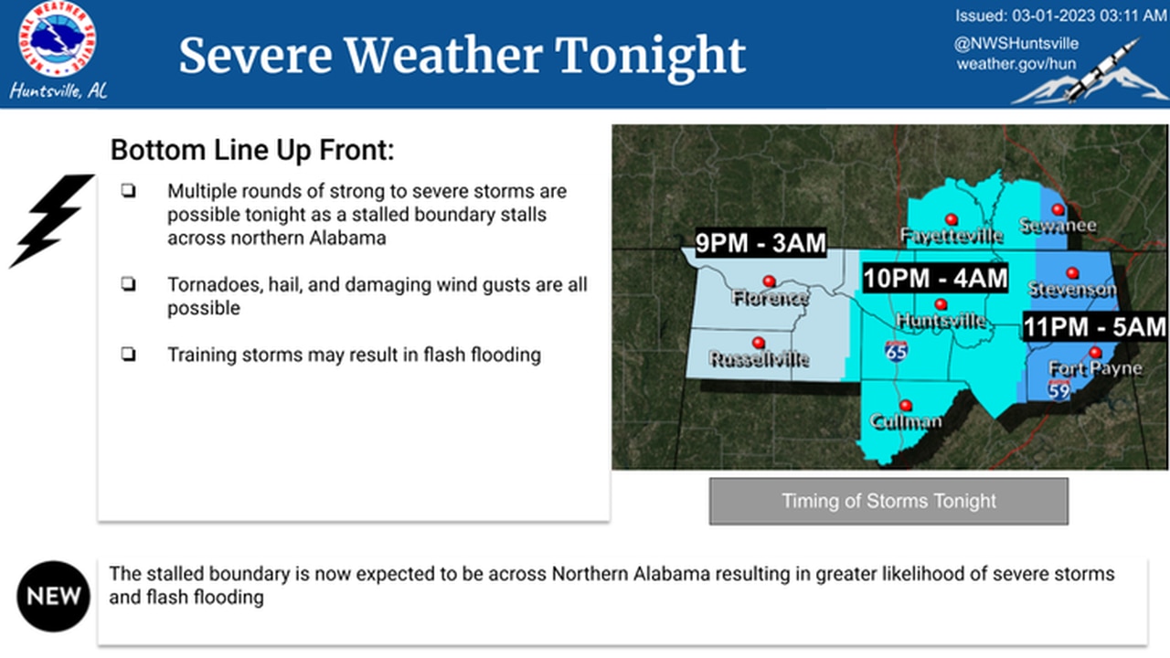
The National Weather Service in Huntsville said multiple rounds of rain and storms will be possible tonight as a stalled frontal boundary settles near northern Alabama.
The weather service said storms will be possible in northwest Alabama starting around 9 p.m., and the threat will migrate eastward through the overnight hours.
Here’s a look at the timing for north Alabama:
Here’s when storms are expected to affect north Alabama tonight.
Heavy rain will also be possible for north Alabama, and a flood watch will be in effect from 6 p.m. today until 6 p.m. Friday. One to 3 inches of rain will be possible, with some areas potentially getting up to 4 inches.
Here’s a look at the potential rainfall for north Alabama:
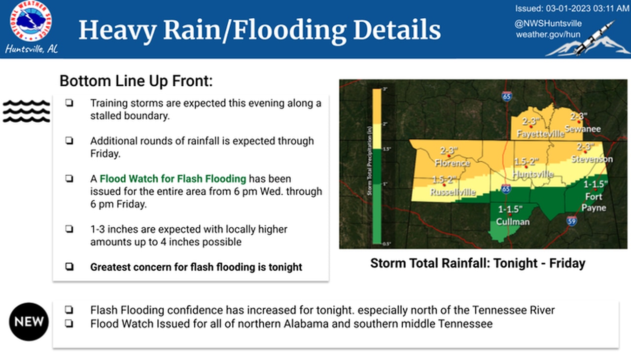
Flash flooding will be possible across parts of north Alabama starting later tonight.
The threat for severe storms this afternoon will be more conditional for central Alabama, according to the weather service. Storms are not a sure thing for central Alabama, but if they manage to develop they could intensify quickly.
However, the northern part of central Alabama has a better chance of seeing severe storms later tonight and into the overnight hours.
The weather service in Birmingham said central Alabama could see storms from 1 until 7 p.m. today, and areas in the northwest part of the region could see them later tonight, from 8 p.m. until 3 a.m.
Here’s a look at the timing for central Alabama:
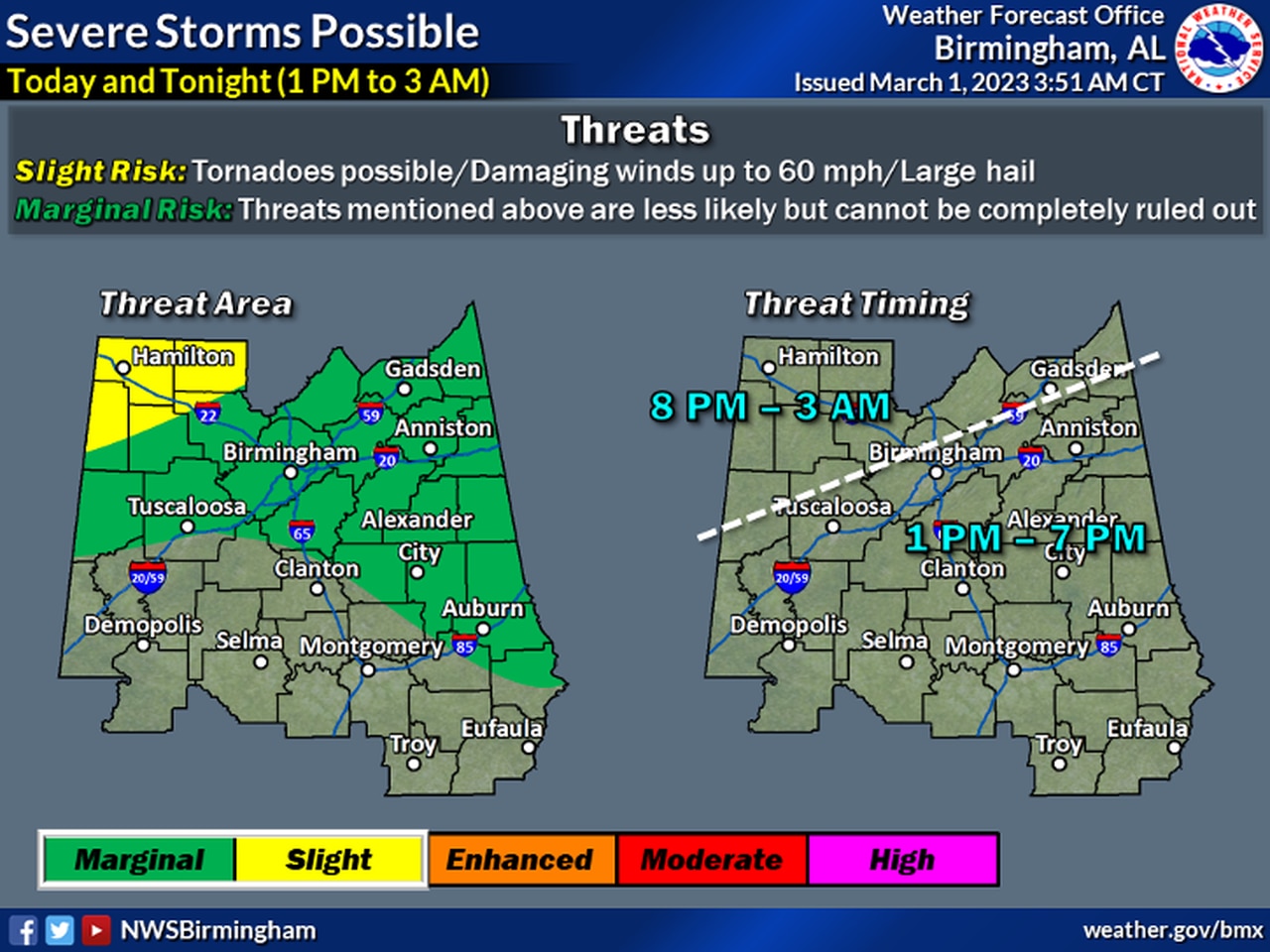
Storms will be possible across the northern part of central Alabama later this afternoon and into the overnight hours.
The weather service said storms will be possible through the afternoon hours, and then attention will turn to the west, where storms are expected to approach the state line from Mississippi later tonight.
No severe weather is expected across south Alabama, according to the weather service.
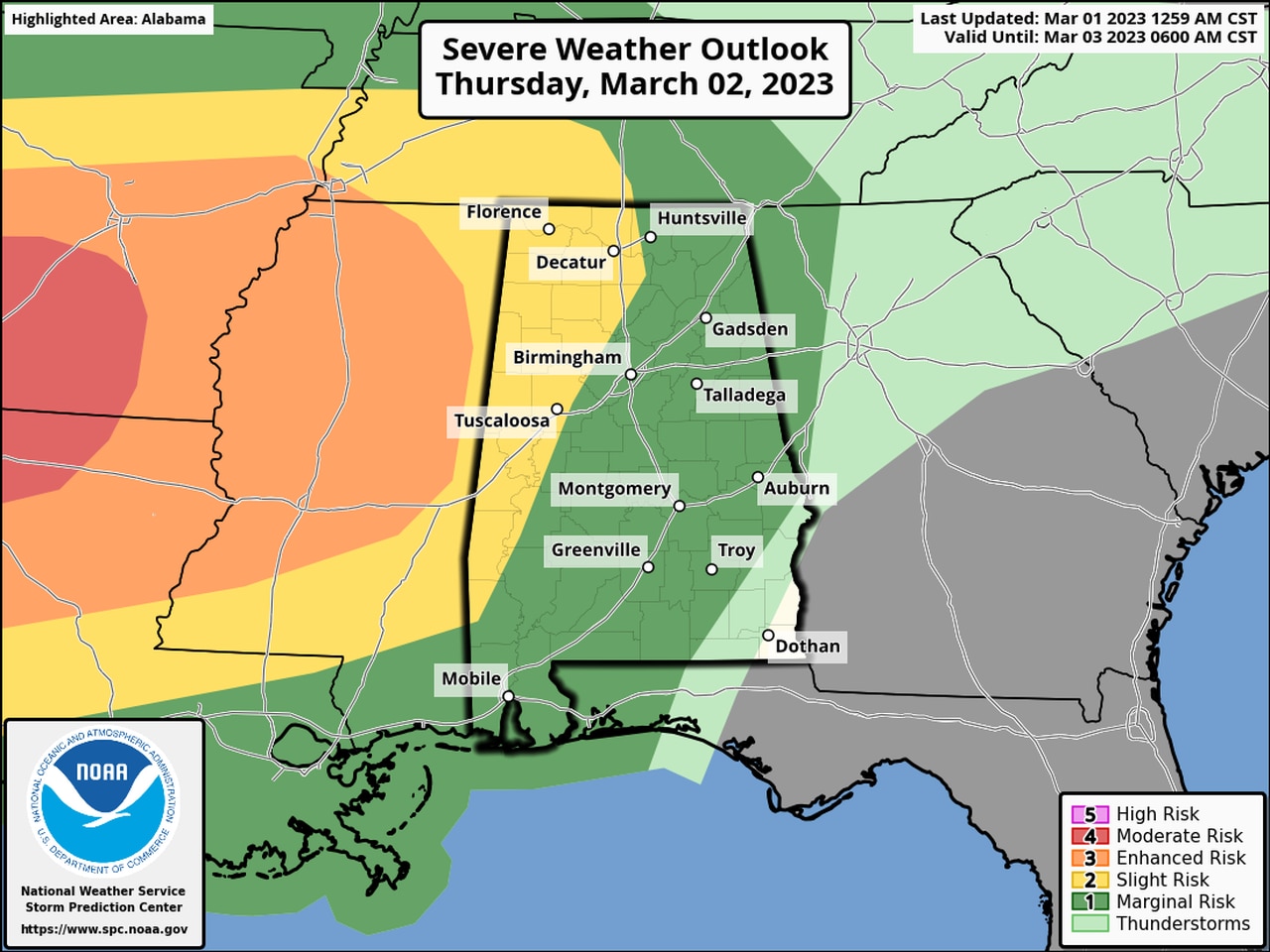
The western part of Alabama has the better potential to see severe storms on Thursday.
The Storm Prediction Center has nearly all of Alabama in some sort of severe weather risk for the late Thursday-Friday morning period. The time frame for the map above is from 6 a.m. Thursday until 6 a.m. Friday.
The areas in yellow will have a Level 2 out of 5 risk for severe weather, which means scattered severe storms will be possible.
The areas in dark green will have a Level 1 risk, which means isolated severe storms will be possible.
The threat for severe weather will continue into the day on Friday. Here is Friday’s severe weather outlook, which has nearly all of Alabama in a Level 2 out of 5 risk for severe storms (this map is valid from 6 a.m. Friday through 6 a.m. Saturday):
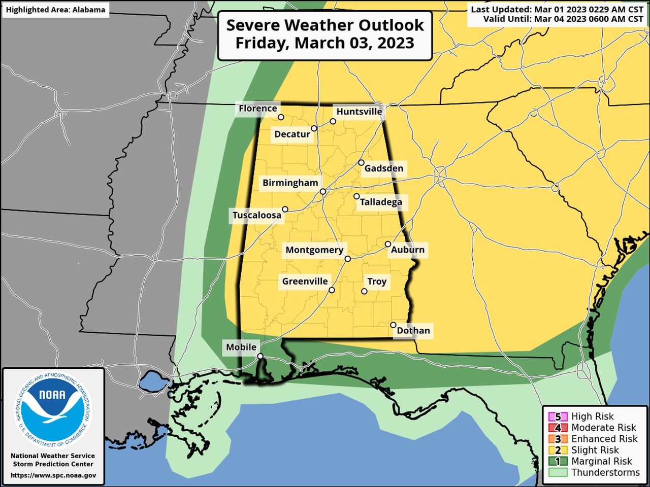
All of Alabama could see strong to severe storms on Friday.
Tornadoes, damaging winds, hail and heavy rain will again all be possible with the strongest storms.
Forecasters will be tracking a cold front that is expected to approach Alabama from the west. The timing continues to be pushed back, and the front isn’t expected to approach Alabama until early Friday morning.
However, the weather service cautioned that changes to the timing could be possible as the system gets closer.
The National Weather Service in Huntsville said a few storms will be possible for north Alabama on Thursday afternoon, and some could be strong to severe.
The National Weather Service in Birmingham said showers and a few storms will be possible across the northern part of central Alabama on Thursday morning through the afternoon hours. Those daytime storms could help mitigate the threat for stronger storms for central Alabama on Thursday afternoon, forecasters said.
Then the front makes it here during the overnight hours, bringing the potential for severe storms statewide from west to east through Friday afternoon.
Here’s a look at the timing for potential storms for different regions in Alabama from the weather service:
NORTH ALABAMA
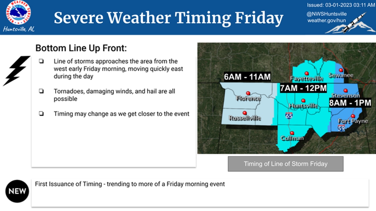
Storms could reach northwest Alabama early Friday morning and track eastward.
CENTRAL ALABAMA
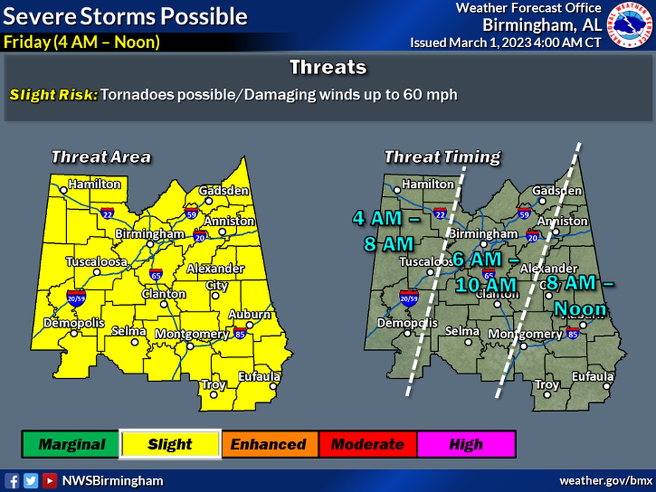
Storms could make it to the western part of central Alabama by 4 a.m. Friday and track east.
SOUTHWEST ALABAMA
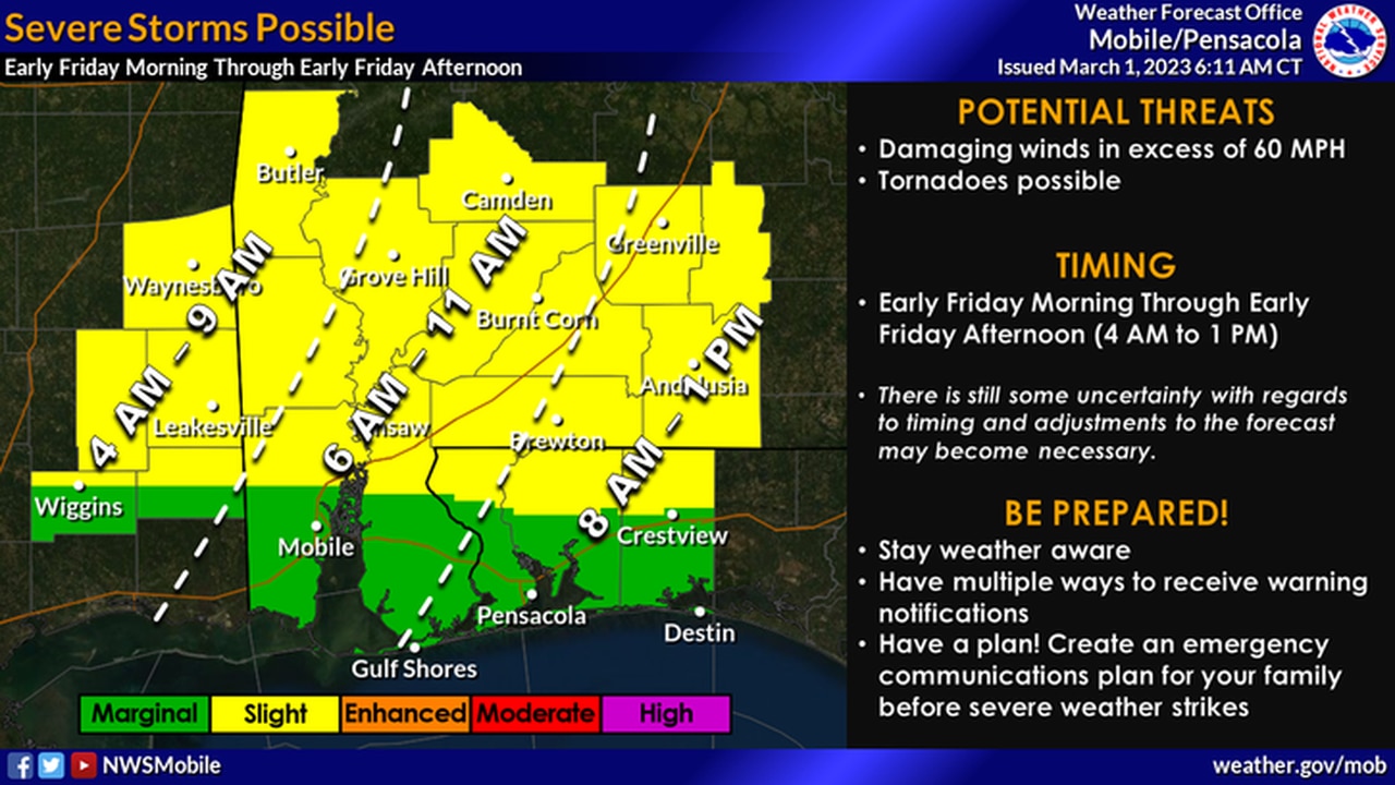
Storms will make it to the western part of south Alabama early Friday morning.
SOUTHEAST ALABAMA
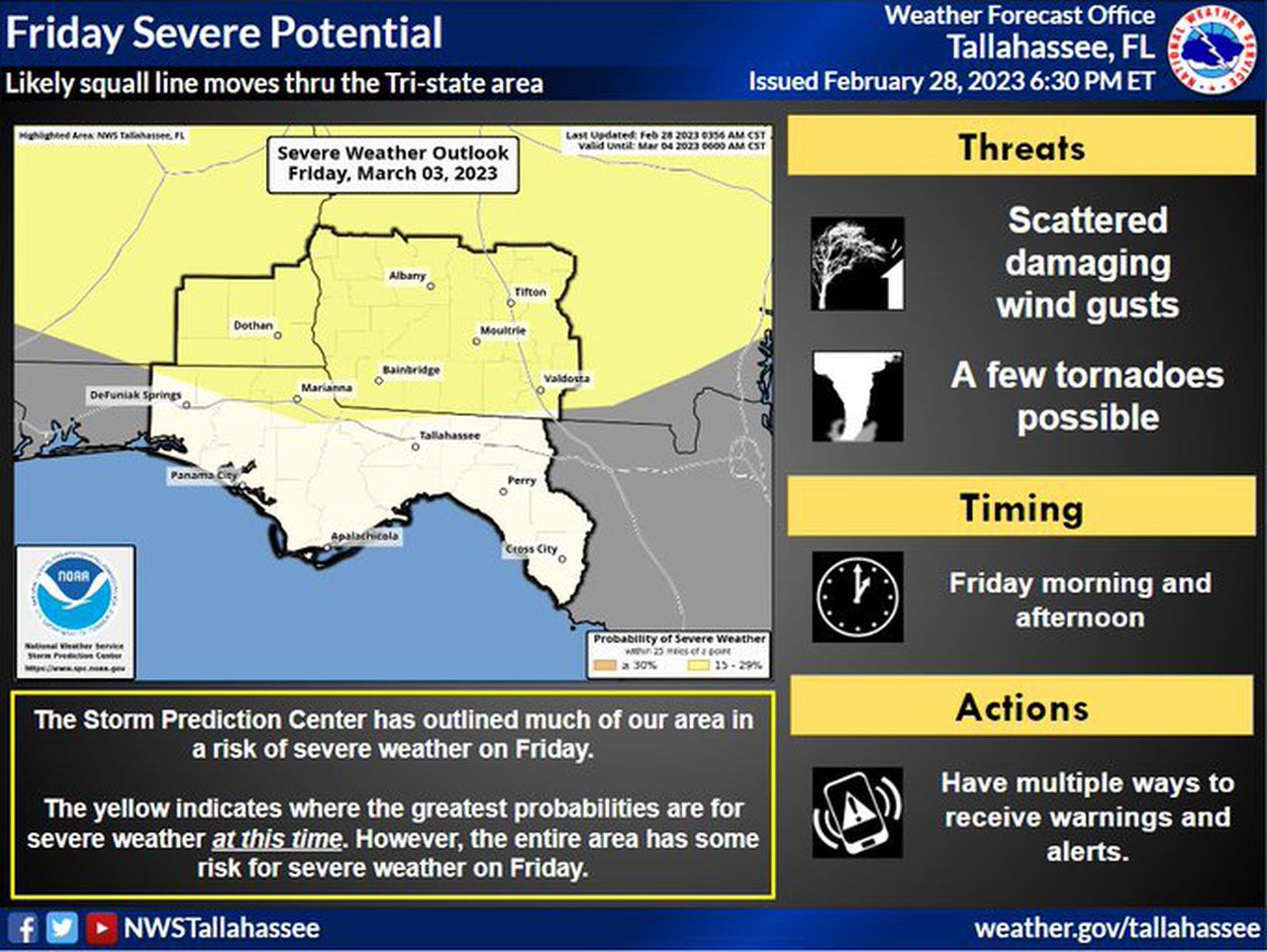
Storms could approach southeast Alabama on Friday morning.
Cooler, drier and calmer weather is expected to follow Friday’s storms, and no severe weather is expected through at least the first part of next week.
