Severe weather possible overnight in Alabama
The threat for severe weather was still hanging over Alabama late Friday, and a PDS tornado watch continued for three counties in the northwest part of the state.
However, as of 10 p.m. all was quiet across the state, with no severe weather reported.
But that could change overnight.
NOAA’s Storm Prediction Center was maintaining a Level 4 out of 5 risk for severe weather for the northwest part of Alabama overnight. The rest of north Alabama and parts of central and southwest Alabama also had a chance to see severe storms, which were expected to arrive ahead of a cold front.
Severe weather wasn’t expected overnight in south Alabama, but on Saturday there could be isolated strong to severe storms in the southeast corner of the state.
The National Weather Service offices in both Huntsville and Birmingham adjusted their timing a bit for the arrival of storms — pushing the start times back some from earlier forecasts (more on that below).
Severe storms had already wrought considerable damage in parts of Arkansas and Tennessee as of Friday night.
A PDS tornado watch remained in effect for Lauderdale, Colbert and Franklin counties in northwest Alabama until 1 a.m. Saturday. PDS means “particularly dangerous situation,” and it’s a kind of heightened watch not used all that often.
Friday saw a wide-ranging area from the Southeast to the Midwest under threat for severe weather.
The National Weather Service offices in Alabama were keeping a close eye on action to the west late Friday.
The weather service in Huntsville said the timing for storms to arrive had slowed, and they may not reach northwest Alabama until midnight or so.
Storms were expected to drop to the east and south and work their way across the northern half of the state overnight.
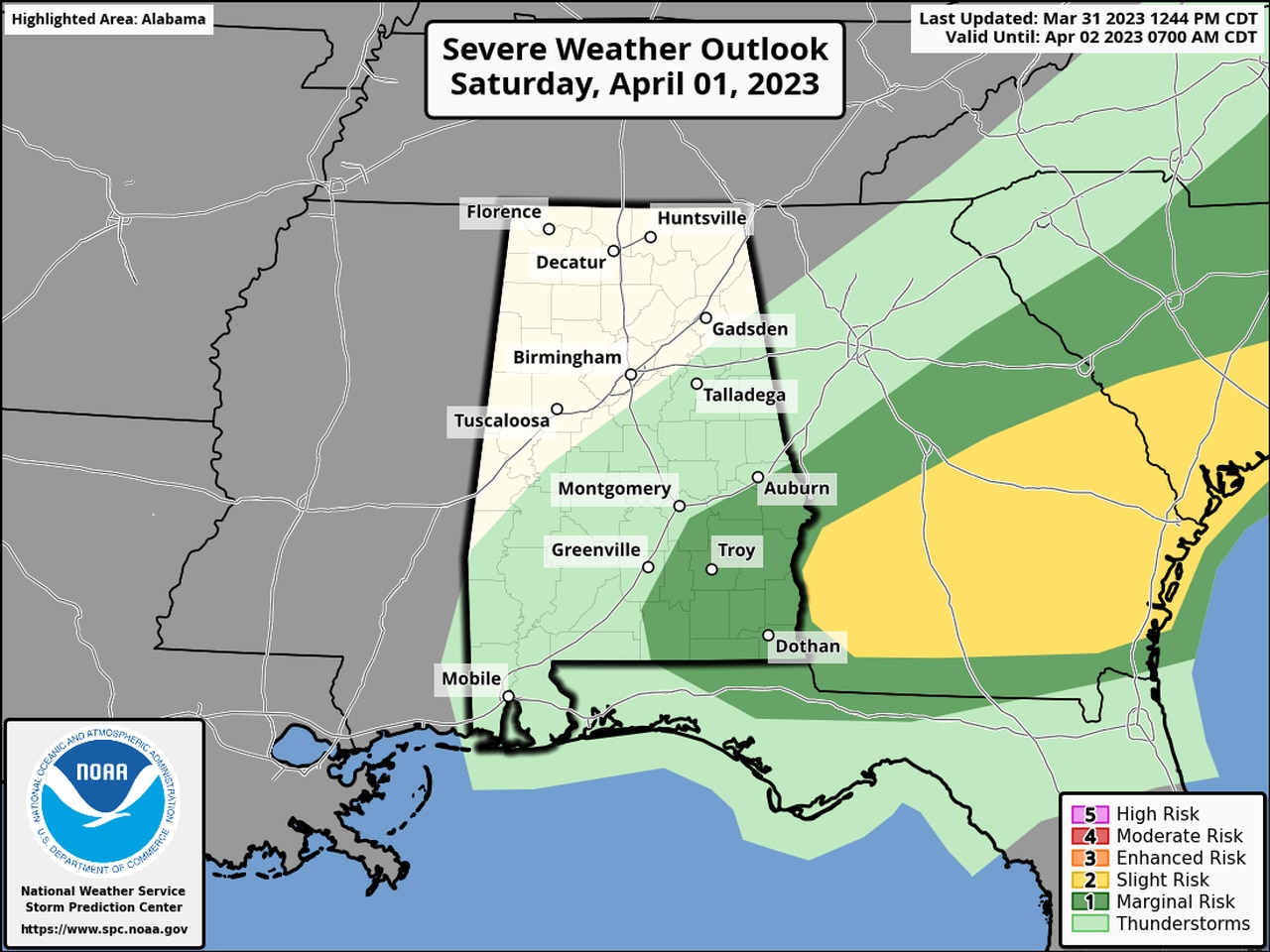
A Level 1 risk for severe weather will last into Saturday for the southeast corner of Alabama:
Isolated severe storms will be possible during the day on Saturday in the areas in dark green.
Sunday is expected to be quiet weather-wise, but another chance for storms could enter the picture for Alabama by mid-week, according to forecasters.
