Severe weather possible on Friday in south Alabama
Strong to severe storms will be possible on Friday for much of south Alabama, according to the National Weather Service.
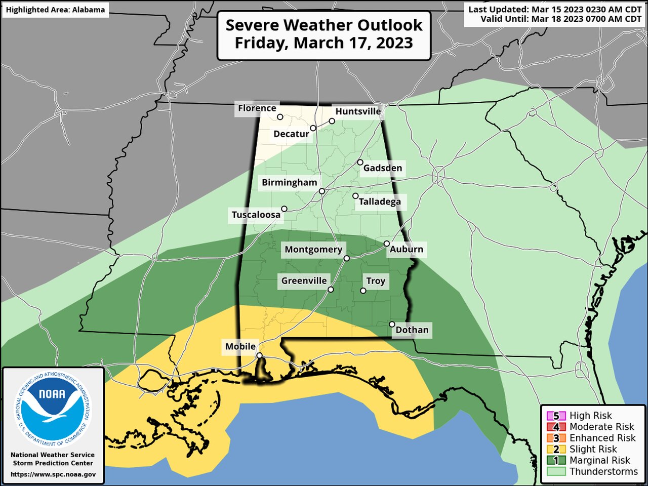
Areas closest to the coast will have the best chances of seeing the worst weather, which could include wind gusts up to 60 mph and a tornado or two, according to forecasters. However, isolated severe storms will be possible as far north as Clanton and points to the east and west.
Storms will be possible from the late morning hours through the evening on Friday, with the most likely time for storms during the afternoon.
NOAA’s Storm Prediction Center has added a Level 2 out of 5 risk for severe weather for much of southwest Alabama for Friday. A Level 2 risk means that scattered severe storms will be possible.
The rest of south Alabama, and part of south-central Alabama, will have a Level 1 risk for severe weather, which means that isolated severe storms will be possible.
No severe weather is expected across the rest of Alabama, but there could be some thunderstorms and heavy rain and times.
The wet weather is expected to move into the state ahead of a cold front. Much cooler air will again spread over Alabama following the front and over the weekend, and some parts of the state could again have to deal with temperatures at or below freezing.
Below-average temperatures are expected going into next week.