Severe weather possible across Alabama next week
Another round of potentially severe storms is in the forecast for Alabama next week.
Several rounds of rain aren’t out of the question from Monday into Wednesday, but the National Weather Service said Tuesday is the most likely day for strong to severe storms. Tornadoes, damaging winds, hail and flooding rain will all be possible as storms track across the state ahead of a cold front.
NOAA’s Storm Prediction Center has nearly all of Alabama included in a risk for severe weather on Tuesday. The exception is southeast Alabama. (See the areas affected in the map at the top of this post.)
The weather service said the chances for rain and storms will increase starting on Monday, but the main window for stronger storms will come on Tuesday. Heavy, potentially flooding rain could last into Wednesday.
The weather service said it will be watching for two things that could affect the intensity of Tuesday’s storms.
The first is the potential for rain earlier in the day on Tuesday, which could help to stabilize the atmosphere ahead of the approaching front.
Another scenario is that rain and storms develop closer to the Gulf Coast. Those could help cut off the flow of warm, moist air from the Gulf and reduce the potential for severe storms farther north.
Forecasters said those details will become more clear in the coming days, so be sure and keep up to date with the forecast.
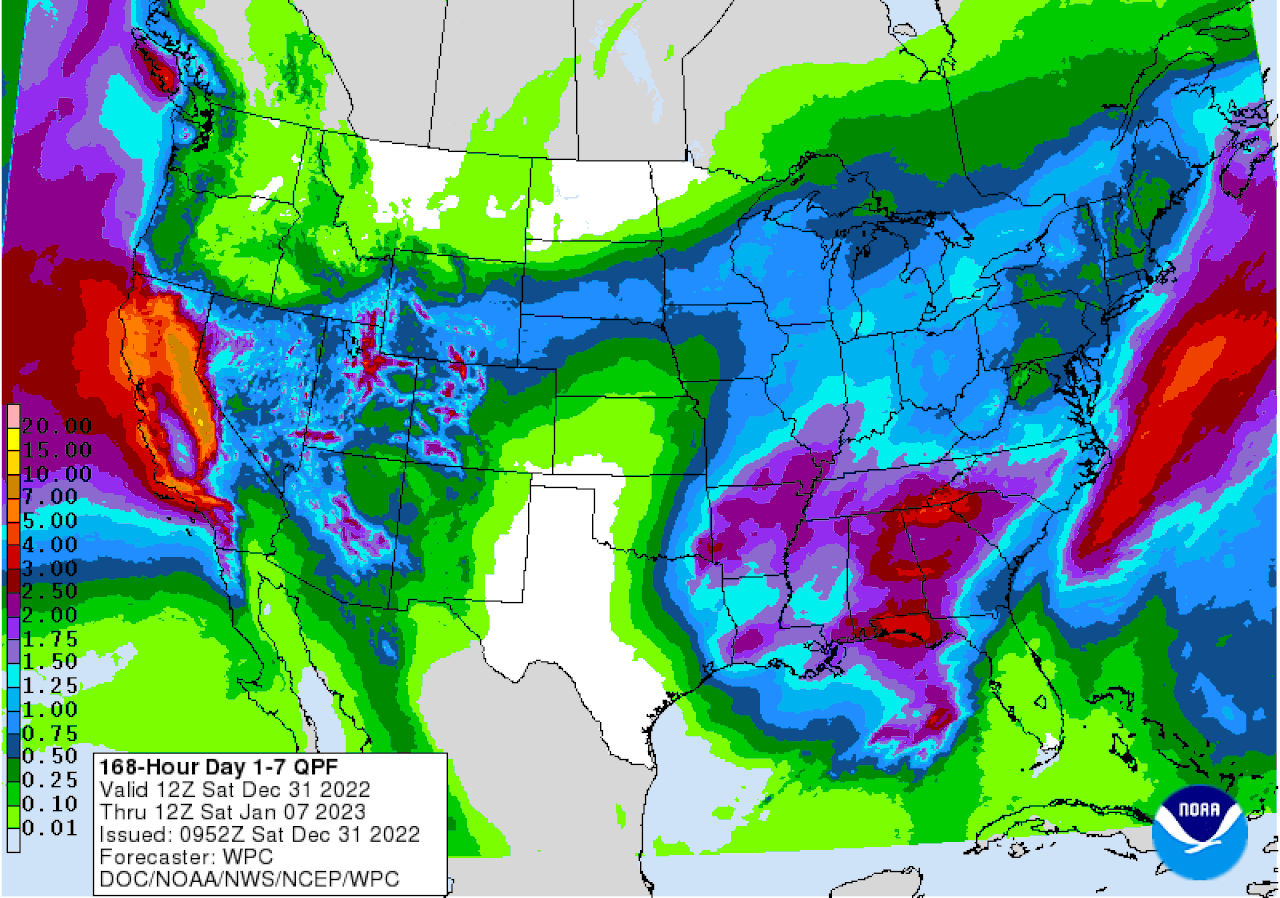
The weather service will also be watching the potential for flooding, especially from Tuesday into Wednesday morning. Forecasters said 2 to 3 inches of rain will be possible, and areas that get repeated storms could get even more.
Here is the precipitation outlook for the next five days:
Parts of Alabama could see several inches of rain over the next five days.
The cold front is expected to move out of the state by Wednesday. And drier weather and more seasonable temperatures are expected to take over in Alabama and hang around for the rest of next week.
