Severe weather in Alabama: What to expect this week; what time will storms arrive?
A round of heavy rain and storms are expected in Alabama through Friday.
Jim Stefkovich, meteorologist, Alabama Emergency Management Agency, said a frontal boundary combined with an upper-level disturbance will move into the vicinity of Alabama/Tennessee state line Wednesday evening. Scattered to numerous showers and thunderstorms are forecast to develop across the northern part of the state from 7 p.m.-4 a.m. The area, which includes places like Florence, Decatur and Huntsville, are in the slight risk area.
A few of these storms could contain large hail, damaging straight-line winds, and perhaps a tornado or two.
READ MORE: Alabama faces threat of severe storms today, Thursday and Friday
The central part of the state, included in the marginal risk area, will see isolated to widely scattered showers and a few thunderstorms developing this afternoon into early evening.
“There is warm air aloft which will suppress thunderstorm development. However, if thunderstorms are strong enough to overcome the warm air aloft, then a couple could produce large hail and damaging straight-line winds,” Stefkovich said.
The tornado threat is minimal in the marginal risk area.
In addition, heavy rain of up to 2 inches will occur across the northern sections of the state this evening and lasting into Thursday. A flood watch is in effect beginning at 6 p.m. today.
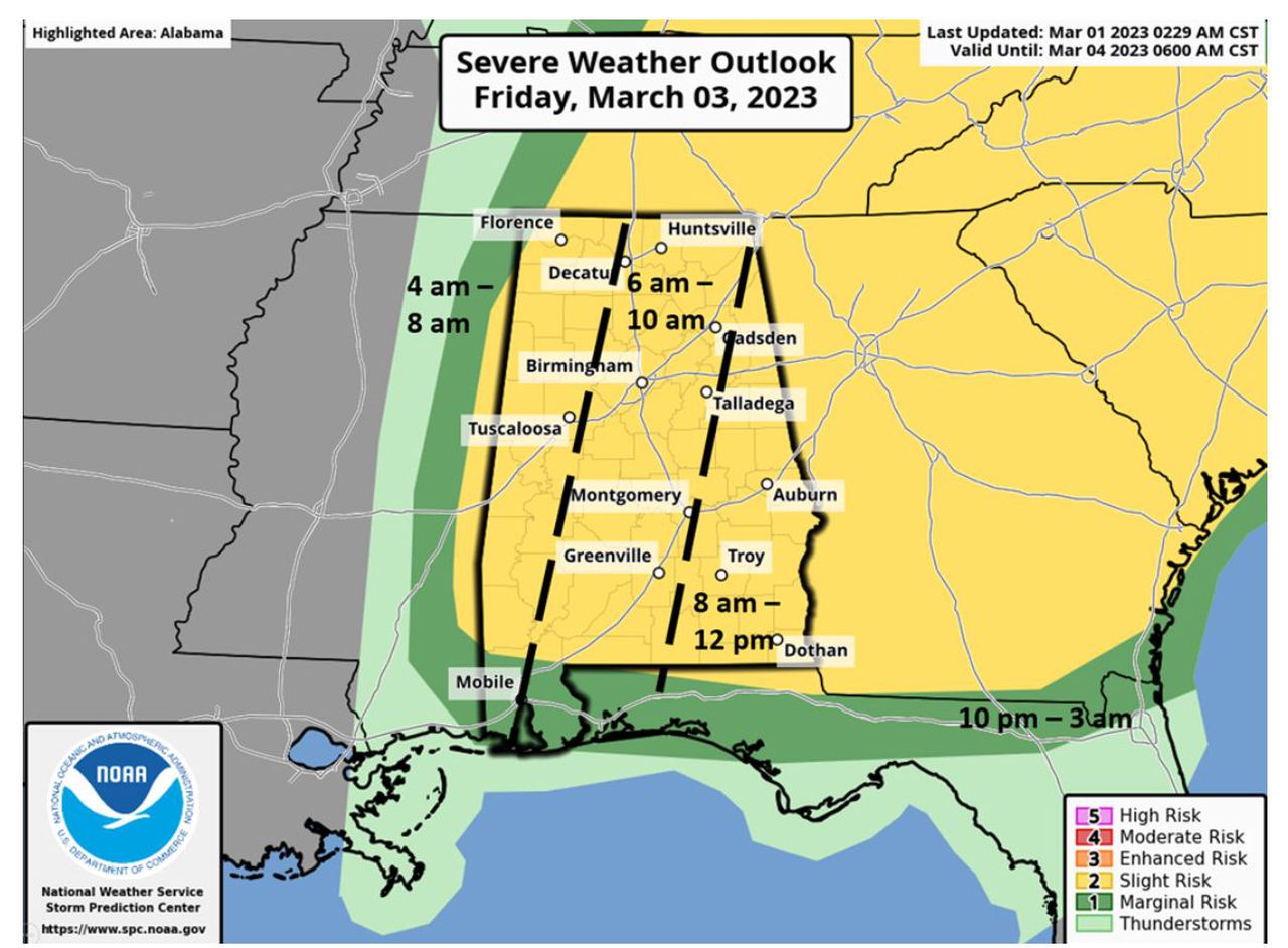
Almost the entire state remains under a slight risk for severe weather Friday. A very fast-moving line of storms ahead of a cold front will race across the state, entering the western portions between 4 a.m.-8 a.m. and existing in the east by noon. Straight-line wind gusts around 60 mph and a couple of tornadoes are possible.
Strong winds will occur immediately behind the front and continue through 6 p.m. Friday. Sustained winds statewide will be 15-30 mph with gusts of 35-50 mph. The wind intensity will decrease after 6 p.m. Friday.
