Severe weather in Alabama: What to expect overnight, Thursday morning
Severe weather, including at least one reported tornado in Abbeville, has swept through Alabama Wednesday.
Jim Stefkovich, a meteorologist with the Alabama Emergency Management Agency, said there have been a couple of tornadoes Wednesday afternoon as well as damaging wind gusts near and north of I-20.
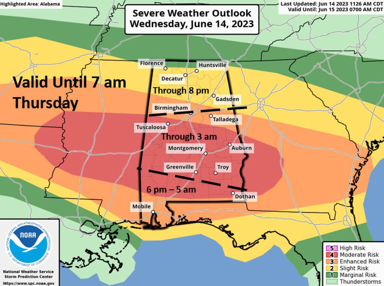
The north part of Alabama, including Huntsville, Decatur and Florence will remain under a slight risk for severe storms through Wednesday at 8 p.m. Higher risks are in central Alabama – including placed like Tuscaloosa, Montgomery, Birmingham and Auburn – through 3 a.m. Thursday. Risks will be higher in extreme south Alabama, including Mobile, through Thursday at 5 a.m.
READ MORE: Alabama severe weather videos, pictures: Tornado reported in Abbeville, damage in Eufaula
There will be 2-4 hour lulls between each wave of storms through the night, Stefkovich said. The exception could be a nearly stationary boundary stretching from near the Tuscaloosa/Montgomery/ Eufaula line. Within 50 miles of either side of this line, numerous storms are possible in an almost continuous basis through the state.
Into the evening near and south of I-20, the potential continues for a few tornadoes, including some that could be up to EF2, pockets of straight-line wind gusts of 80 mph and baseball-sized hail. In addition, torrential rainfall could lead to flash flooding and flood watches are in effect across much of the state into Thursday.
Redevelopment of strong to severe thunderstorms along with torrential rainfall is expected generally south of Hwy 80 – I-85 between 1-8 p.m. Thursday. Straight-line winds and large hail will be the main threats.