Severe weather in Alabama today: When will storms arrive where I live?
The entire state of Alabama could see severe weather today, including the potential for strong tornadoes, hail and wind gusts up to 70 mph.
Jim Stefkovich, meteorologist with the Alabama Emergency Management Agency, said there could be a number of supercell developing ahead of a broken line of storms.
“The line itself will likely contain supercells as well, enter the northwestern portions of the state late this afternoon and exit the southeastern portions before dawn on Friday,” Stefkovic said.
READ MORE: Strong tornadoes, severe storms possible in Alabama Thursday
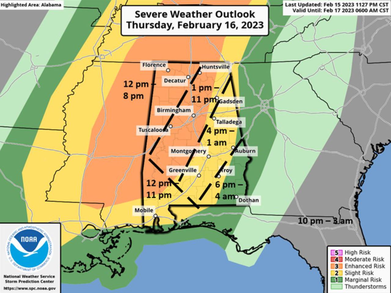
Damaging straight-line winds, tornadoes, large hail and isolated flash flooding are all possible. Within the Enhanced Risk area, EF2+ long-tracked tornadoes, baseball size hail and straight-line wind gusts of 70-plus mph could occur
There will be a weakening trend late tonight, especially south of I-85 and east of I-65, Still, severe weather will be possible until the line of storms clears the state early Friday morning, Stefkovic said.
Much colder air will enter the state on Friday. Low temperatures early Friday morning will range from the middle 30s north to middle 50s south with high temperatures from the middle 40s north to upper 50s south. Gusty northwest winds from 20-25 mph will also occur. Low temperatures Saturday morning will range from the middle 20s north to lower 30s near the coast.
Timing of the storms
Storms will enter the northwest part of the state starting around noon and lasting until 8 p.m. Storms will also hit the southwest corner of the state starting at noon but lasting until around 11 p.m. Central Alabama, also in the enhanced risk area, will see storms from 1 p.m.-11 p.m. That area includes places like Huntsville, Birmingham and Montgomery.
Places like Gadsden, Talladega and Mobile will see strorms from 4 p.m.-1 a.m. before storms exit the southeast corner of the state from 6 p.m. until 4 a.m. Friday morning.
