Severe weather and flooding risk grows for Friday
Strong to severe storms will be possible in parts of Alabama starting on Friday evening and lasting into Saturday.
The strongest storms could have wind gusts as high as 60 mph, heavy rain and a few tornadoes.
Since the storms could affect parts of the state overnight, it’s important to have not one but several ways to get severe weather warnings — warnings that will wake you up — in case one is issued for your area.
The National Weather Service is also worried about flash flooding. Up to 4 inches of rain could be possible in some areas from Friday into Saturday. Flash flood watches will go into effect for parts of the state on Friday.
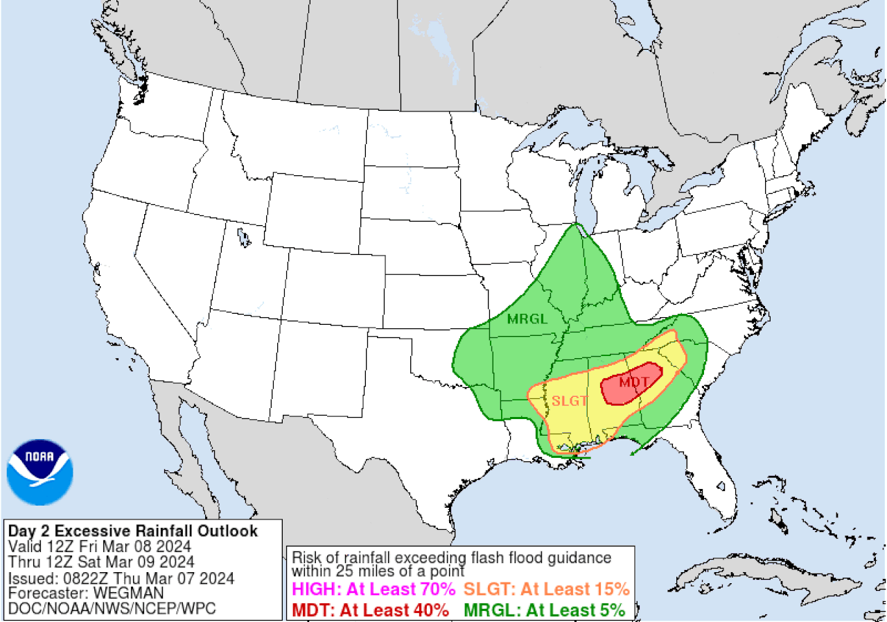
The weather service also noted that NOAA’s Weather Prediction Center has added a moderate (or Level 3 out of 4) risk for flash flooding for parts of the state:
Areas in Alabama in red will have a Level 3 out of 4 risk for flash flooding on Friday.Weather Prediction Center
NOAA’s Storm Prediction Center has expanded the areas in Alabama that could have to deal with storms on Friday.
A large area in south and west Alabama is now included in a Level 2 out of 5 risk for severe weather for Friday. A Level 2 risk means that scattered severe storms will be possible. The Level 2 risk area for Friday includes places like Tuscaloosa, Montgomery, Mobile and Troy, but doesn’t extend as far east as Auburn and Dothan. (See the outlook at the top of this post.)
Most of the rest of Alabama will be in a Level 1 severe weather risk on Friday and could have isolated severe storms. The only area not in a severe weather risk on Friday is extreme northeast Alabama.
The risk for severe storms will last into Saturday afternoon for parts of east and south Alabama. The Storm Prediction Center has a Level 2 risk in place for those areas on Saturday:
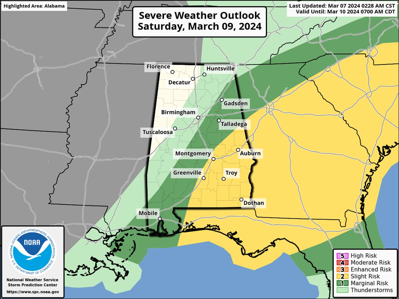
Areas in southeast Alabama could have severe weather during the day on Saturday.SPC
A storm system will bring rain to Alabama as soon as Friday afternoon, but the potential for strong storms will increase from 6 p.m. into the overnight hours, according to the weather service.
Forecasters will be watching the northward progression of a warm front on Friday. Areas along and south of the front will have the greatest potential for severe storms into Saturday.
Storms could repeatedly move over the same areas, which will increase the risk for flash flooding. Here’s the rainfall outlook for Alabama from Friday morning until Saturday evening:
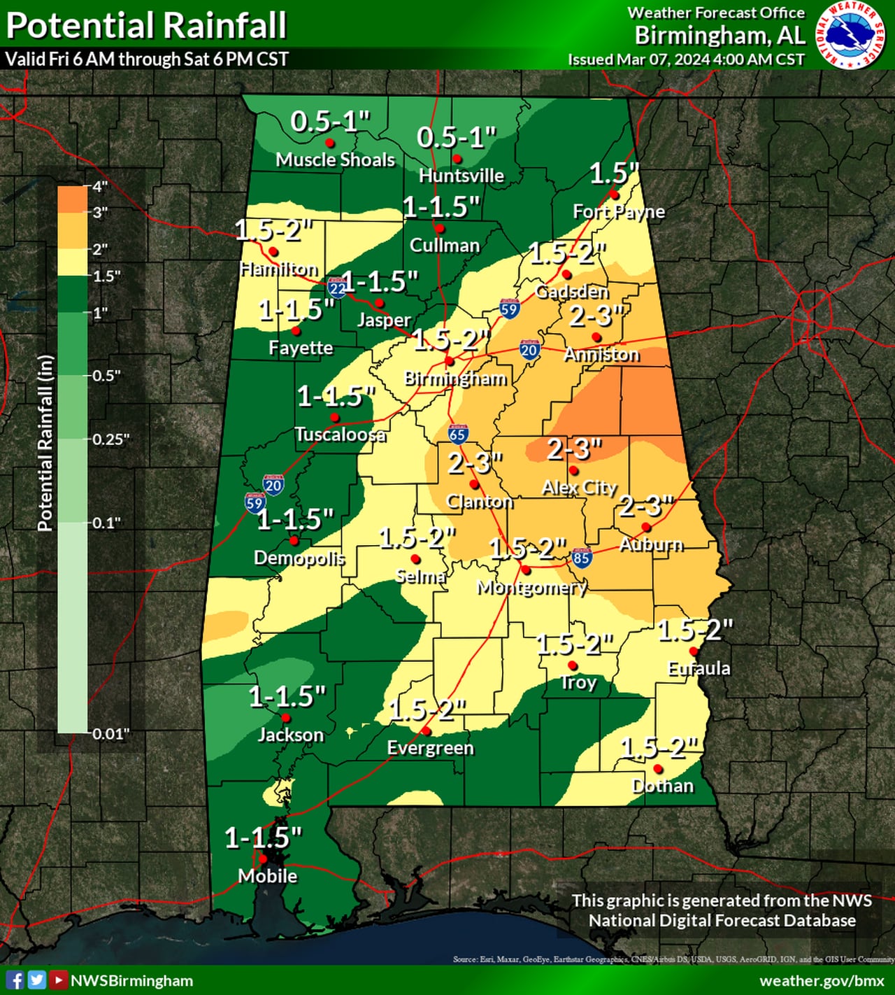
Up to 4 inches of rain will be possible in parts of Alabama from Friday until Saturday evening.NWS
The rain is expected to move out later on Saturday, and drier and cooler weather is expected on Sunday and Monday. Temperatures are expected to moderate next week, and the next chance of rain could arrive on Wednesday.