Severe thunderstorm watch for south Alabama
Severe weather will be possible today in Alabama, and a severe thunderstorm watch is already in effect for the southern part of the state.
The Storm Prediction Center said the watch will be in effect until noon today.
Forecasters said damaging winds with gusts to 75 mph will be possible in the watch area, which also includes parts of Mississippi, Florida and Louisiana. Also possible will be hail up to 2 inches in diameter and a tornado or two.
Forecasters said the main risk will be for large hail, but the winds and a tornado will also be possible with storms as they spread eastward through the morning hours.
The Alabama counties in the severe thunderstorm watch are Baldwin, Butler, Clarke, Conecuh, Covington, Crenshaw, Escambia, Mobile, Monroe and Washington.
Strong to severe storms will also be possible later in much of the rest of Alabama, according to the SPC.
Rain and storms were moving across parts of north and central Alabama Thursday morning, but that activity wasn’t severe. The National Weather Service expects the storms to ramp up in coverage and intensity later this morning and through the afternoon and evening hours.
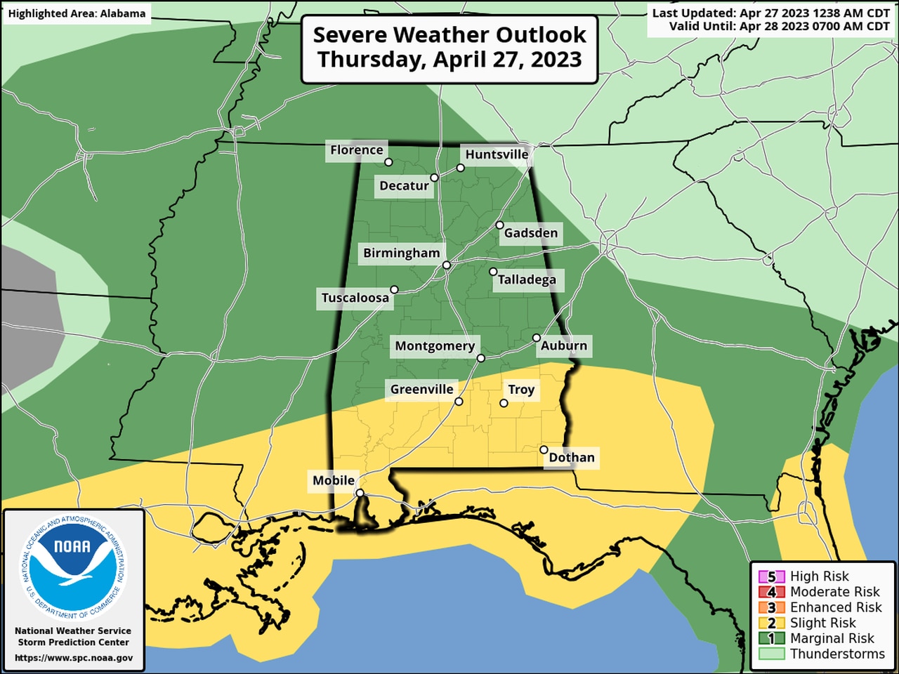
South Alabama has a Level 2 out of 5 risk for severe weather today, which means that scattered severe storms will be possible.
Nearly all of the rest of Alabama has a Level 1 risk, which means that isolated severe storms will be possible.
Strong to severe storms will be possible for the rest of the state starting later this morning and will be possible through the evening hours, according to the National Weather Service.