Severe storms possible today: When will they arrive?
The National Weather Service continued to monitor the potential for severe weather in parts of Alabama on Friday. Forecasters also warned of a “significant” potential for flash flooding overnight in parts of the state.
Rain will be possible on and off through the day today, and the potential for strong to severe storms is expected to increase this afternoon and last into Saturday.
Wind gusts up to 60 mph, tornadoes and heavy rain will all be possible.
Storms will be possible in two rounds in south Alabama, the first starting as soon as noon and lasting into the nighttime hours. Storms will be possible this afternoon in central and north Alabama as well.
Another round of storms could affect the state overnight (see below for timing for the various parts of the state from the weather service).
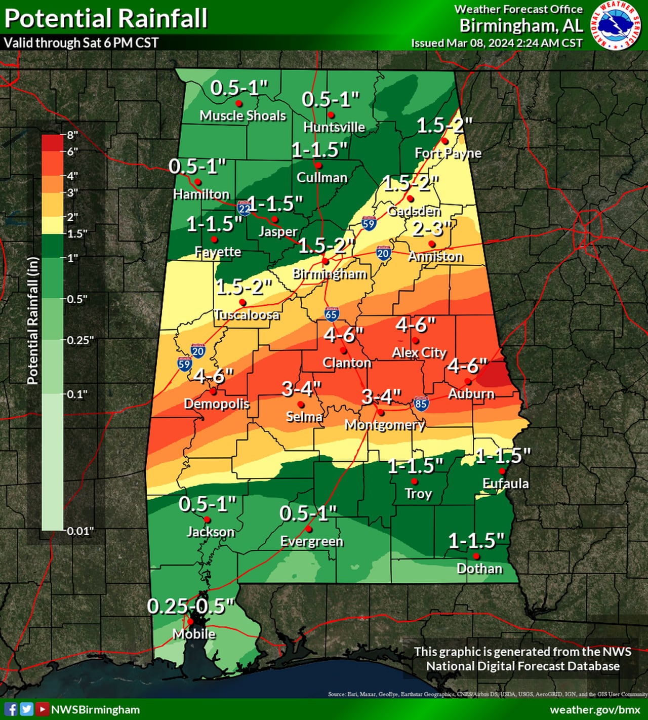
The heavy rain is of particular concern, and the weather service warned that flash flooding will be possible in areas that get repeated storms. Up to 6 inches of rain will be possible from today through Saturday evening. NOAA’s Weather Prediction Center mentioned that isolated areas could potentially get up to 8 inches before it’s over.
The heaviest rain could fall across south-central parts of Alabama. Here’s the rainfall forecast from the National Weather Service:
Some parts of Alabama could get up to 6 inches of rain through Saturday, which could cause deadly flash flooding.NWS
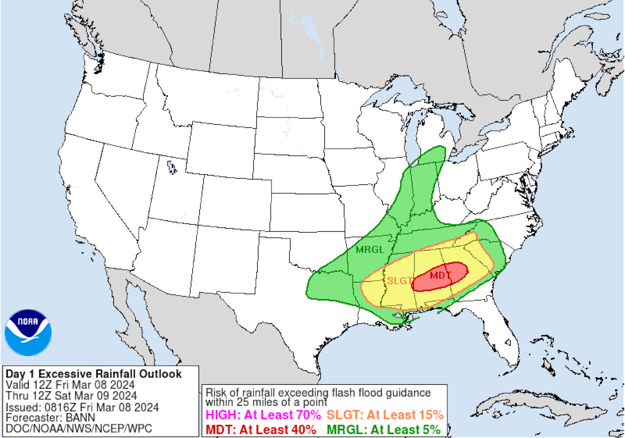
A flood watch will be in effect for much of central Alabama and a few north and south Alabama counties, and NOAA’s Weather Prediction Center is maintaining a Level 3 out of 4 risk for flash flooding in parts of the state:

A Level 3 out of 4 risk for flash flooding (in red) will be in effect for parts of Alabama today and tonight.Weather Prediction Center
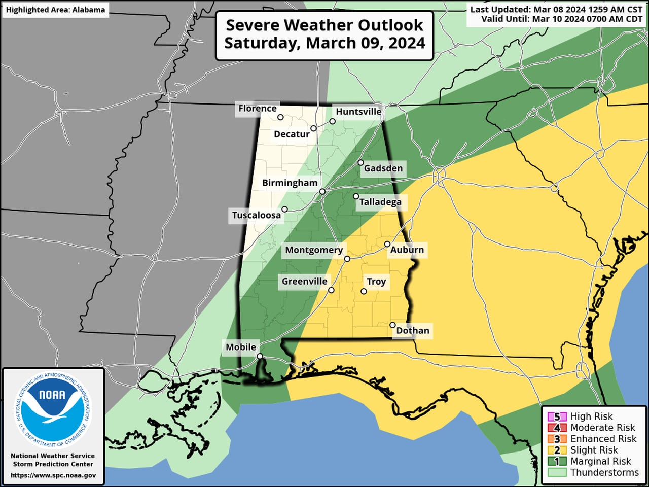
NOAA’s Storm Prediction Center is forecasting a Level 2 out of 5 risk for severe weather for much of south and central Alabama for today. A Level 2 (or slight) risk means that scattered severe storms will be possible.
Almost all of the rest of the state has a Level 1 out of 5 risk, which means that isolated severe storms will be possible. The exception is the northeast corner of Alabama, which could have storms but severe weather isn’t expected.
South Alabama could experience storms first, as soon as noon, according to the weather service. More storms will be possible during the overnight hours.
The storms could last overnight and into the day on Saturday for parts of eastern Alabama, and the SPC has a Level 2 risk outlined for that part of the state:

The threat for severe storms will continue into Saturday in east and south Alabama.SPC
Storms are expected to move out of Alabama from west to east during the day on Saturday, and Sunday is expected to be cooler and drier. The next chance for rain won’t arrive until Wednesday, and so far no severe weather is expected.
Here’s a look at what the National Weather Service was expecting for Alabama:
