Severe storms possible in south Alabama today
Keep an eye out for a few strong storms today (Friday) if you’re in south Alabama.
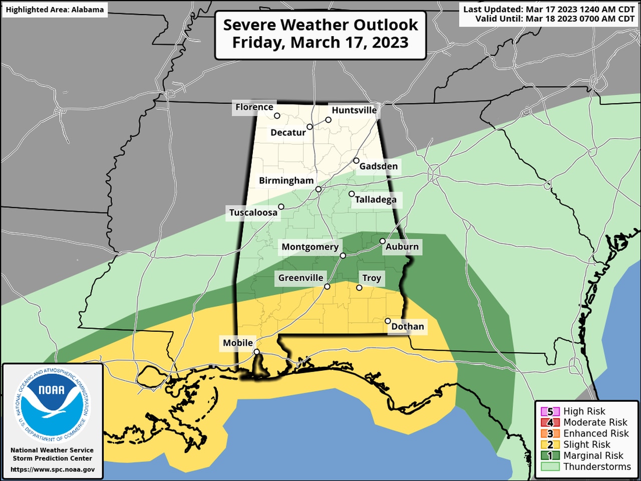
NOAA’s Storm Prediction Center has a Level 2 out of 5 severe weather risk in place for that area today.
A Level 2 risk means that scattered severe storms will be possible.
The Level 2 risk area includes Mobile, Dothan, Enterprise, Troy and Greenville, among other areas.
The strongest storms could bring 60 mph wind gusts and a tornado or two this afternoon, according to the National Weather Service.
Rain and storms were moving through the state on Friday morning, but so far none had reached severe limits. That could change this afternoon as temperatures rise.
The National Weather Service in Mobile said another line of storms could form later this morning and track eastward in the wake of this morning’s storms.
Areas east of Interstate 65 could have a better shot at seeing strong storms later this afternoon.
Much cooler air is expected to follow today’s cold front, and frost advisories have already been issued for the northern parts of the state for the weekend.