Severe storms possible across all of Alabama today
Alabama faces another round of strong to severe storms today (Friday). Storms will be possible starting this morning.
Tornadoes, damaging winds, hail and heavy rain will all be possible across the state through the afternoon hours, according to the National Weather Service.
In addition there will be non-thunderstorm winds to deal with again, and wind advisories will be in effect statewide. Winds could be sustained at 20-30 mph and could gust as high as 55 mph. The winds are expected to be strongest from 10 a.m. through around 1 p.m., according to forecasters.
Storms could move into west Alabama by 8 a.m. and track quickly eastward through the day.
A tornado watch was in effect just to the west of Alabama on Friday morning, and the National Weather Service thinks that at least part of the state will be under a watch at some point later today — either a severe thunderstorm or tornado watch.
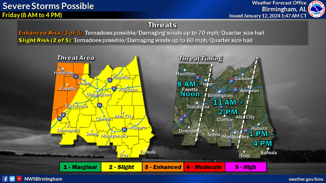
NOAA’s Storm Prediction Center has maintained a Level 3 out of 5 risk for severe weather for part of north and west Alabama today. A Level 3 risk means that numerous severe storms will be possible.
All of the rest of Alabama has a Level 2 risk today, which means that scattered severe storms will be possible.
Here’s a look at timing from the National Weather Service.
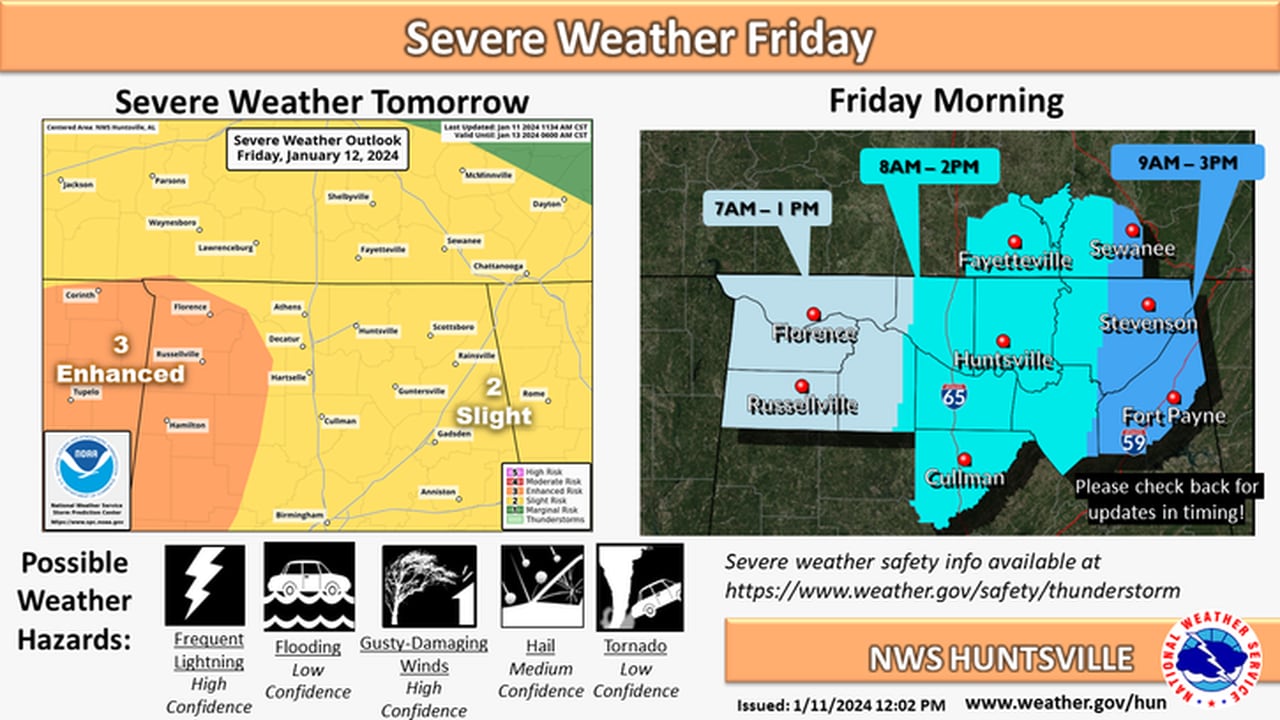
NORTH ALABAMA — 7 A.M. UNTIL 3 P.M.:
Storms will reach north Alabama this morning an track eastward through the afternoon.NWS
CENTRAL ALABAMA — 8 A.M. UNTIL 4 P.M.:

Here’s a look at storm timing for central Alabama.NWS
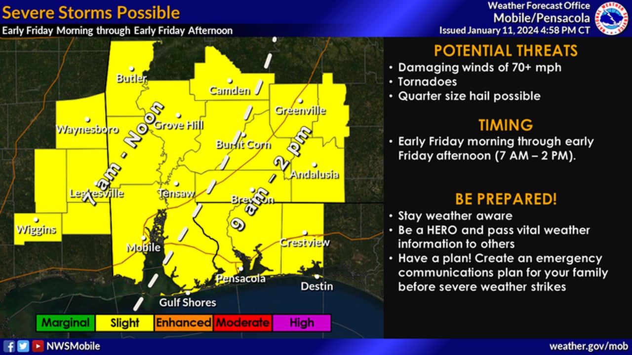
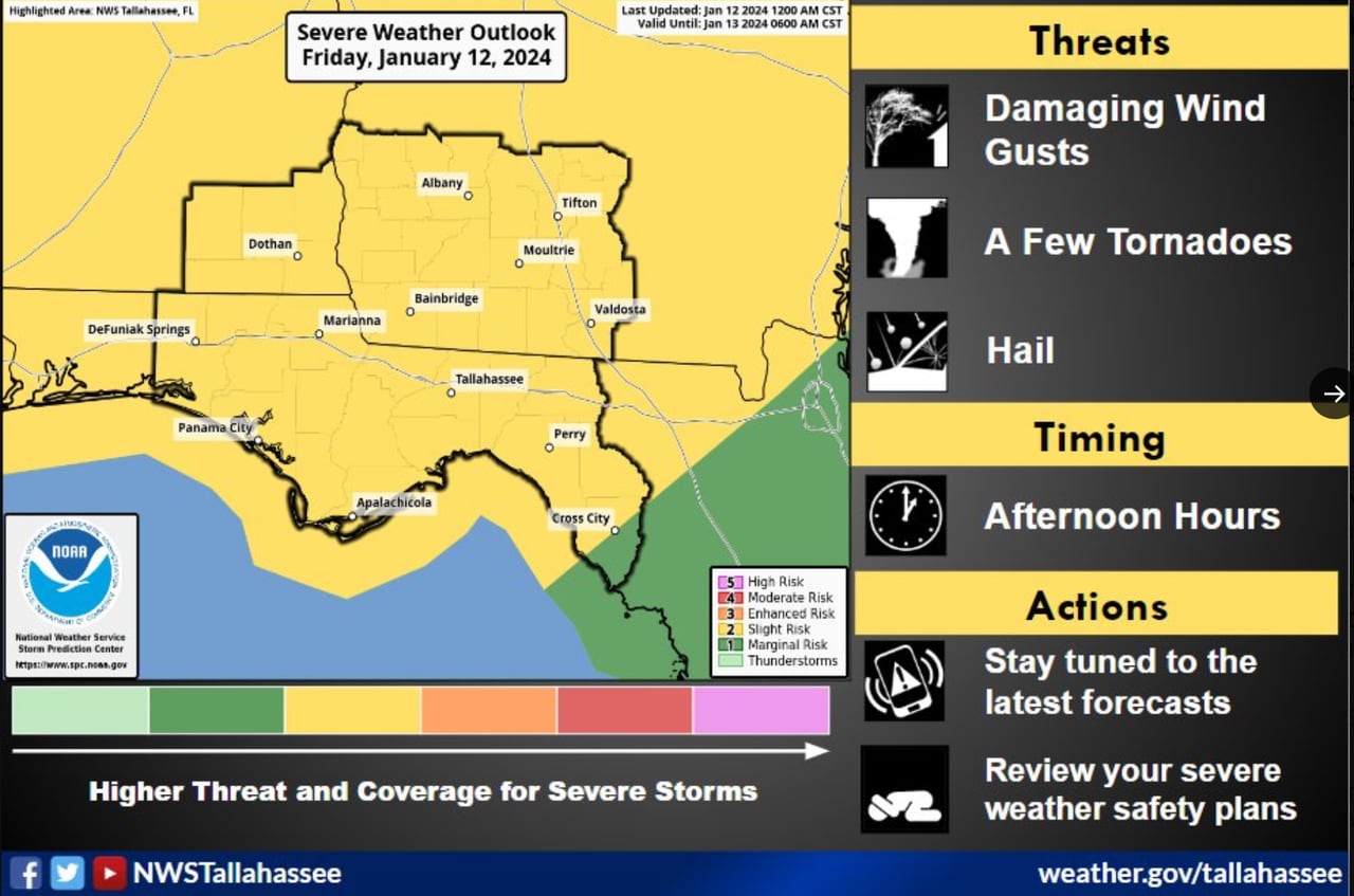
SOUTH ALABAMA — 7 A.M. UNTIL LATER THIS AFTERNOON

Storms could reach southwest Alabama this morning and track eastward through the afternoon.NWS

Storms aren’t expected to reach southeast Alabama until this afternoon.NWS
Colder temperatures will follow today’s storms, and snow is looking more likely for parts of northern Alabama on Monday and Tuesday. Keep an eye on the forecast this weekend for more updates.
