Severe storms likely today: When to expect bad weather
Alabama is facing its first threat for severe weather in months later today.
Tornadoes, damaging winds, hail and heavy rain will all be possible starting later tonight, and the threat for storms could last into Tuesday as well.
The rain could be beneficial and add up to 1 to 3 inches for various parts of the drought-stricken state. The National Weather Service cautioned, however, that if it falls too fast it could cause some flooding concerns.
It will also be windy starting later today — both near and away from storms — and wind advisories will go into effect tonight for the northern half of the state. Winds could gust as high as 40 to 50 mph.
NOAA’s Storm Prediction Center has adjusted it severe weather risk outlook for Alabama for today, expanding a Level 2 out of 5 (or slight) risk for severe weather to cover much of west Alabama (see the map at the top of this post).
A Level 2 risk means that scattered severe storms will be possible.
The rest of west Alabama and parts of central Alabama (from north to south) have a Level 1 risk today, which means that isolated severe storms will be possible.
Scattered rain and storms will be possible through the day today, but the potential for stronger storms will begin tonight as a cold front approaches the state.
The weather service is expecting a line of storms to develop and move through the state either along or ahead of the front. It’s those storms that could become strong to severe.
The storms are expected to move from west to east overnight and into Tuesday, so it will be important to have a reliable way to get severe weather warnings overnight if needed.
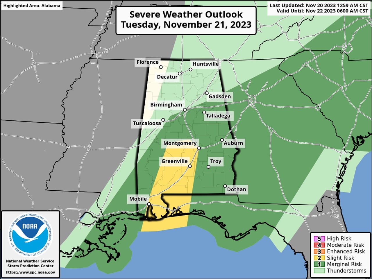
The threat for storms will persist into Tuesday, and the Storm Prediction Center has a Level 2 risk in place for the central part of south Alabama, with a Level 1 risk for the rest of south and south-central Alabama:
There will be a Level 2 risk for severe weather for parts of south Alabama on Tuesday, and a Level 1 risk for the southern half of the state.SPC
Tuesday’s storms could also have tornadoes, damaging winds and heavy rain.
The storms are expected to move out of Alabama on Tuesday, but rain could linger behind the front through the rest of the day.
STORM TIMING
Here’s a look at what the National Weather Service offices across the state were expecting later today:
