Severe storms, flooding possible today in south Alabama
More rain and strong to severe storms will be possible today in south Alabama, according to forecasters.
Damaging winds, flooding rain, hail and a tornado or two will all be possible through the day today and into the nighttime hours.
The National Weather Service in Mobile said two rounds of storms will be possible today.
The first could begin later this morning and last until around 3 p.m. Forecasters said a cluster or storms, or mesoscale convective system (MCS), could work its way northward and eastward from the Gulf of Mexico this morning. Areas closer to the coast will have the better chance of seeing storms from that system, which may not travel far enough north to affect more of the state.
Then another round will be possible this afternoon ahead or along a cold front. Those storms could start by 5 p.m. or so and could last until midnight.
In addition to storms, there is also a high risk for deadly rip currents along the coast and a high seas advisory for waves of 5 to 8 feet.
Rip currents have already taken one life on the Gulf Coast this week. The weather service reported that a 39-year-old man from Texas died on Friday after being caught in a rip current in Destin, Fla.
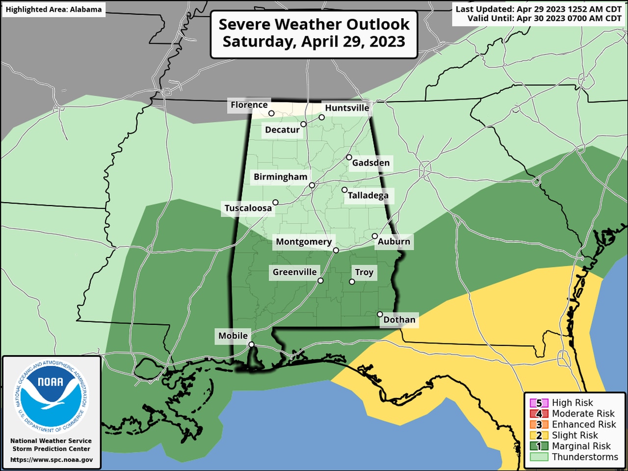
NOAA’s Storm Prediction Center is forecasting a Level 1 risk for severe weather for all of south Alabama, which means that isolated severe storms will be possible.
The Level 1 risk extends northward into south-central Alabama as well.
No severe weather is expected in north and north-central Alabama, but rain and storms will also be possible in those areas later today and tonight, according to the weather service.
After rain moves out on Sunday drier conditions will take over and hang around for much of next week, according to the weather service.
No severe weather is expected in Alabama through at least mid-week next week.
