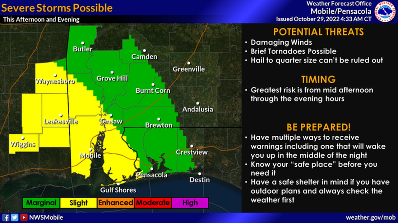
Scattered severe storms possible in southwest Alabama
A few severe thunderstorms will be possible in southwest Alabama later today.
The National Weather Service said the strongest storms could have damaging winds, hail and heavy rain, and a tornado will also be possible.
Forecasters said the greatest chance for severe weather will be from the mid-afternoon into the evening hours.
The areas in yellow have the best chance for seeing strong storms this afternoon.
NOAA’s Storm Prediction Center has a Level 2 out of 5 risk for severe weather in place for the southwest corner of the state today. A Level 2 risk means that scattered severe storms will be possible. (See the map at the top of this post.)
A larger area in southwest Alabama has a Level 1 risk, which means that isolated severe storms will be possible.
Rain and storms will also be possible statewide today, but severe weather isn’t expected in the rest of Alabama.
The National Weather Service in Mobile will also be on the lookout for possible flooding. Forecasters said there will be an elevated risk of flooding today in Mobile and Baldwin counties and a slight risk for flooding farther north.
Localized flash flooding will be possible in those areas, especially this afternoon through this evening.
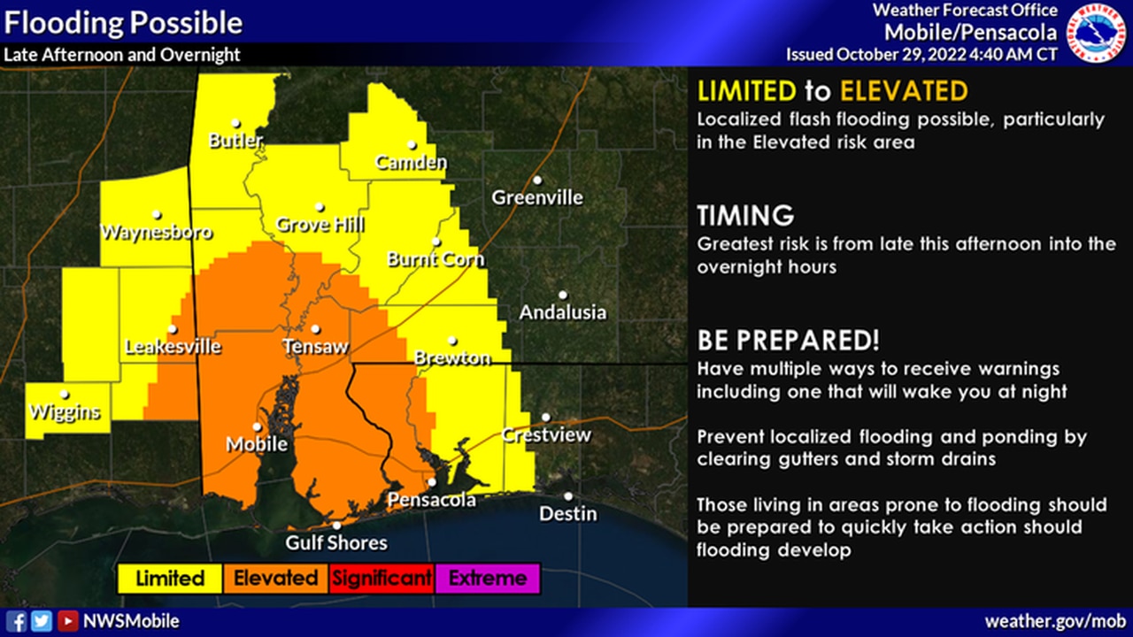
There will be a risk for localized flash flooding today in southwest Alabama.
The weather service said 2 to 3 inches of rain would be possible in the region through Sunday morning.
Forecasters added that the areas of greatest concern for flash flooding would be urban, low-lying and poor drainage areas in Mobile and Baldwin counties.