Not a tropical storm off U.S. coast, forecasters say
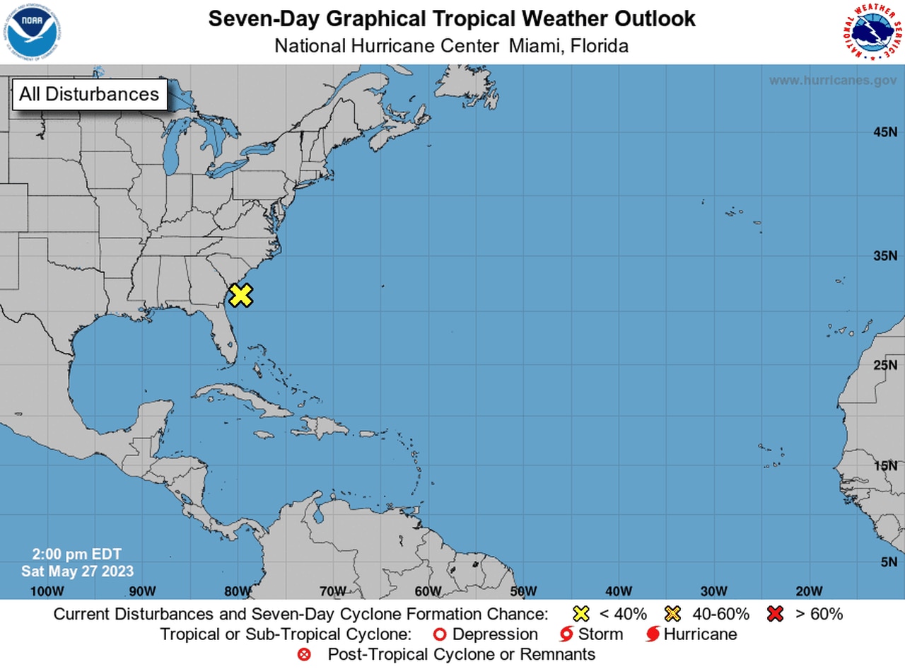
An area of disturbed weather off the coast of the Carolinas sure looks like a tropical system.
But the National Hurricane Center said it isn’t, and there’s zero chance that it could get a name.
Name or no name, it’s expected to bring rain and gusty winds to coastal areas of the Southeastern U.S. over the Memorial Day weekend.
While it looks a lot like it could be a tropical system, the hurricane center said that as of Saturday afternoon it was a non-tropical area of low pressure that was located about 80 miles south of Charleston, S.C.
The hurricane center said one of the reasons it’s not expected to become a tropical system is that it was entangled with a frontal system. It’s expected to remain a part of the frontal system as it moves northward and then inland over the Carolinas tonight or on Sunday.
The National Weather Service echoed those thoughts as well:
Forecasters said it had a zero percent probability of becoming a subtropical or tropical system.
The area of disturbed weather near the Carolinas has zero chance of becoming a tropical or subtropical storm.
However, it could cause some of the same weather — heavy rain, gusty winds and dangerous seas — along the coast through Sunday.
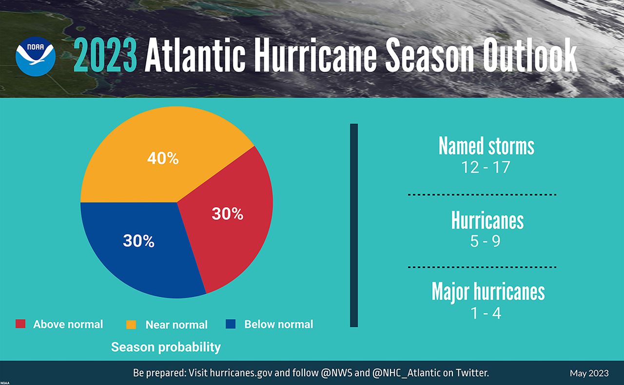
The Atlantic hurricane season officially begins next Thursday, June 1. NOAA released its hurricane outlook this week and said a near-normal season is expected in 2023 — as far as the number of storms goes.
NOAA’s outlook suggests there could be 12-17 named storms (that includes tropical storms and hurricanes), five to nine hurricanes and one to four major hurricanes (Category 3 or stronger storms).
According to NOAA an average season in the Atlantic basin has 14 named storms, seven hurricanes and three major hurricanes.

The NOAA has issued its 2023 Atlantic Hurricane Season forecast.
