No tropical storm, but same feeling for south Alabama?
It’s not a tropical storm, but it could feel a bit like one to those along the Alabama coast over the next day or two.
An area of low pressure in the Gulf of Mexico will bring much-needed rain, gusty winds, rough seas and the threat of deadly rip currents along the Alabama coast, according to the National Weather Service.
The disturbance is not expected to become a tropical storm but instead will merge with a frontal system and push eastward across the Gulf over the next few days. The National Hurricane Center had been watching it for development and even sent the Hurricane Hunters to take a look at it on Tuesday, but tropical development has been ruled out as of Wednesday.
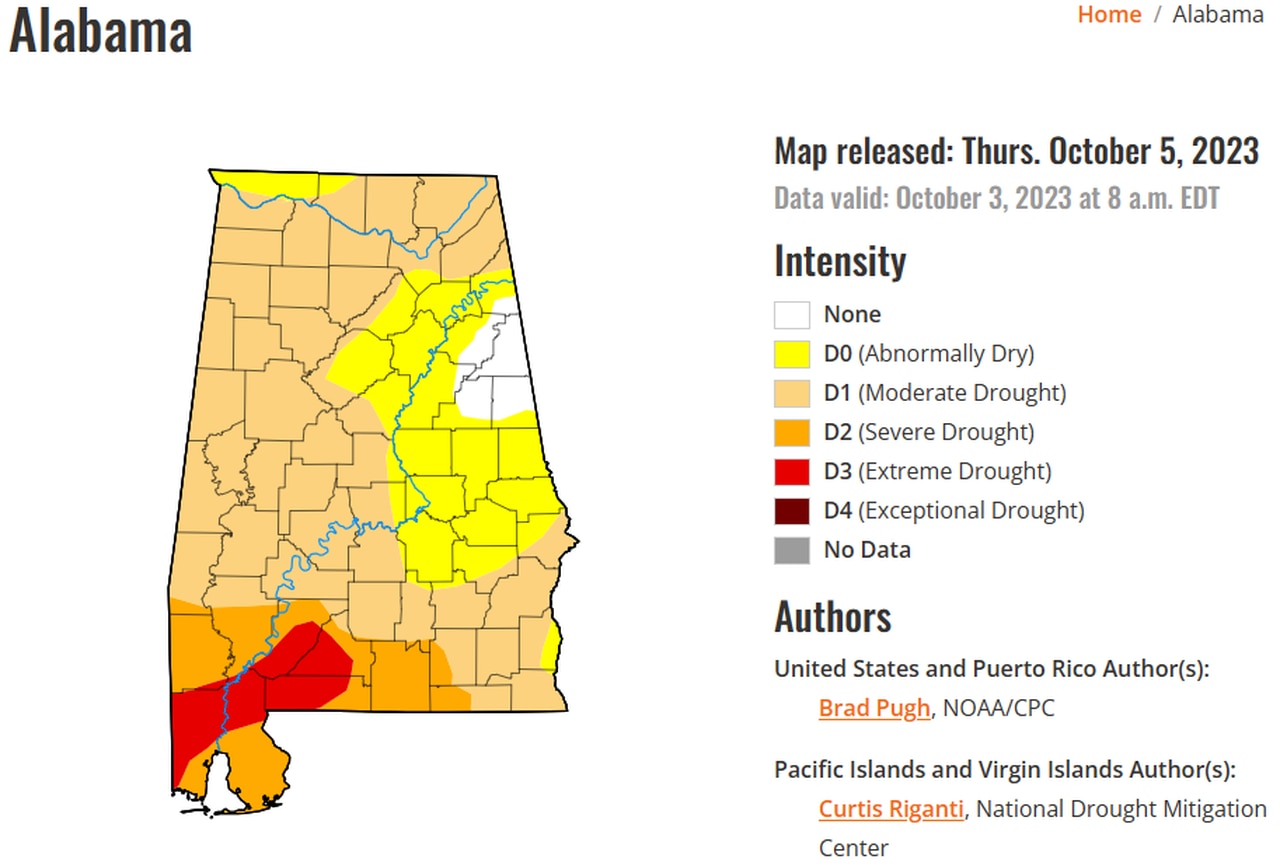
The rain is sorely needed, with extreme drought conditions gripping part of southwest Alabama for the past few weeks.
Most of Alabama is now either in drought or about to be. Some rain will be possible in the next few days and into next week as well.
The weather service in Mobile said widespread rainfall amounts of 1 to 2 inches will be possible across south Alabama, with some areas possibly getting more. That will be “welcome relief” from the ongoing drought, according to forecasters.
Rain is expected across the southern half of Alabama today, with amounts getting smaller as you head northward. No severe weather is expected today, but there could be a thunderstorm or two closer to the coast, according to the weather service.
The system will bring several potential hazards to Alabama’s coastal areas, according to the weather service.
First, it will be very windy along the coast, and a wind advisory will be in effect for central and coastal Mobile and Baldwin counties from 4 p.m. today until 4 a.m. Thursday.
The weather service said northeast winds of 15 to 25 mph with gusts up to 40 mph are expected starting this afternoon.
The Gulf waters will also become quite rough. A high risk of rip currents will go into effect tonight and last into Friday night.
A high risk means rip currents are expected and could prove deadly for even the strongest swimmers.
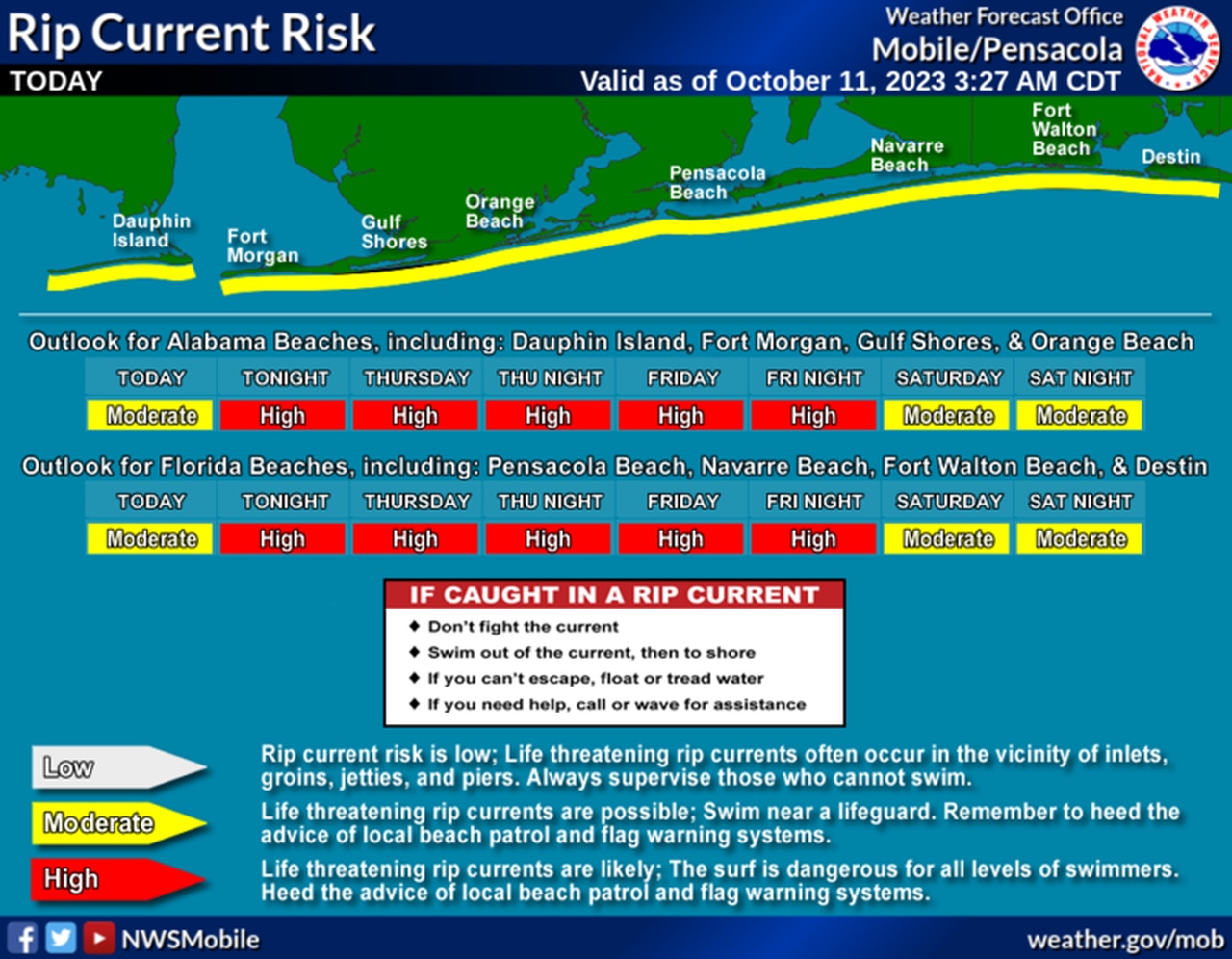
There will be a high risk of rip currents along the Alabama coast starting tonight.
A high surf advisory will also go into effect later today for coastal Mobile and Baldwin counties, with seas up to 6 feet possible, according to the weather service.
And a gale warning will be in effect for the northern Gulf from 11 a.m. today until 6 a.m. Thursday.
The rain is expected to move out starting late Thursday, and drier conditions — and cooler temperatures — are expected for the upcoming weekend, according to forecasters.