Near record highs possible this week in Alabama
Temperatures on Monday across Alabama could peak near record levels.
The National Weather Service is forecasting highs to reach the 70s and 80s across Alabama this afternoon under partly cloudy skies.
If those temperatures materialize they could flirt with record highs for Nov. 6, according to weather service data.
More unseasonably warm weather will also be the story on Tuesday and Wednesday, according to forecasters. In fact, it could be a few degrees warmer in spots on both Tuesday and Wednesday.
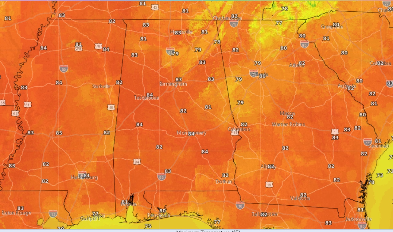
Here is the forecast for Tuesday:
Here are the forecast highs for Tuesday.NWS
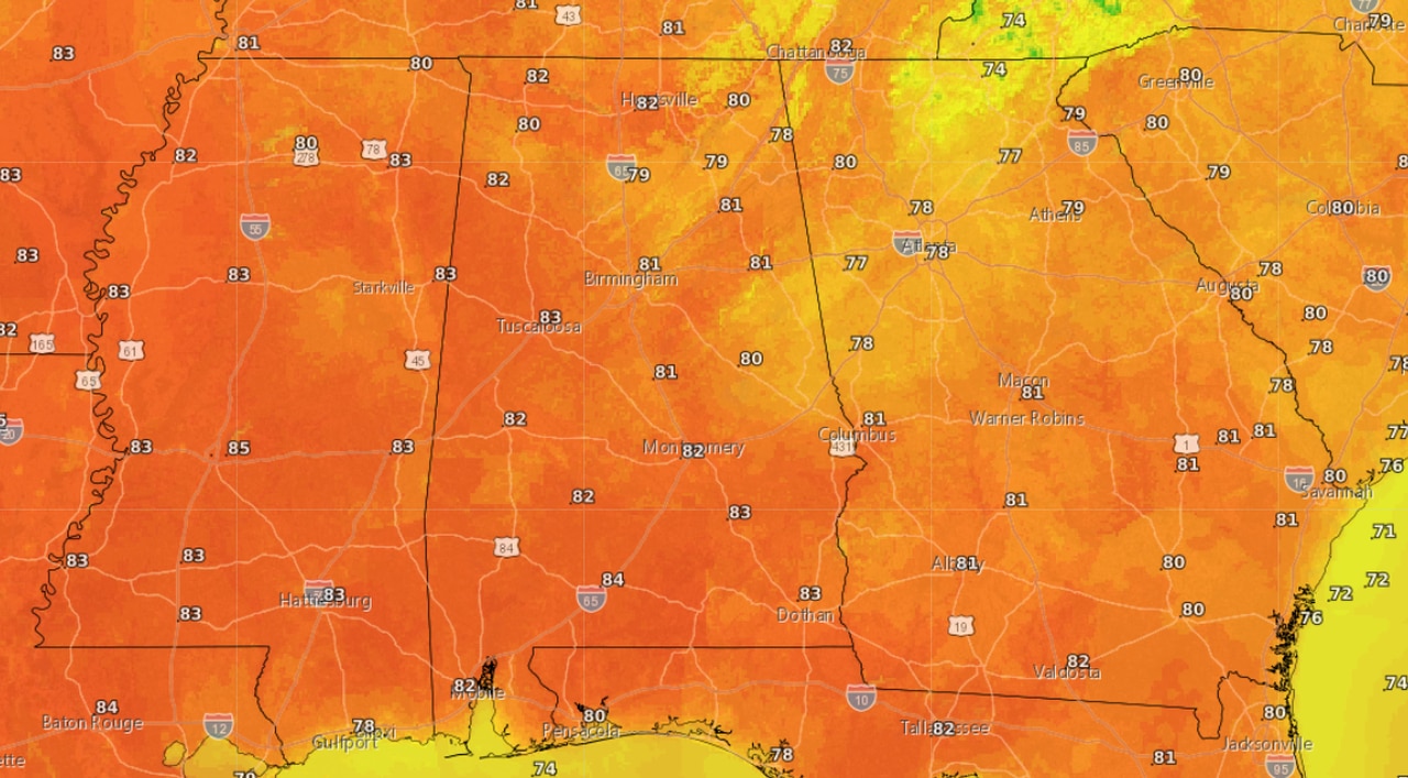
Here is the forecast for Wednesday:

Forecast highs for Wednesday.NWS
A ridge of high pressure will continue to dominate Alabama’s weather pattern for the next few days, but winds will shift to out of the south, bringing in more warm air and raising temperatures above what Alabama normally sees at this point in November.
Here are the record highs for Nov. 6 for a few Alabama cities:
* Anniston: 81 (2022)
* Atmore: 88 (1946)
* Birmingham: 82 (1938)
* Cullman: 82 (2003)
* Dothan: 88 (2022)
* Fort Payne: 80 (2017)
* Greenville: 85 (2022)
* Huntsville: 84 (1914)
* Mobile: 87 (2003)
* Montgomery: 88 (2015)
* Muscle Shoals: 84 (1914)
* Russellville: 83 (2003)
* Selma: 89 (1938)
* Talladega: 84 (1909)
* Tuscaloosa: 83 (2022)
The weather service expects temperatures to come down by the end of the week when a cold front will approach the state. That front isn’t expected to bring severe weather but could bring the best chance for rain the state has seen in a while.
Expect rain chances to begin to increase on Thursday and Friday, according to forecasters.
