More strong storms possible tonight in north Alabama
Another round of strong to severe storms will be possible for Alabama tonight, according to forecasters.
However, this forecast comes with an asterisk. Storms aren’t a sure thing, but if they make it to Alabama they could pack a punch.
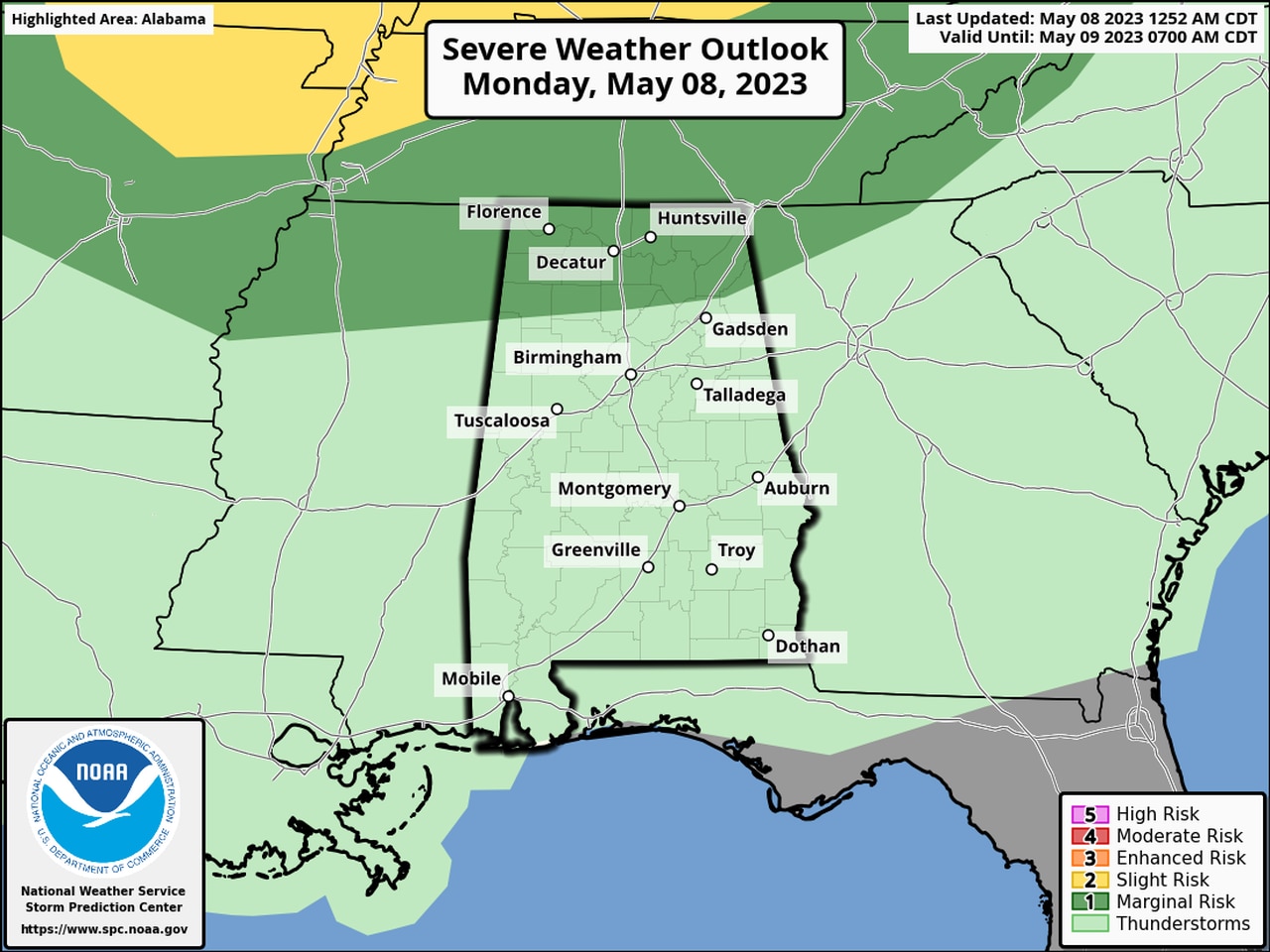
NOAA’s Storm Prediction Center has a Level 1 out of 5 risk for severe weather in place for the northern third of Alabama for Monday. (See today’s severe weather outlook map at the top of this post.)
A Level 1 risk is marginal, and means that isolated severe storms will be possible.
The strongest of those storms could produce wind gusts up to 60 mph and heavy rain, according to the National Weather Service.
The best chance for stronger storms isn’t expected until later tonight — from 9 p.m. onward, according to forecasters.
Severe storms aren’t a sure thing. The weather service said forecast models are suggesting a complex of storms — referred to as a mesoscale convective system or MCS — could develop to the northwest of Alabama later today and push into the state tonight. However, forecasters cautioned that the severe weather threat was conditional and depended on a lot of factors coming together just right to bring severe storms into the state.
Parts of Alabama were dealing with rain and storms on Monday morning, but there has been no severe weather so far today, although there were a few stronger storms overnight in north Alabama.
Rain and storms will be possible through the day today and into Tuesday, however after today there is not expected to be a severe weather threat for Alabama for the rest of the week, according to Storm Prediction Center forecasts.
Look for rain chances to decrease near the end of the week, and also get ready for warmer temperatures, with highs in the 90s possible over the weekend.