More severe storms this afternoon – and flooding
Alabama forecasters were keeping a close eye on their radars on Thursday afternoon as another round of scattered severe storms continued to erupt over parts of the state.
Thursday’s storms were big rainmakers as well, and the National Weather Service has already issued several flash flood warnings for parts of eastern Alabama. The average speed of this afternoon’s storms is around 10 mph, which gives them plenty of time to drop a lot of rain.
Isolated severe storms will be possible in parts of central and north Alabama through tonight.
NOAA’s Storm Prediction Center has a Level 1 out of 5 (or marginal) risk for severe weather for that part of the state for Thursday. Rain and storms — some of them strong — will also be possible across the rest of Alabama, but no widespread severe weather is expected.
Today’s storms could produce very gusty winds — strong enough to bring down tree limbs and power lines — as well as hail and heavy rain.
The weather service has already gotten several reports of hail with storms today.
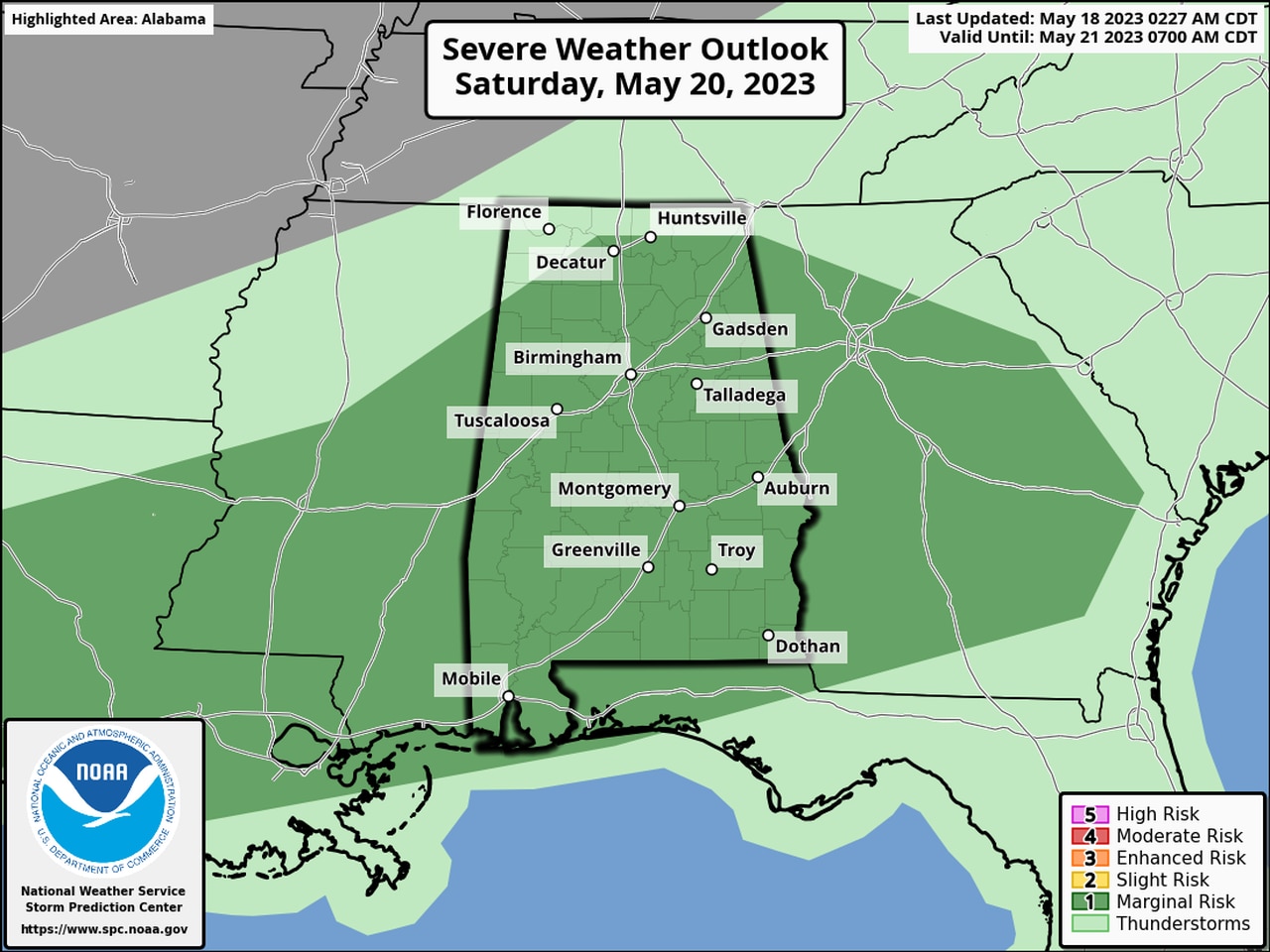
Rain chances will stay in the forecast on Friday and Saturday, when the SPC is forecasting another Level 1 risk for severe weather. Saturday’s severe weather risk will include nearly all of the state.
Here is Saturday’s severe weather outlook:
Nearly all of Alabama could be at risk of seeing isolated severe storms on Saturday.
