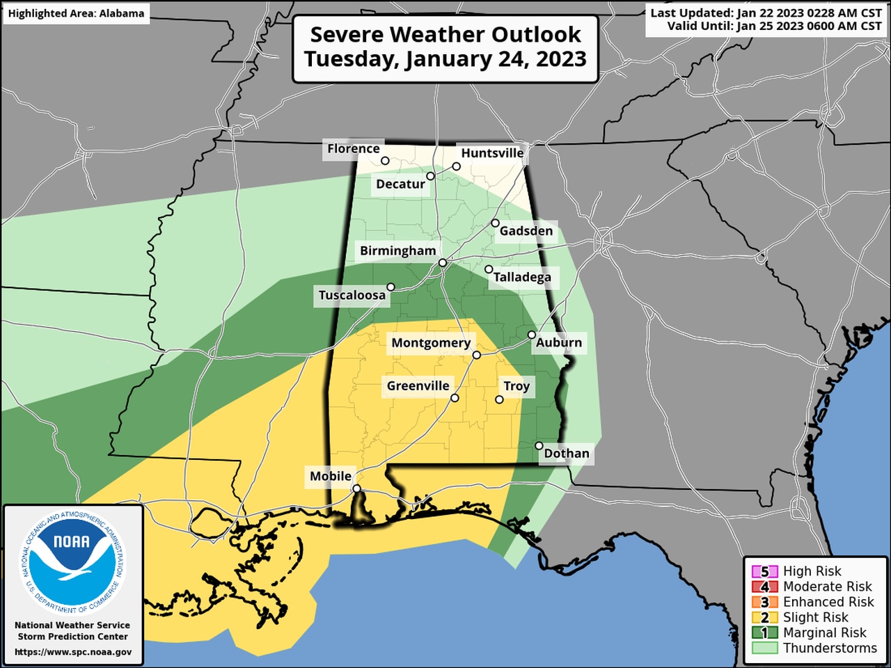
More severe storms possible this week in Alabama
Another round of potentially severe weather will be possible for the southern part of Alabama starting late Tuesday.
Tornadoes, wind gusts up to 70 mph and heavy rain will be possible as a cold front pushes through the state.
NOAA’s Storm Prediction Center has put the southern half of Alabama — from just north of Montgomery southward to the Gulf — in a Level 2 out of 5 risk for severe weather.
A Level 2 risk, or slight risk, means that scattered severe storms will be possible.
Areas farther north, as far north as Birmingham, will have a Level 1 risk for severe weather, which means that isolated severe storms will be possible.
This round of severe weather looks to begin late Tuesday night and last into the morning hours on Wednesday.
The National Weather Service also cautioned that it will be windy on Tuesday and Wednesday — even for areas not affected by storms. Winds could gust up to tropical-storm strength (40 mph) on Tuesday across the state, which could lead to sporadic downed tree limbs and even power lines.
The weather service said the threat for severe weather on Tuesday is not a slam-dunk. Forecasters will be watching to see how much instability can build across the region to fuel stronger storms. It’s also unclear how far north the most unstable air will make it. Areas closer to the coast could see the best chances for storms.
Cooler and drier weather is expected to take hold during the day on Wednesday, and the rest of the work week looks to be quiet, forecasters said.
