More record highs possible in Alabama on Thursday
Alabama’s streak of spring-like warmth is set to continue today (Thursday).
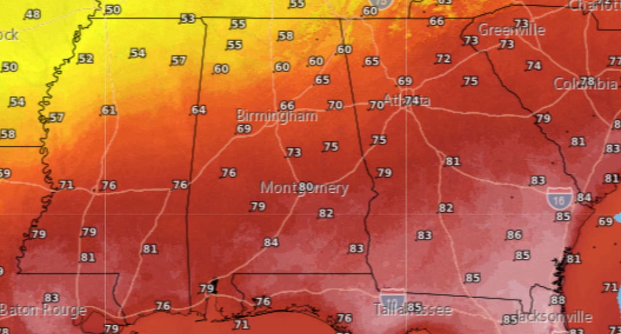
The National Weather Service is forecasting temperatures to reach the 80s across most of the state today — which will be 10 to even 20 degrees above what’s typical for this time of year.
Average high temperatures for late February in Alabama range from the upper 50s and lower 60s in north Alabama to the upper 60s in south Alabama, according to weather service data.
Today most of the state could reach the 80s, with only the higher terrain of northeast Alabama forecast to stay in the 70s. (See the forecast highs at the top of this post.)
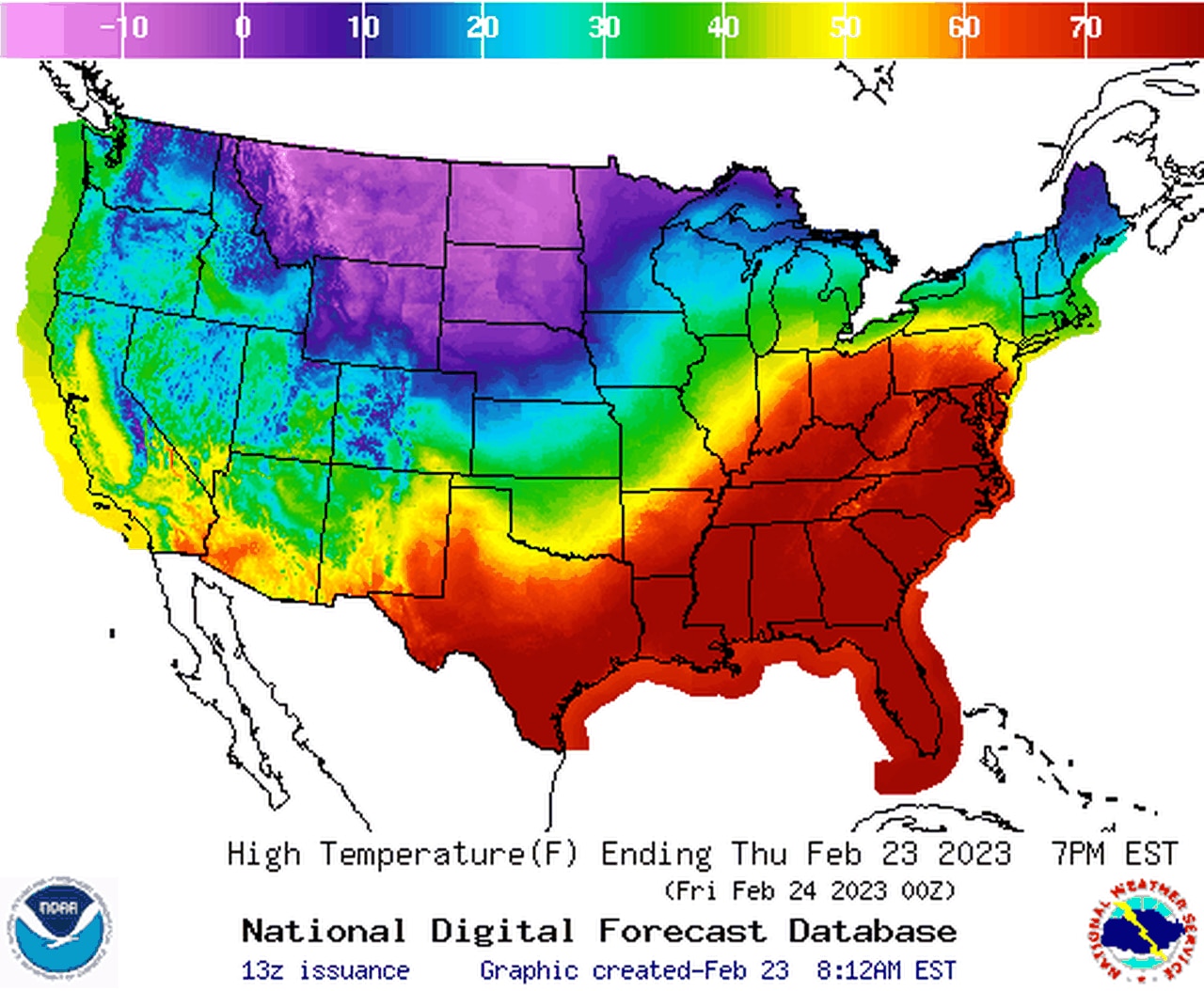
While Alabama is basking in the warmth, areas in the northern U.S. are facing extremely cold temperatures and snow.
Will that cold make it here? The weather service is not expecting that big chill to make it this far south.
That’s because a ridge of high pressure, situated over the western Atlantic, continues to usher in warmer air from the south over Alabama and much of the Southeast U.S.
The weather service said the ridge is situated just to the east of Florida. The clockwise flow of air around the high is bringing in in air from the southwest into Alabama.
The ridge won’t budge too much, even with a cold front approaching from the northwest, the weather service said. That will keep Alabama in that milder, spring-like airmass, while parts of the upper Midwest shiver with the winter chill.
Here’s a look at the temperature extremes in today’s forecast highs:
Much colder air is lurking far to the north of Alabama in the upper Midwest.
Here is a look at the existing Alabama temperature records for today, Feb. 23:
Birmingham: 83 (1996)
Cullman: 77 (2018)
Dothan: 86 (2019)
Gadsden: 81 (2018)
Huntsville: 83 (1996)
Mobile: 82 (2022)
Montgomery: 85 (2019)
Muscle Shoals: 83 (2012)
Troy: 84 (2018)
Tuscaloosa: 83 (2012)
Several Alabama cities broke or tied their record highs on Wednesday. Mobile and Birmingham both hit 82 degrees and added to their record books while Anniston (82 degrees) and Tuscaloosa (83 degrees) tied their records for Feb. 22.
A cold front will attempt to push into the state later today and could bring temperatures back closer to average for areas in north and north-central Alabama on Friday.
Highs on Friday will range from the mid-50s to low 60s in north Alabama to the mid-60s to low 70s in central Alabama. Areas south of the front, which is expected to stall out over the state, could stay in the upper 70s and low 80s.
Areas in north Alabama are forecast to cool off on Friday as a front moves through part of the state. Areas in the south will stay warm, however.
No severe weather is expected with the front, and the slightly cooler temperatures will start to warm up again over the weekend and into next week.