More rain expected in Alabama this week, but how much?
More rain is in the forecast for drought-stricken Alabama this week — and it could add up in some parts of the state.
NOAA’s Weather Prediction Center is suggesting parts of southern Alabama could get 2 to 4 inches in the next seven days, with areas farther north getting less.
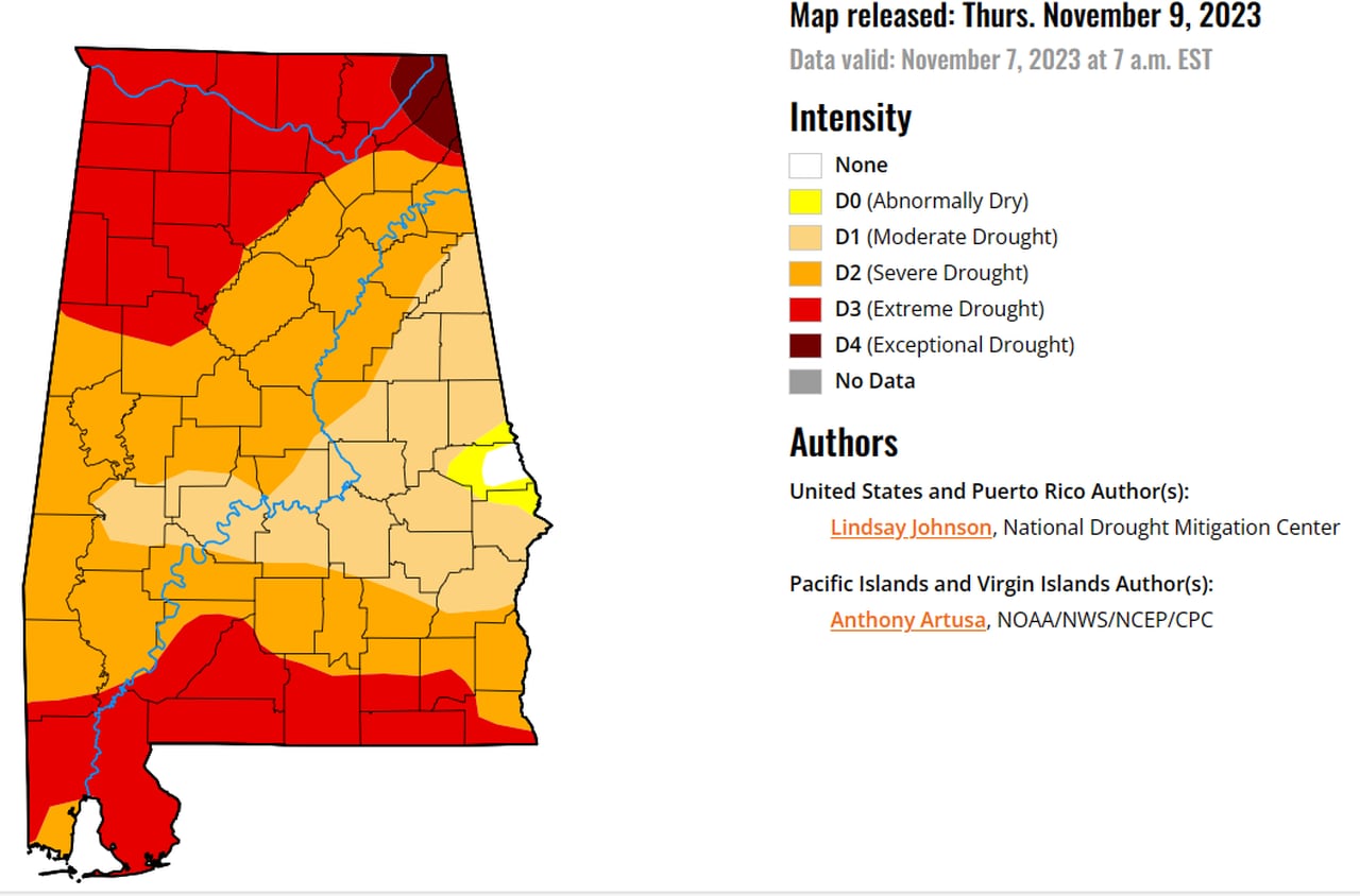
Any rain will be appreciated in Alabama, which is still stuck in the grips of a drought. Here’s the latest drought map from the U.S. Drought Monitor:
Alabama’s drought got worse in the past week, with the worst drought category, Level 4, taking hold in the northeast part of the state. Extreme drought, or Level 3, also expanded across the northern and southern parts of the state.U.S. Drought Monitor
No severe weather is expected this week, but the Storm Prediction Center said a few thunderstorms will be possible Wednesday.
Here’s the thunderstorm outlook for Wednesday:
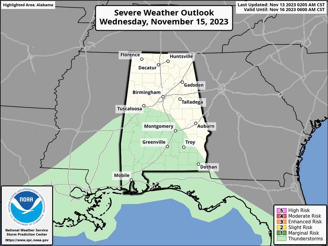
There could be some thunder in the areas in green on Wednesday, but no severe weather is expected.Storm Prediction Center
The National Weather Service said an area of low pressure over Texas will track to the northeast and along the Gulf Coast this week, spreading rain along with it.
The rain will benefit those in south Alabama the most; amounts are expected to be lighter in north Alabama, with 1 inch or less.
Forecasters noted that there is still some uncertainty about the track of that area of low pressure. A more northward track could increase rain amounts for Alabama, but a more southern path could reduce rain totals.
Rain chances will increase from south to north starting tonight, according to forecasters. South Alabama could see some rain, but most of north and central Alabama will remain dry. Look for rain chances to increase for the rest of the state on Tuesday.
Winds could also be gusty across the state as the system moves through, and along the coast there will be a high risk of rip currents starting on Tuesday and lasting into at least Thursday night. The weather service said there is also the potential for some coastal flooding Tuesday night into Wednesday.
Wednesday could be the day with the potential for the most rain, with showers possibly lingering into Thursday and Friday.
Forecasters said a cold front will move through the state on Friday, but only a few showers are expected with it.
The first part of the weekend could be on the drier side before another weather system arrives on Sunday into Monday.