More of Alabama now in Level 3 risk for severe weather
Parts of Alabama now have a slightly higher probability of seeing severe weather later tonight, according to forecasters.
NOAA’s Storm Prediction Center has expanded a Level 3 out of 5 risk for severe weather for parts of north and west Alabama tonight into Saturday morning. The enhanced risk area now includes places like Huntsville, Decatur, Florence, Hamilton, Cullman and Muscle Shoals, among others.
A Level 3 risk means numerous severe storms will be possible.
Other parts of Alabama also face the prospect of severe weather tonight and into Saturday morning. A swath of north, central and west Alabama has a Level 2 risk, which means that scattered severe storms are possible.
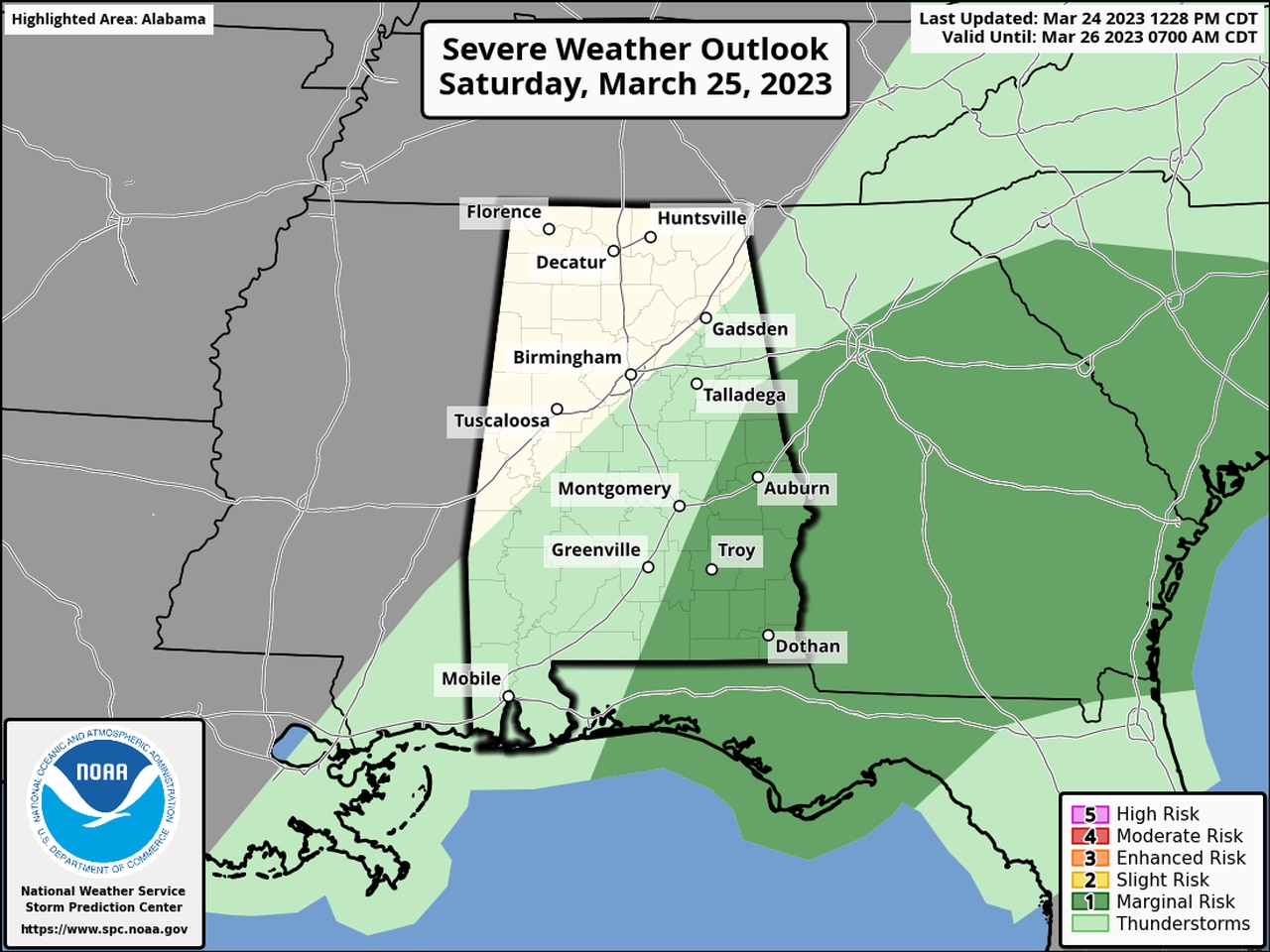
And parts of east and south Alabama have a Level 1 risk and could see isolated severe storms.
The Level 1 risk will extend into Saturday morning for areas in southeast Alabama as well.
Areas in dark green could see isolated severe storms later on Saturday morning.
Tornadoes, damaging winds, hail and heavy rain will all be possible with the strongest storms tonight.
The National Weather Service urged Alabamians to make sure they have a reliable way to get severe weather warnings — warnings that will wake you up — in case they become necessary later tonight.
Storms could reach Alabama’s western border by 10 p.m. and track eastward through the overnight hours.
The National Weather Service was tracking storms that were moving across parts of Mississippi as of 6:30 p.m., and a tornado watch stretched across that state and right up to the Alabama border.
Here’s a look at when the National Weather Service is expecting storms to reach Alabama:
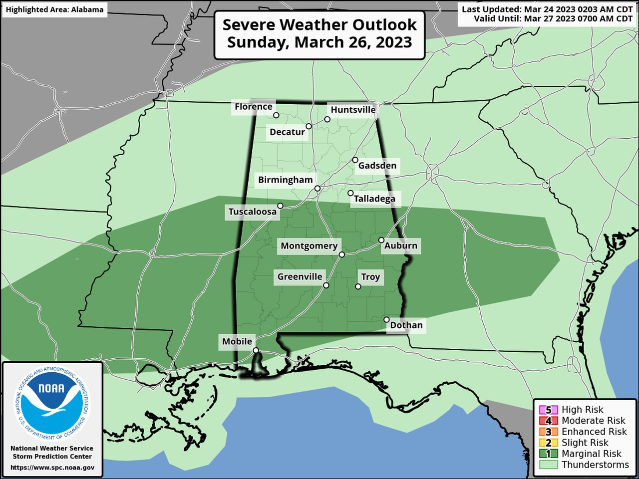
Calmer weather is expected by Saturday afternoon, but more storms will be possible, especially across south Alabama, on Sunday as a warm front lifts northward across the state.
There will be a Level 1 risk for severe weather for south and south-central Alabama on Sunday:

There will be a Level 1 risk for severe weather for much of south Alabama on Sunday as well.
