Level 2 severe weather risk overnight in south Alabama
Forecasters will be on guard overnight for the possibility of severe weather in south Alabama.
NOAA’s Storm Prediction Center has upgraded the southwest corner of the state from a Level 1 to a Level 2 out of 5 severe weather risk through the overnight hours.
A Level 2 risk means that scattered severe storms will be possible.
A larger area in south Alabama will also have a Level 1 risk for storms overnight. A Level 1 risk means isolated severe storms will be possible.
All those in south Alabama should have in hand a reliable way to get severe weather warnings overnight if they are issued. Don’t rely on an outdoor siren to wake you.
Severe weather is not expected in north or north-central Alabama, but there could be rain and storms overnight, according to the National Weather Service.
The strongest storms could have damaging wind gusts, and a tornado will remain possible.
Storms during the day on Friday remained below severe limits. However, as of late Friday night there was an ongoing tornado watch just to the west of the state line, and more strong storms were tracking toward Alabama.
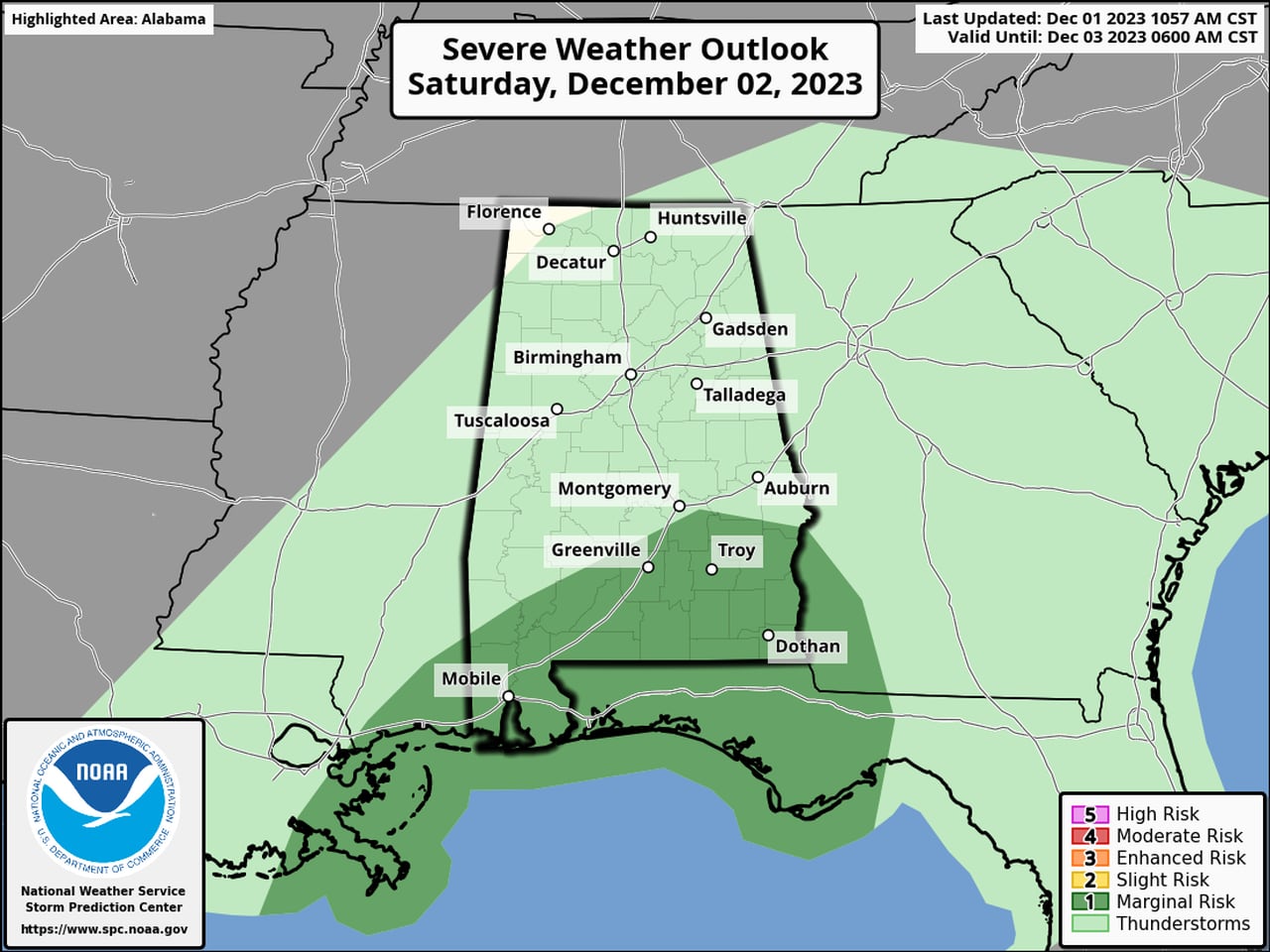
The risk for strong storms will continue into the day on Saturday, with south Alabama again facing a Level 1 severe weather threat. Below is the severe weather outlook for Saturday:
There will be a Level 1 risk for severe weather in the areas in dark green during the day on Saturday.SPC
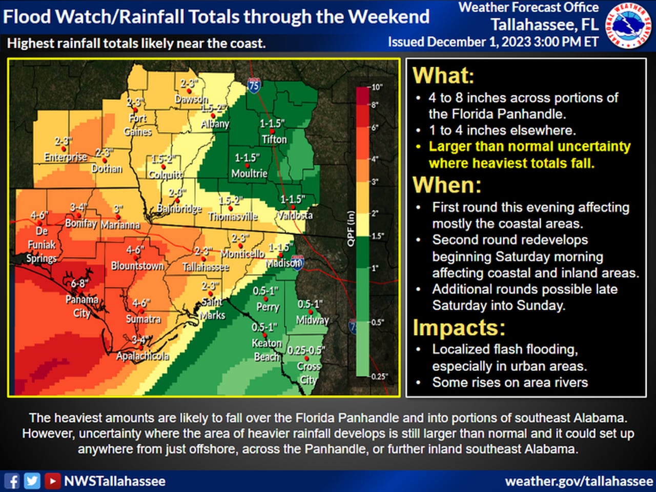
There is also the possibility of flooding rain for areas in southeast Alabama, and a flood watch will be in effect for a few counties until Sunday afternoon.
The weather service office in Tallahassee, Fla., said 2 to 3 inches of rain will be possible in Alabama through the weekend. The flood watch includes Coffee, Dale, Henry, Geneva and Houston counties.

Here are the rainfall forecasts through this weekend.NWS
Rain and storms are expected to move out by Sunday, and the first half of the work week appears to be on the dry side.
