Level 2 severe weather risk for part of Alabama Sunday: What to know
Alabama is facing the prospect of strong to severe storms for the next three days.
The National Weather Service said the strongest storms could have winds capable of knocking down trees and power lines as well as hail, lightning and heavy rain.
The weather service said storms will be possible today, Monday and Tuesday, with the most organized threat coming on Monday.
The most likely time for storms will be during the afternoon and evening hours.
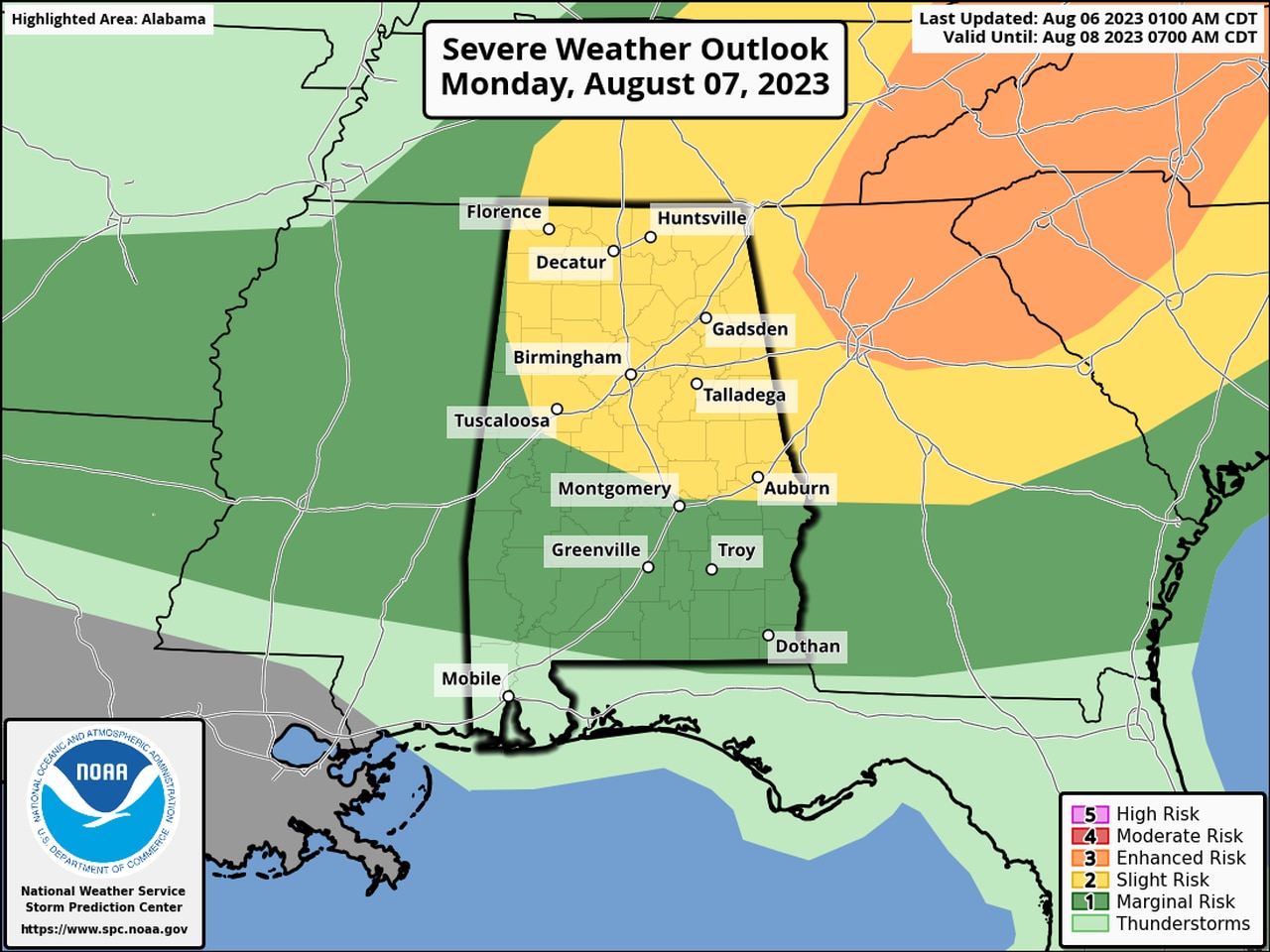
For today, NOAA’s Storm Prediction Center has the northern half of Alabama, from roughly Montgomery northward, in a Level 2 out of 5 risk for severe weather.
A Level 2 risk means that scattered severe storms will be possible.
Nearly all of the rest of the state, except for southwest Alabama, has a Level 1 risk, which means isolated severe storms will be possible.
MONDAY
More isolated to scattered severe storms will be possible in Alabama on Monday.
On Monday the weather service expects a more organized threat for severe weather. There could also be a low risk for a tornado in the northeastern part of the state, according to the Storm Prediction Center.
On Monday the SPC has a similar forecast to today’s, with a Level 2 risk for the northern half of the state and a Level 1 risk for south Alabama except for the southwest corner.
TUESDAY

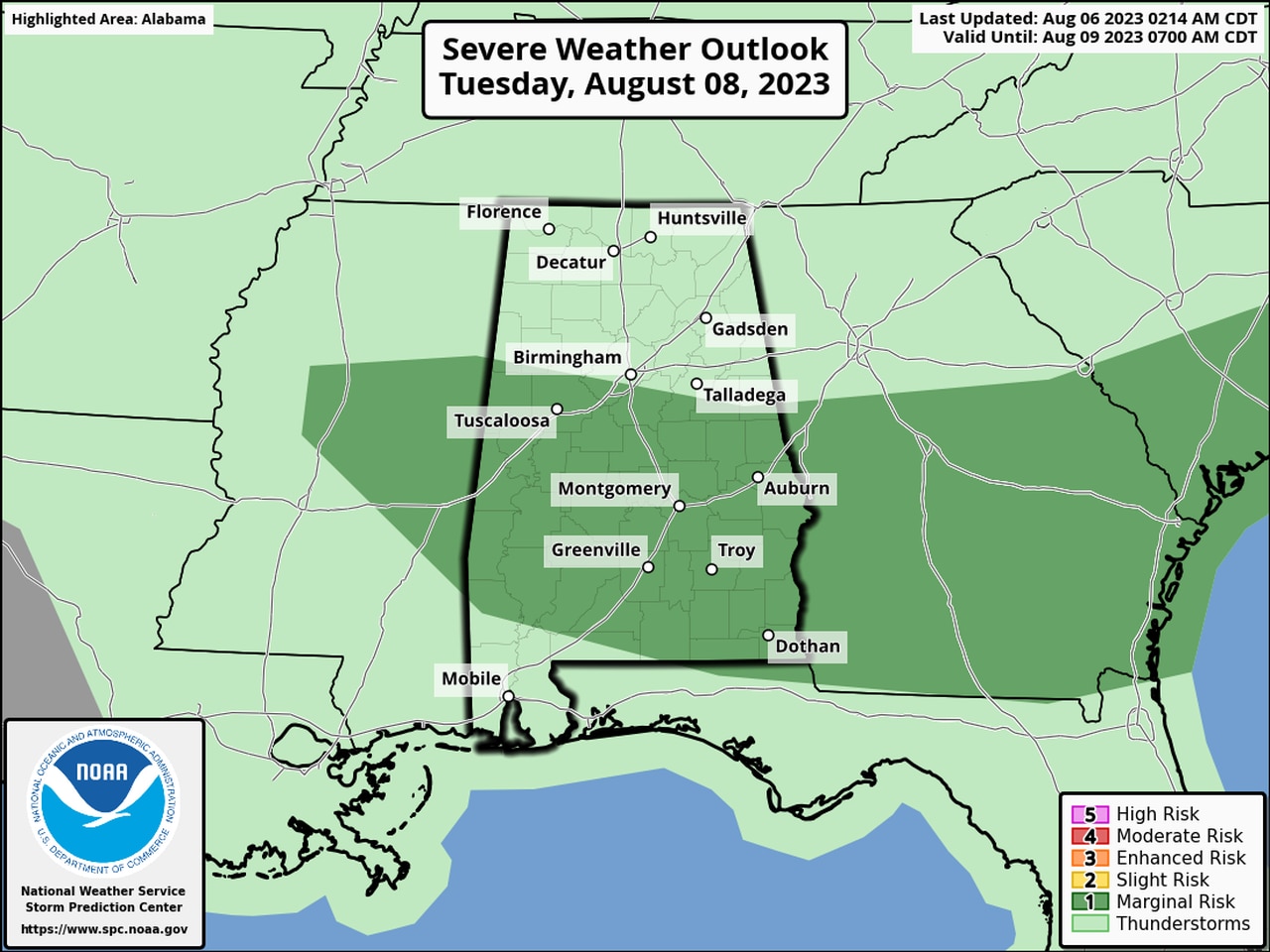
There will be a risk for isolated severe storms on Tuesday in the areas in dark green.
On Tuesday the threat for storms is expected to shift southward. The SPC has most of south Alabama in a Level 1 risk for severe weather on Tuesday.
A Level 1 risk means that isolated severe storms will be possible.
