Level 2 severe weather risk for Alabama on Thursday
This afternoon and tonight could be stormy for parts of Alabama.
NOAA’s Storm Prediction Center has added a Level 2 out of 5 risk for severe weather for most of north Alabama and the northern part of central Alabama for Thursday.
A Level 2 risk means that scattered severe storms will be possible.
Most of the rest of central Alabama has a Level 1 risk for severe weather today, which means that isolated severe storms will be possible.
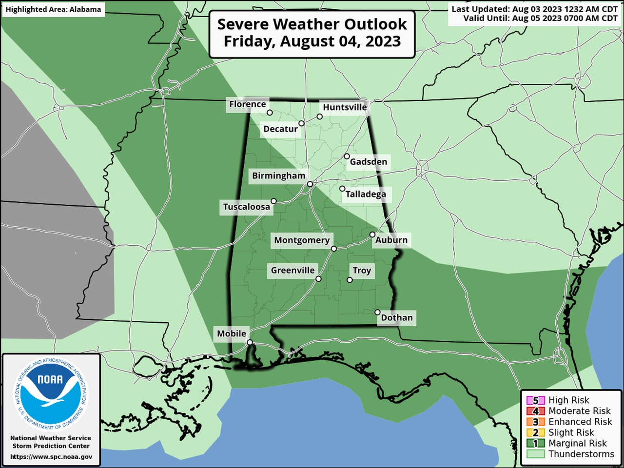
There will also be a Level 1 risk for storms on Friday for southern Alabama.
The most likely time for storms today will be this afternoon into tonight.
The strongest storms on both days could have wind gusts capable of toppling trees and power lines. Forecasters added that there is a low but non-zero threat for tornadoes and hail, but confidence on those hazards being realized was low.
The National Weather Service said multiple rounds of storms will be possible through tonight.
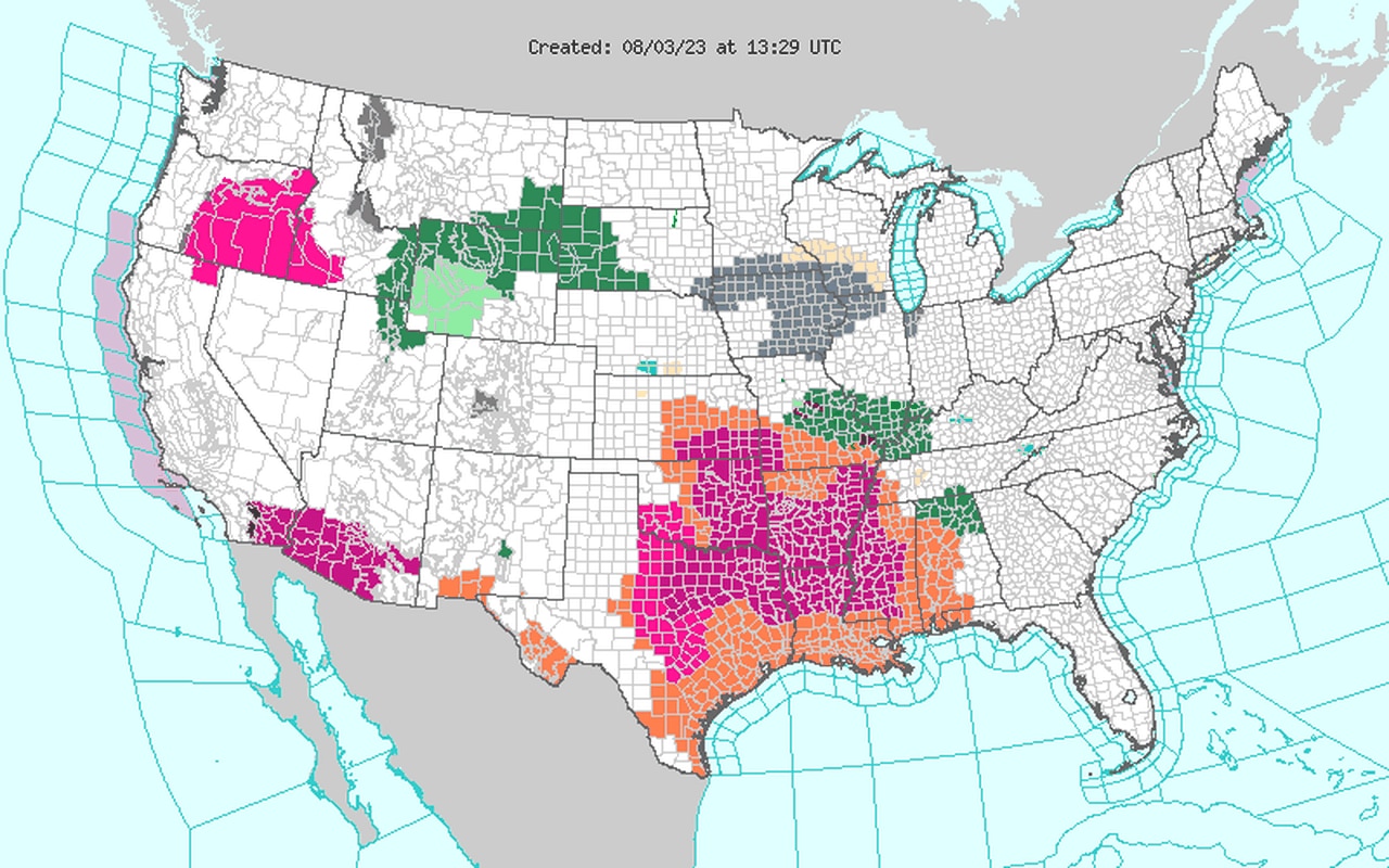
There will also be the potential for heavy rain, and a flood watch has been issued for parts of north and north-central Alabama. Up to 3 inches of rain could be possible in areas that get hit with multiple storms.
* A flood watch for north Alabama includes Colbert, Cullman, DeKalb, Franklin, Jackson, Lauderdale, Lawrence, Limestone, Madison, Marshall and Morgan counties and will be in effect from now until Friday afternoon.
* A flood watch will also be in effect for the central Alabama counties of Blount, Calhoun, Cherokee, Cleburne, Etowah, St. Clair and Winston from 4 p.m. today until Friday afternoon.
Areas in west Alabama that don’t see storms will get extremely hot today, and heat advisories will also be in effect through tonight. The heat index could climb past 105 degrees both today and Friday.
Here is a look at the flood watch and heat advisories for Alabama, with the flood watches in green and the heat advisories in orange:
The Alabama counties in orange will be under heat advisories today. The counties in green are under a flood watch.
As far as today’s storms go, the National Weather Service said organized clusters of showers and storms are expected to move southward from Tennessee this afternoon through tonight.
“These storms will have the potential for damaging wind gusts, along with heavy rainfall that could lead to localized flooding,” the weather service said. “We’ll see a similar setup once again on Friday.”
The Storm Prediction Center was watching storms in Tennessee that could affect north Alabama starting later this morning and monitoring trends for a potential watch:
Forecasters said the wind-damage threat in those areas could increase over the next few hours, and if storms intensify then a watch may be needed.
Those storms are expected to continue to drop southeastward today.
The threat for strong storms is expected to shift southward on Friday, with the southern part of the state in a Level 1 severe weather risk.
Here is the severe weather outlook for Friday:

The areas in dark green will have a Level 1 risk for severe weather on Friday and could see isolated severe storms.
Friday’s storms could also bring damaging winds and heavy rain, according to the weather service.
No severe weather is in the forecast for Alabama from the SPC after Friday, at least so far.
